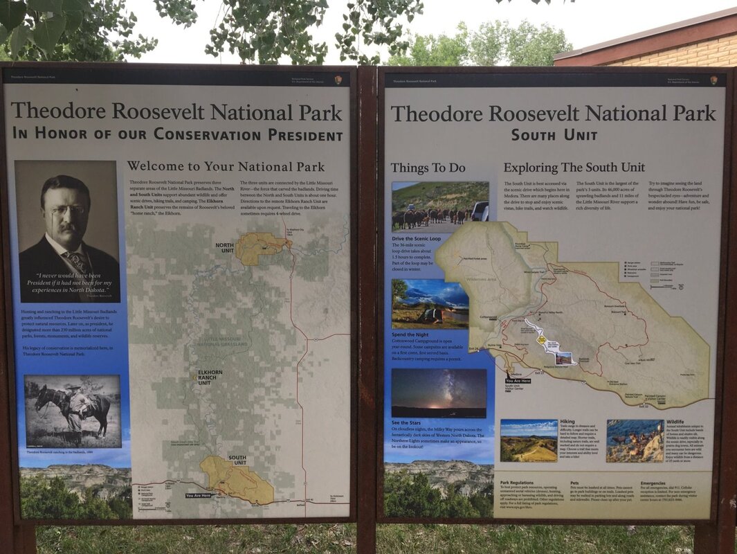
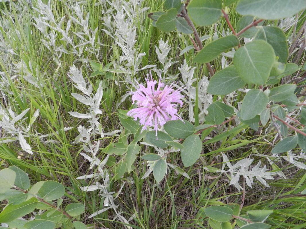
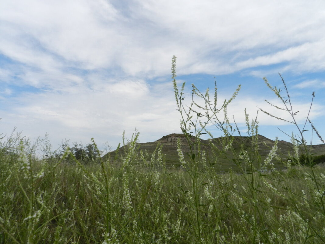
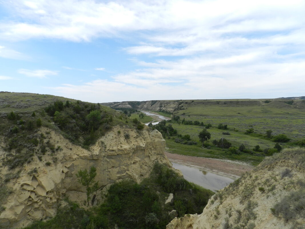
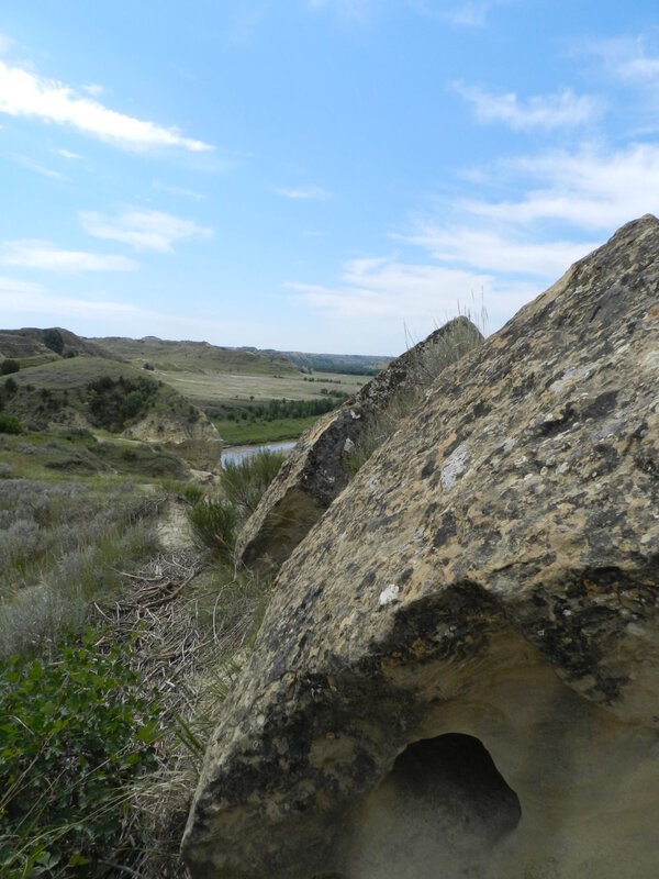
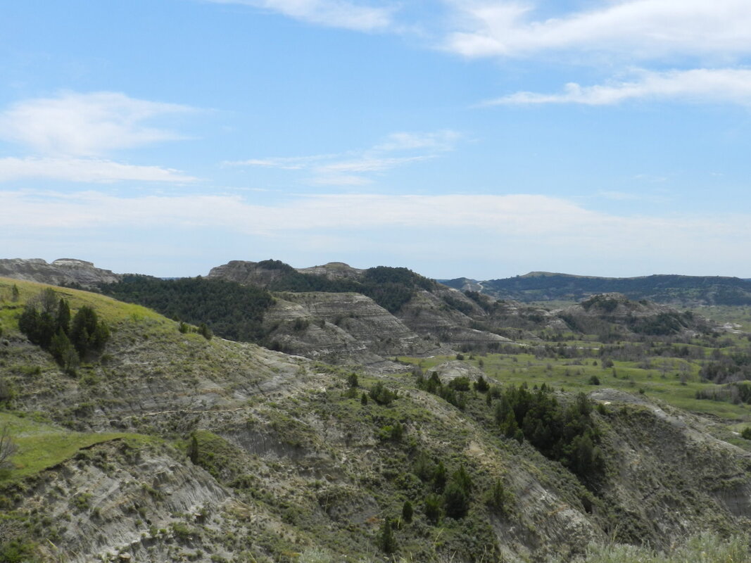
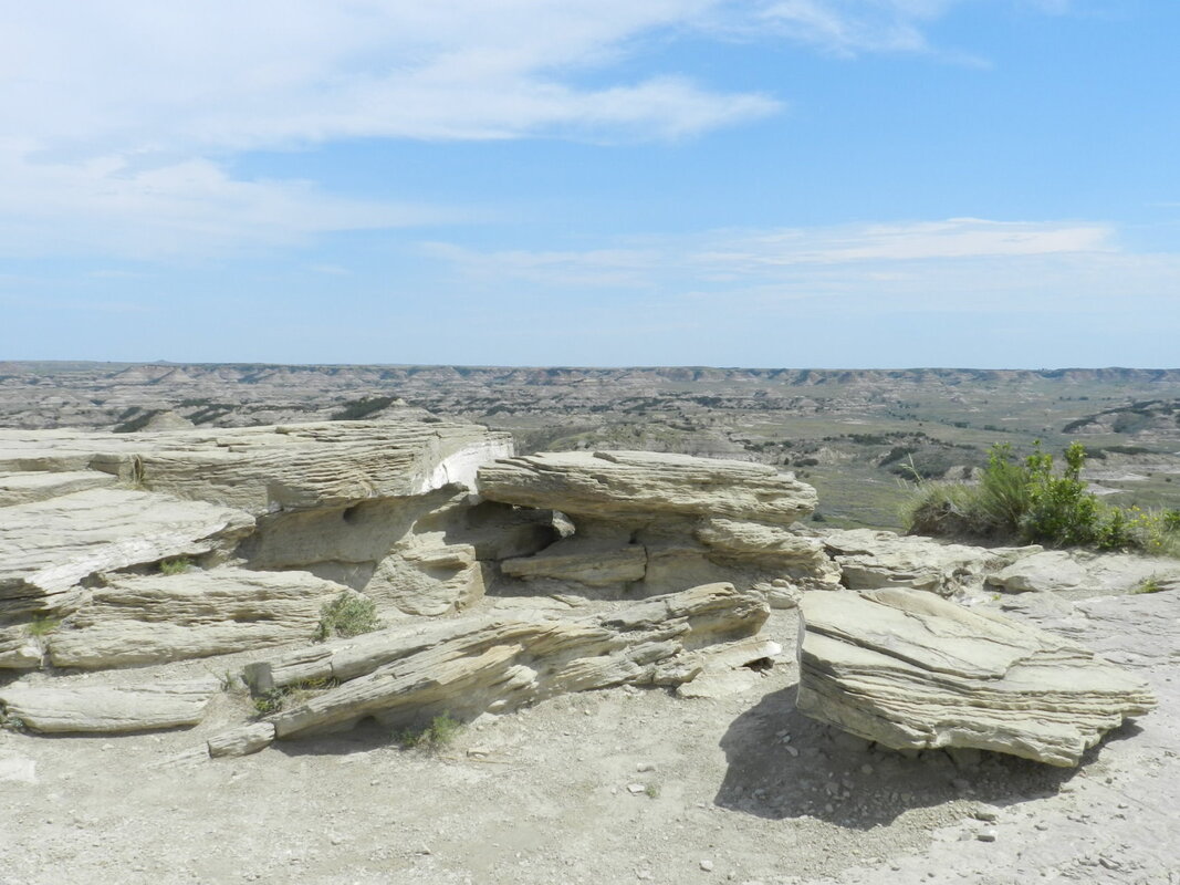
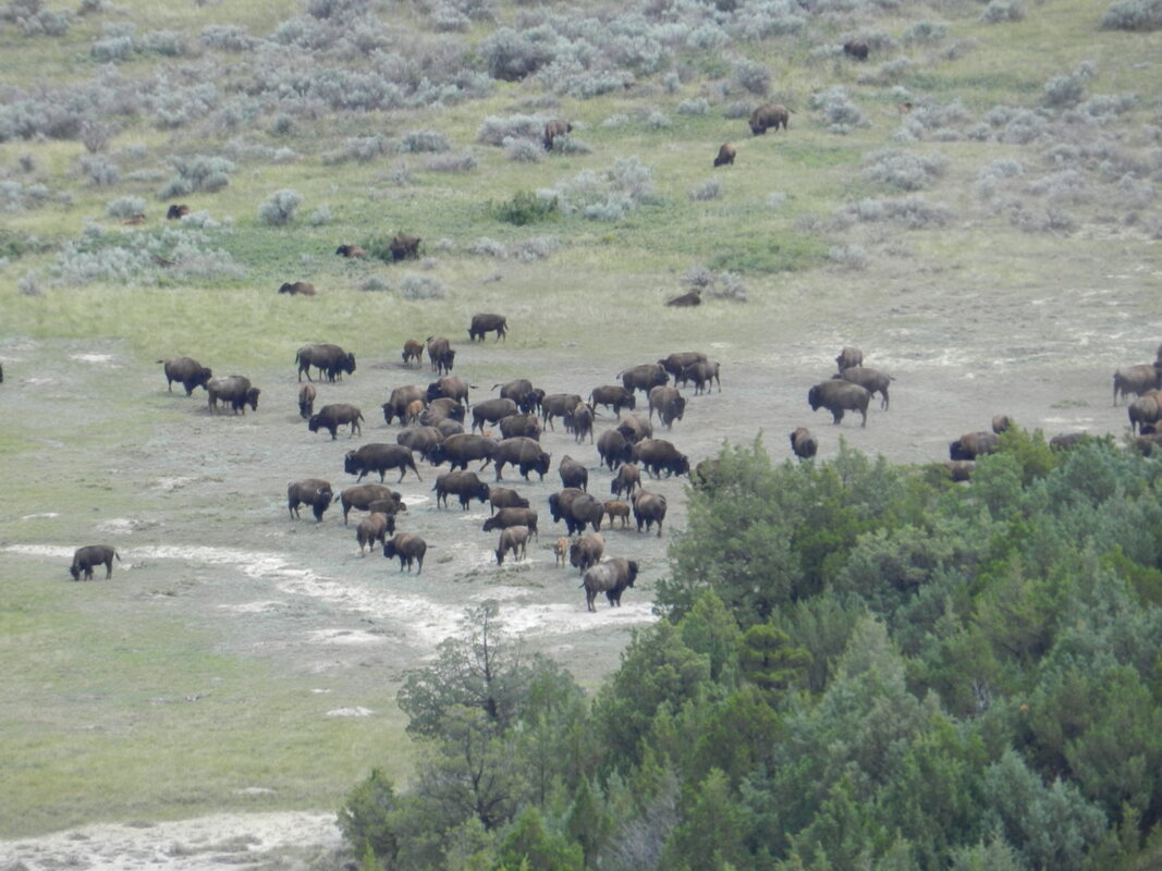
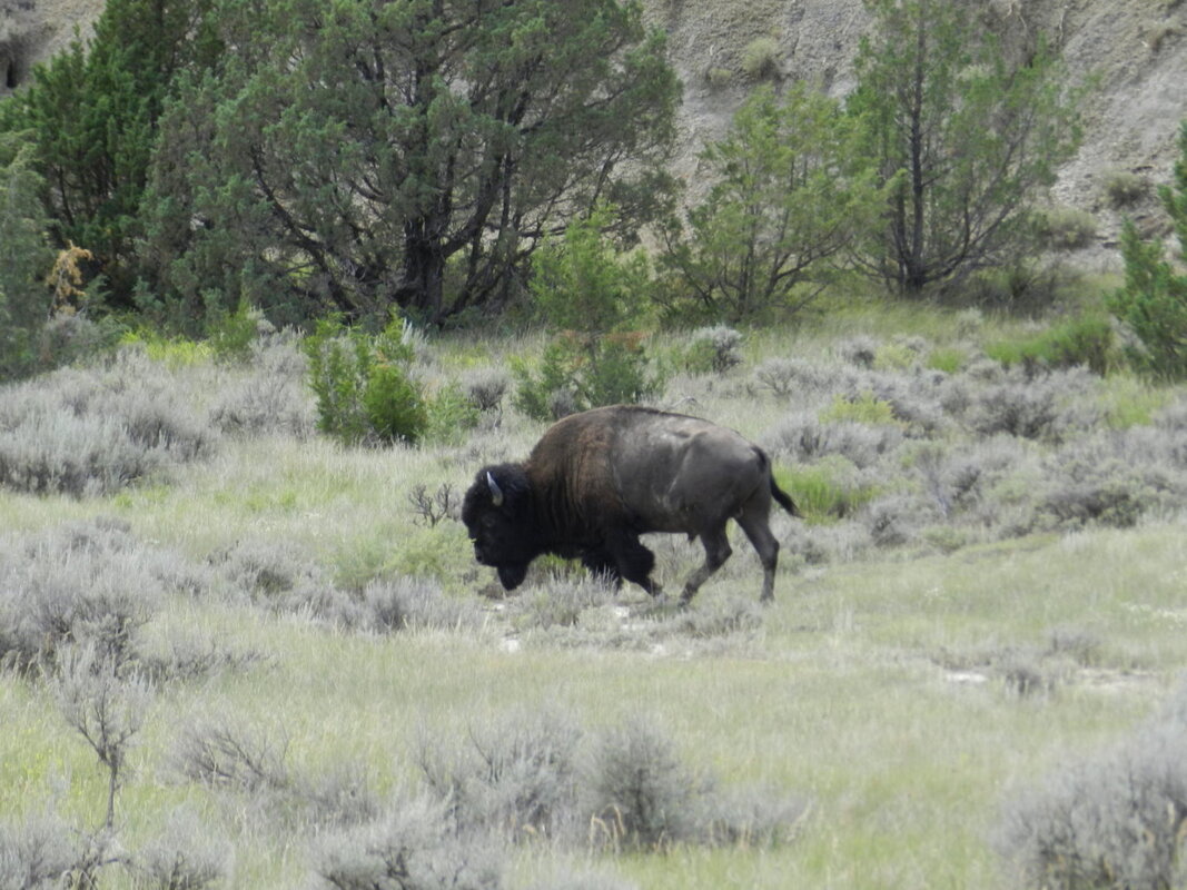
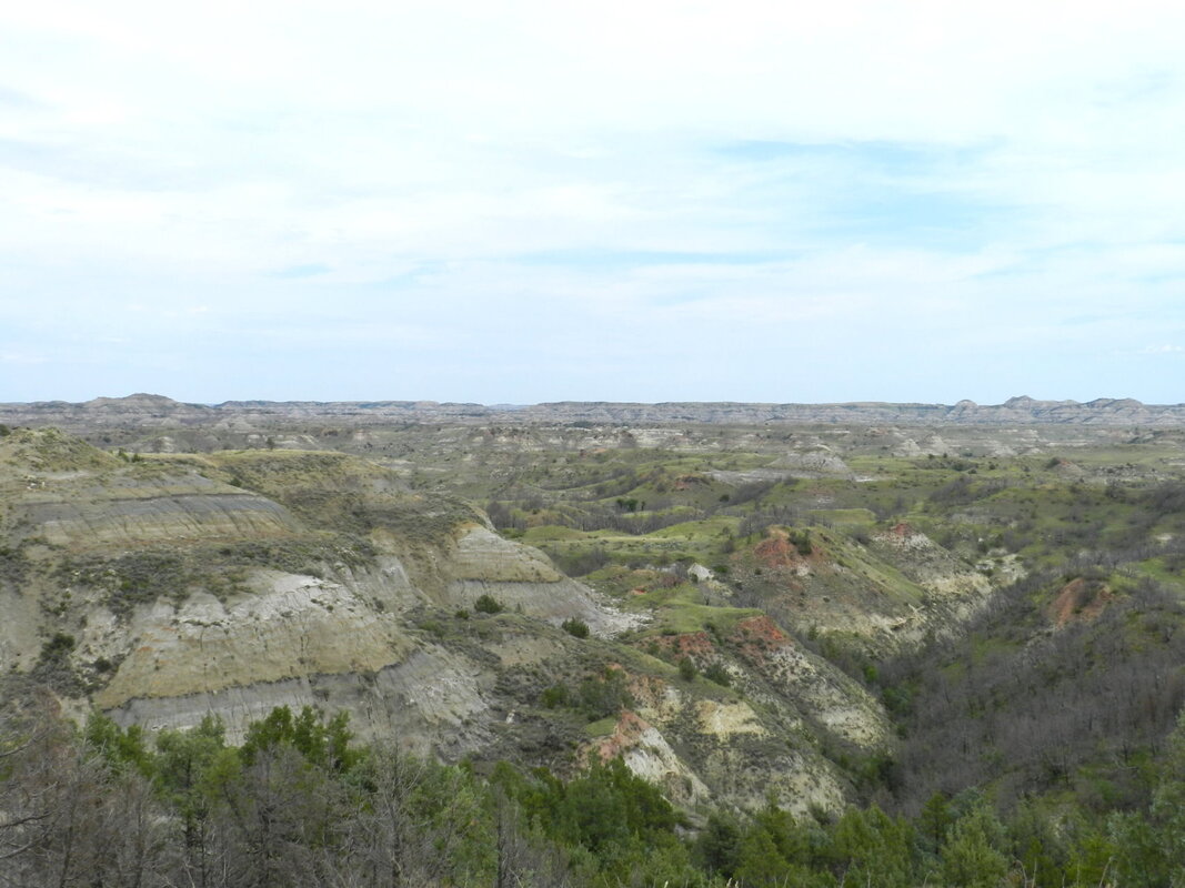
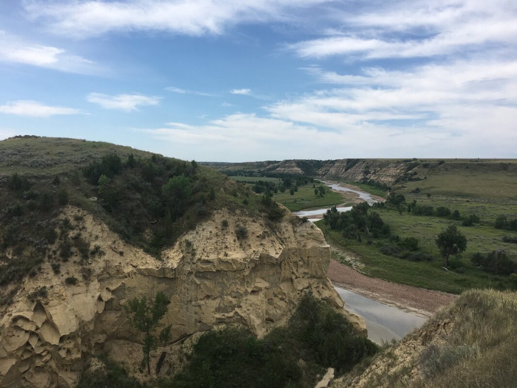
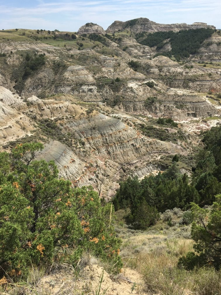
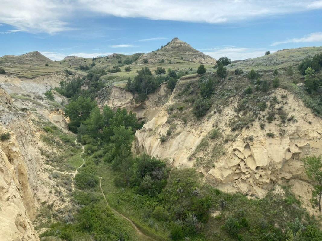
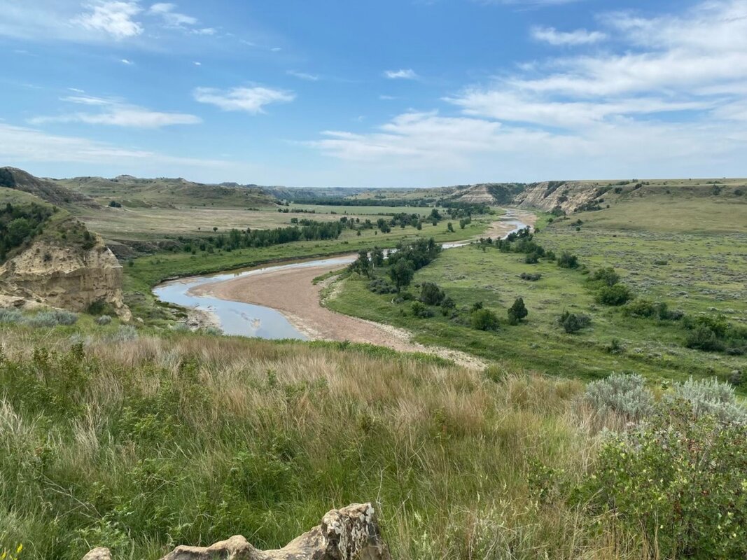
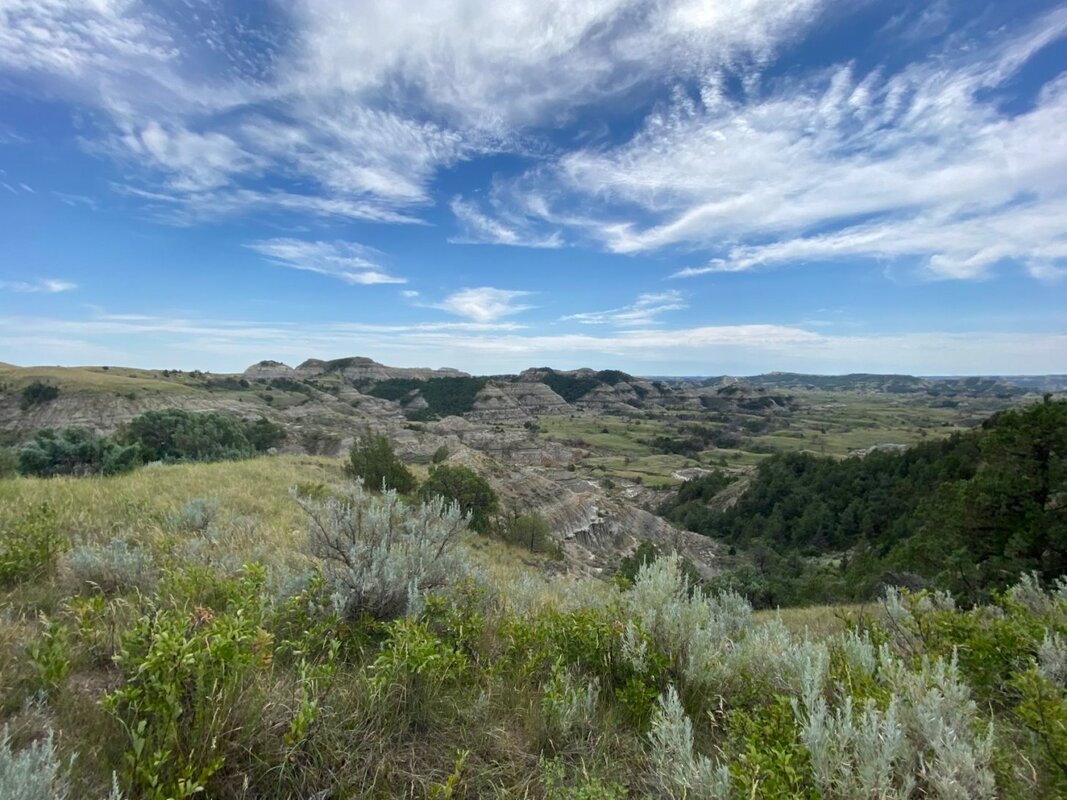
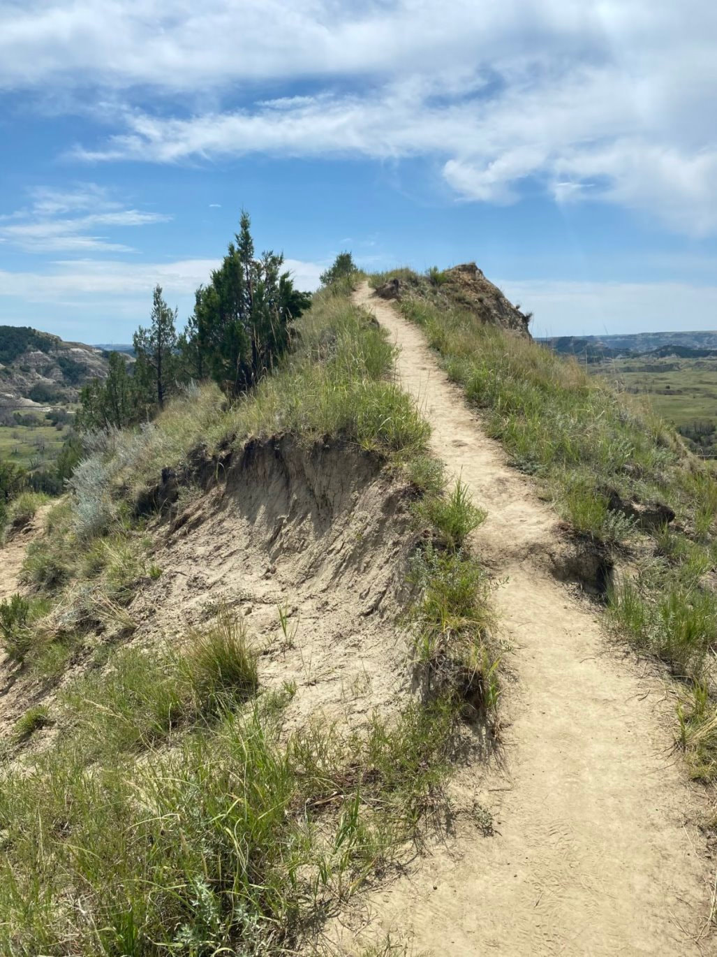
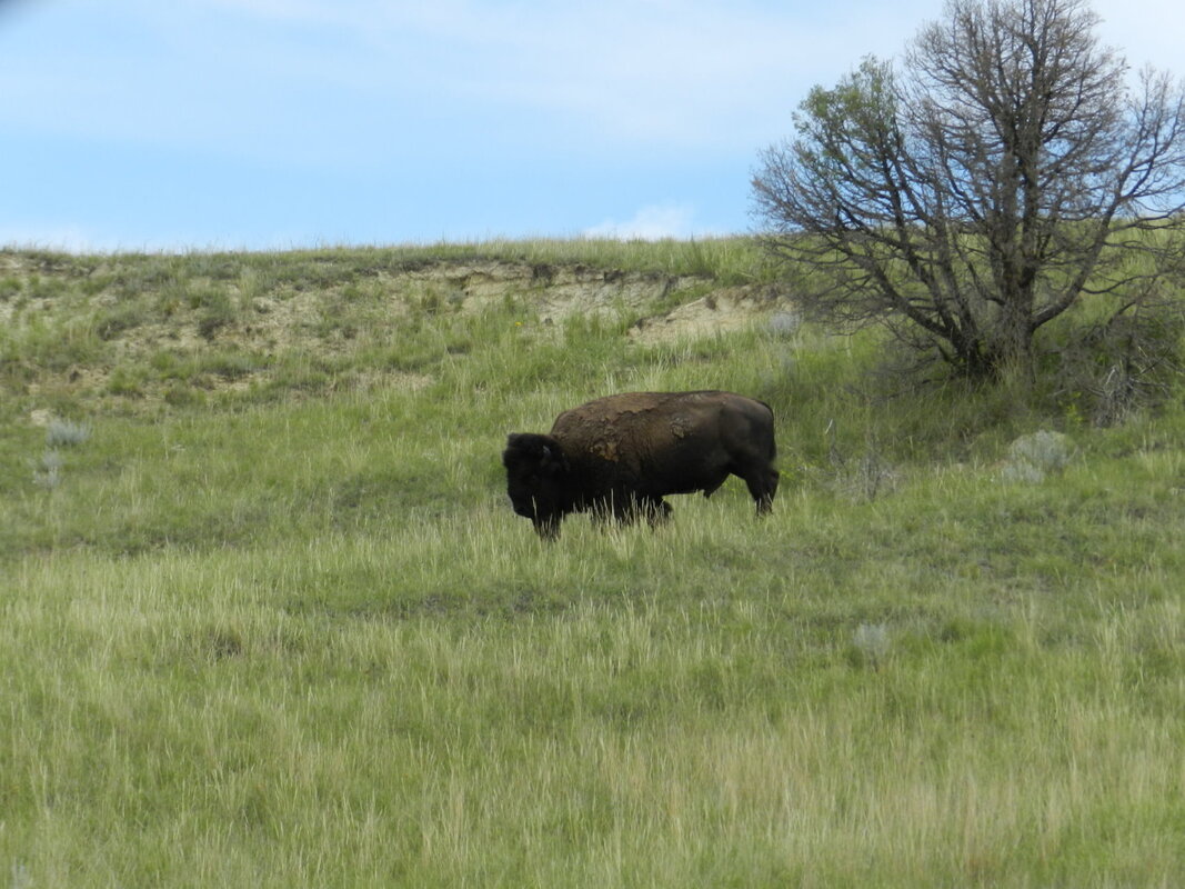
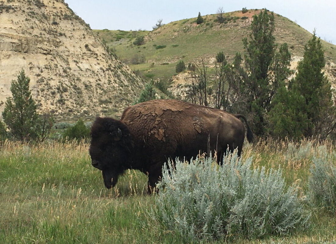
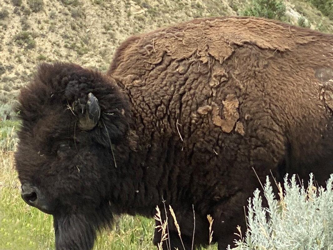
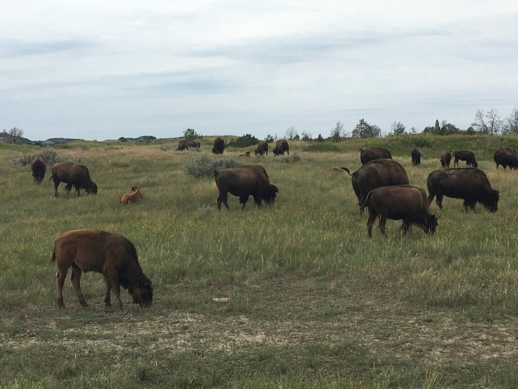
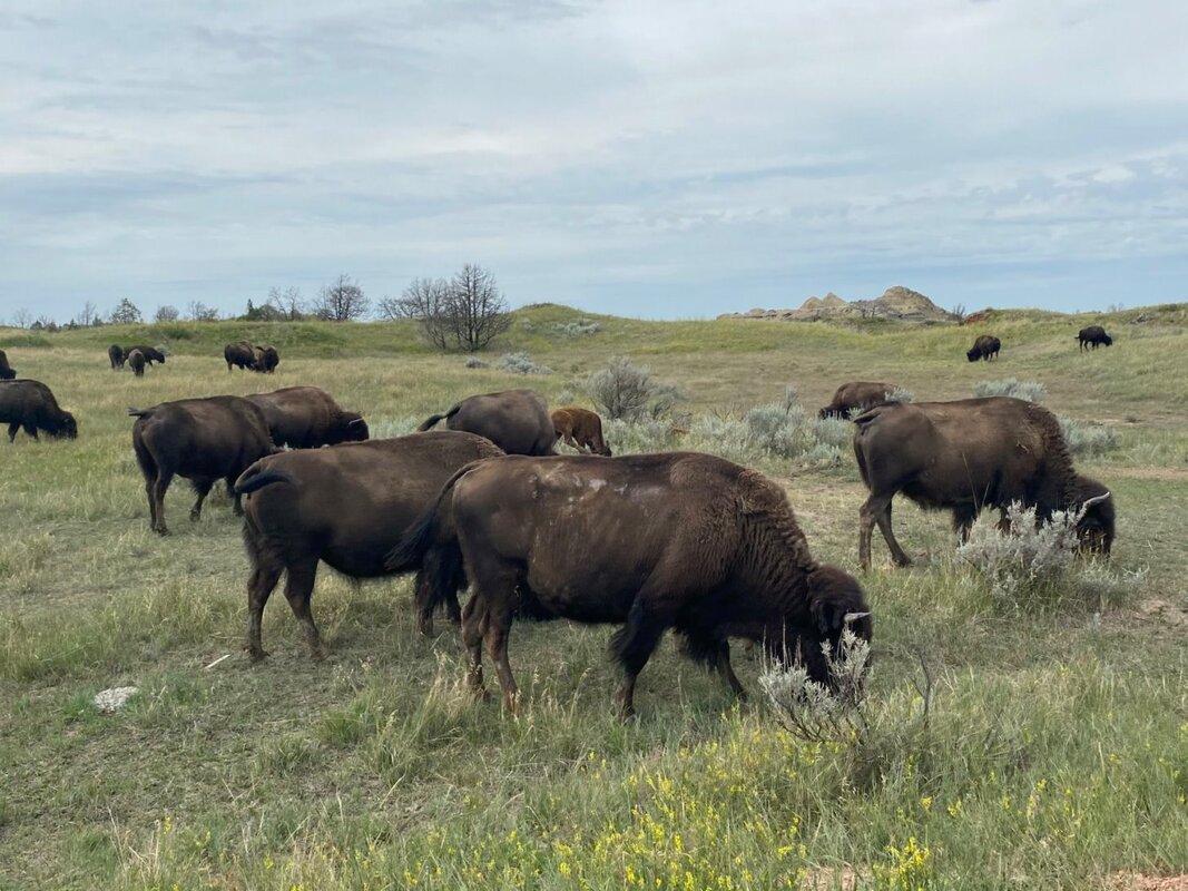
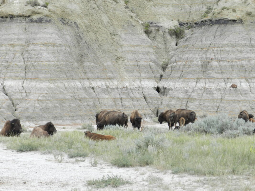
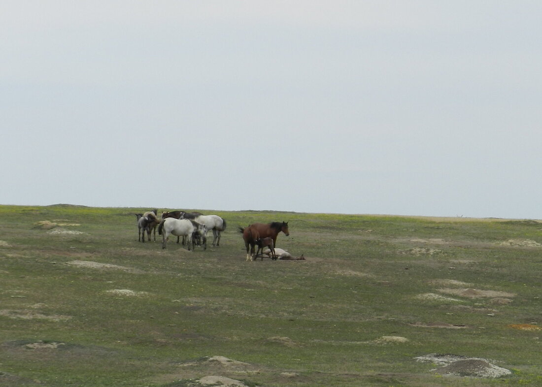
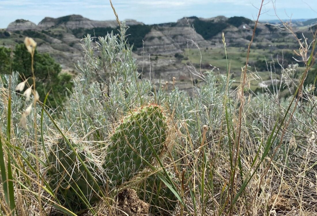
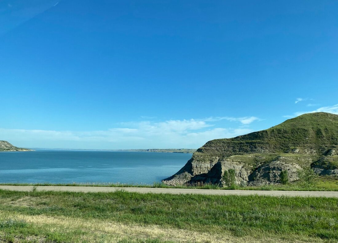
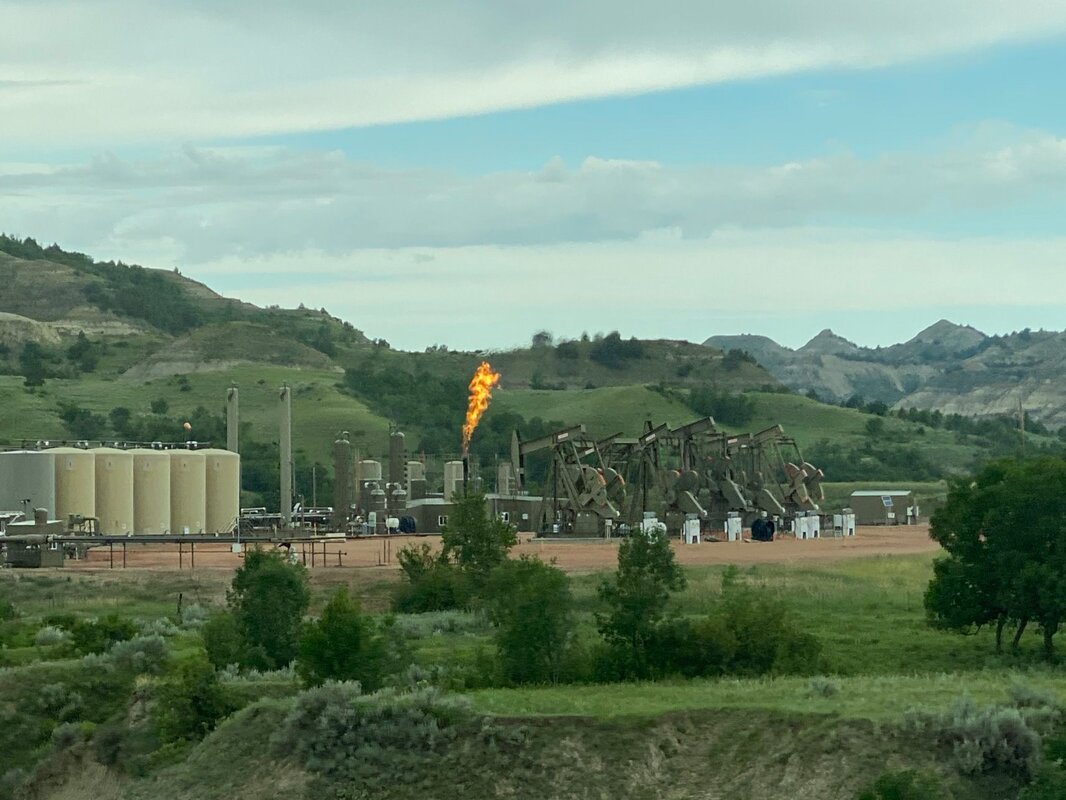
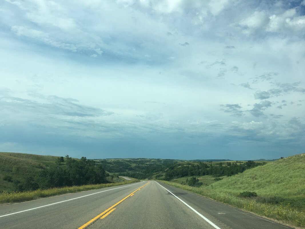
Where the Buffalo Roam and the Skies are Not Cloudy All Day On Day #15 of our 30-day, 9376 mile, road trip to see more of America we visited the Theodore Roosevelt National Park in Medora, North Dakota. Named after the 26th President of the United States because of his ties to the region, the Theodore Roosevelt National Park is a national park located in the western North Dakota badlands with three geographically separated areas; the North Unit, the South Unit, and the Elkhorn Ranch Unit. The park has 70,446 acres (110.072 square miles) of land. Teddy Roosevelt first came to the North Dakota to hunt bison in 1883 and subsequently fell in love with the rugged lifestyle and the "perfect freedom" of the West. While in Medora Roosevelt invested in the Maltese Cross Ranch. Then in 1884, following the death of both his wife and mother, Roosevelt returned to North Dakota and purchased the Elkhorn Ranch, located 35 miles north of Medora. A life-long outdoorsman and hunter, Roosevelt's time in the badlands impacted him deeply and helped shape many of the policies that he implemented during his years as President of the United States (1901-1909). We visited the South Unit of the park on a perfect day – great weather and not many people. During our visit we hiked many of the trails and were able to see, up close and personal, bison, turkeys, prairie dogs, and wild horses (click on any photo to start the slideshow): If you want to learn more about the Theodore Roosevelt National Park, or other things to do in the Medora area, here are a couple of links to check out: https://www.nps.gov/thro/index.htm https://www.ndtourism.com/best-places/8-things-see-and-do-theodore-roosevelt-national-park https://medora.com/do/outdoor/theodore-roosevelt-national-park/ As a side note, to get to the Theodore Roosevelt National Park we drove the Killdeer Mountain Four Bears Scenic Byway. The terrain and sights were stunning. This drive is certainly one of the prettiest in North Dakota. (click on any photo to start the slideshow): Here’s are links to all of North Dakota’s scenic highways and some of the specific sights on the Killdeer Byway: https://www.ndtourism.com/best-places/north-dakota-scenic-byways-and-backways-and-more https://www.ndtourism.com/best-places/5-stops-killdeer-mountain-four-bears-scenic-byway https://www.beautifulbadlandsnd.com/history-and-landscape-in-the-mid-section-of-this-badlands-scenic-highway-22-part-2/ 
1 Comment
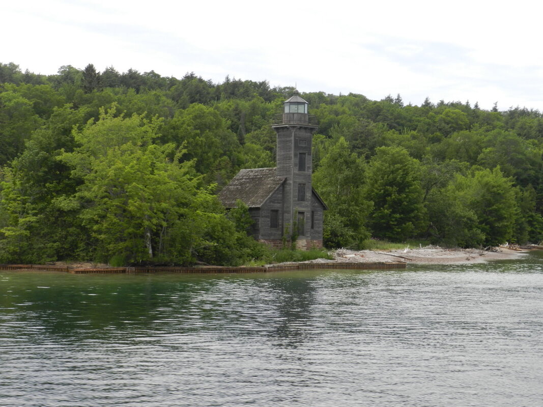
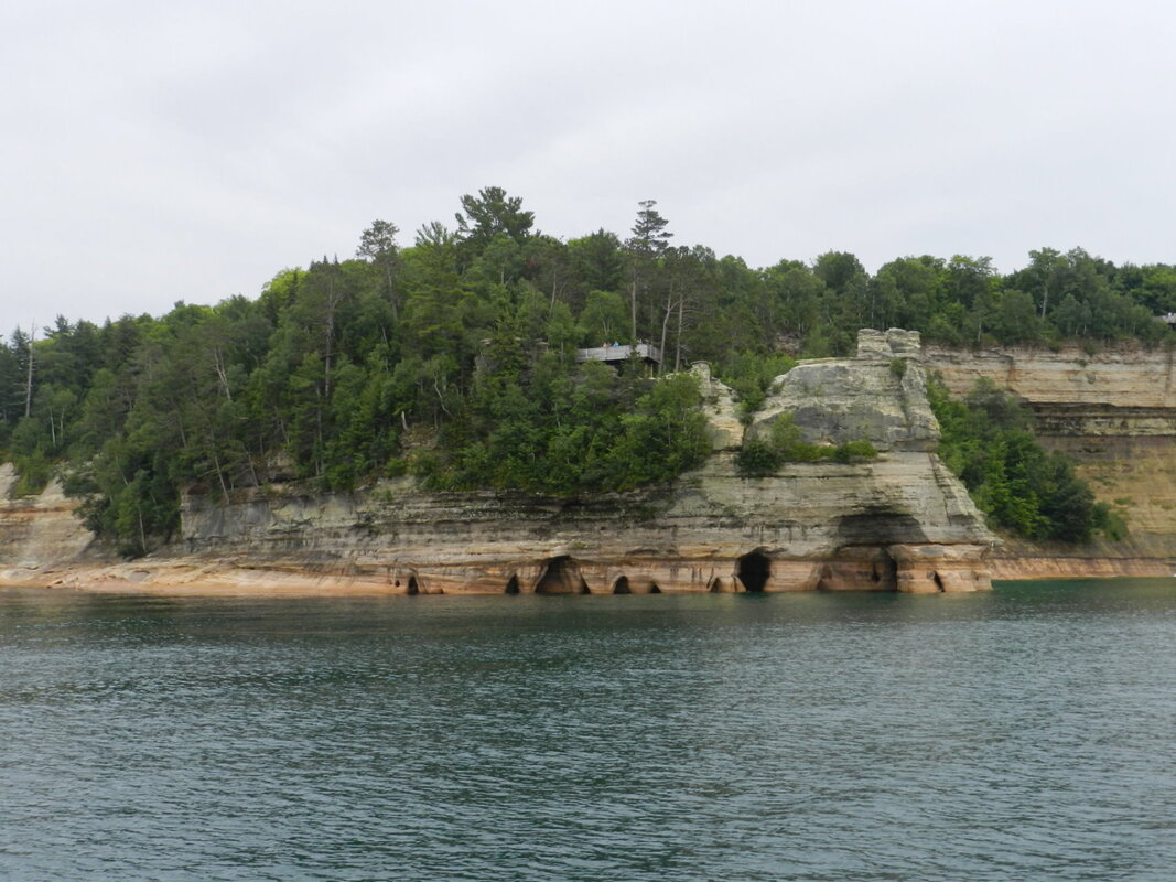
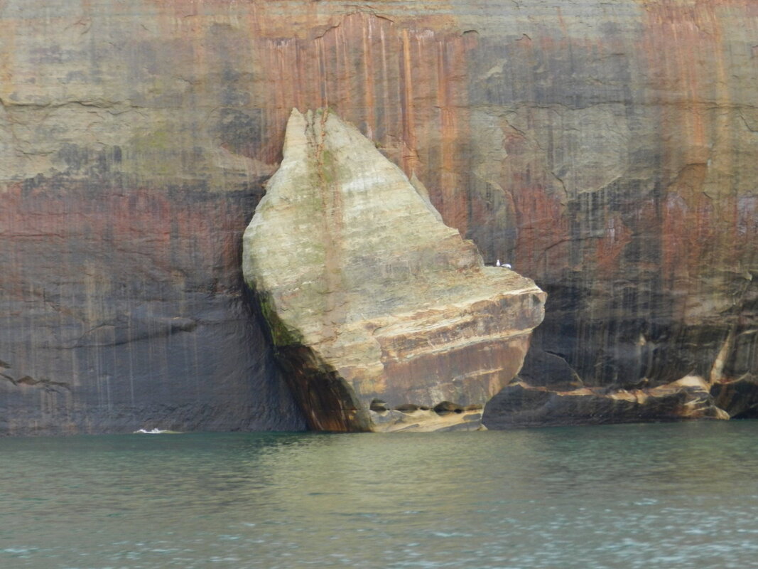
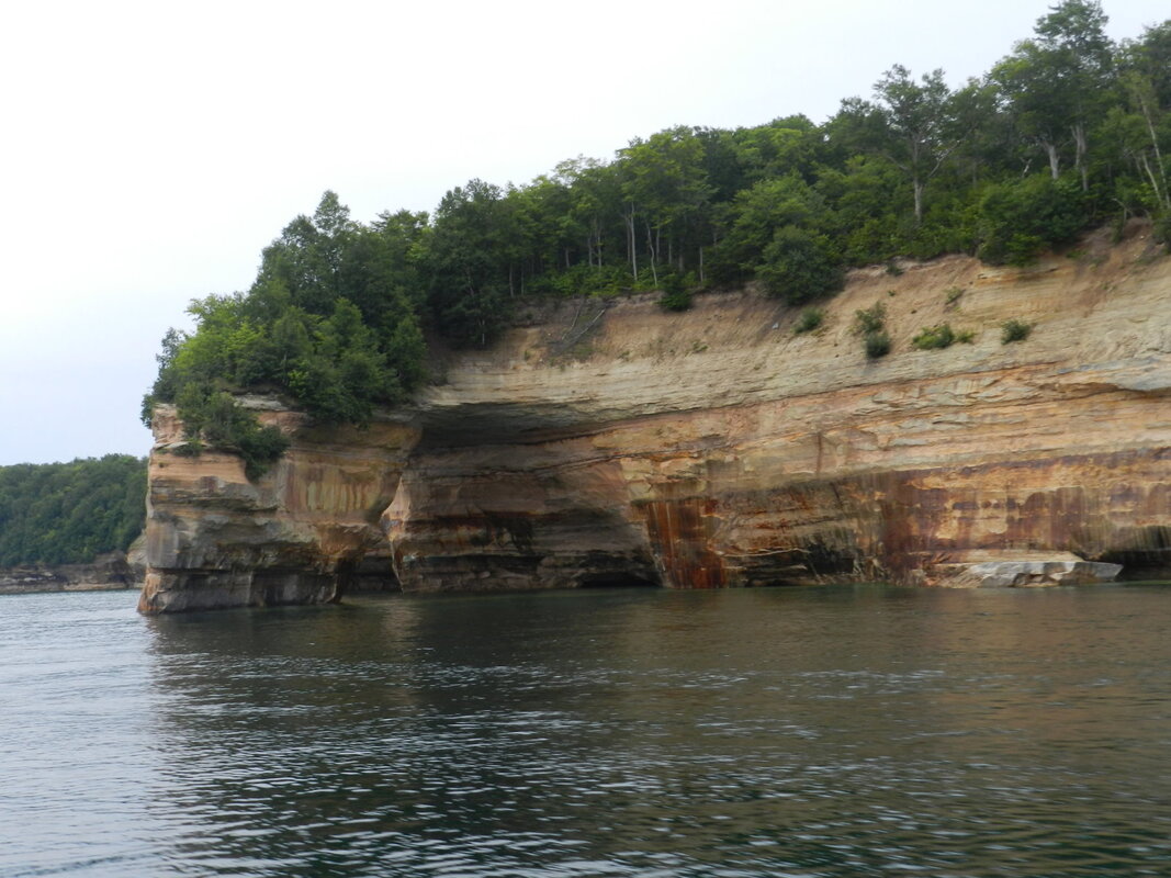
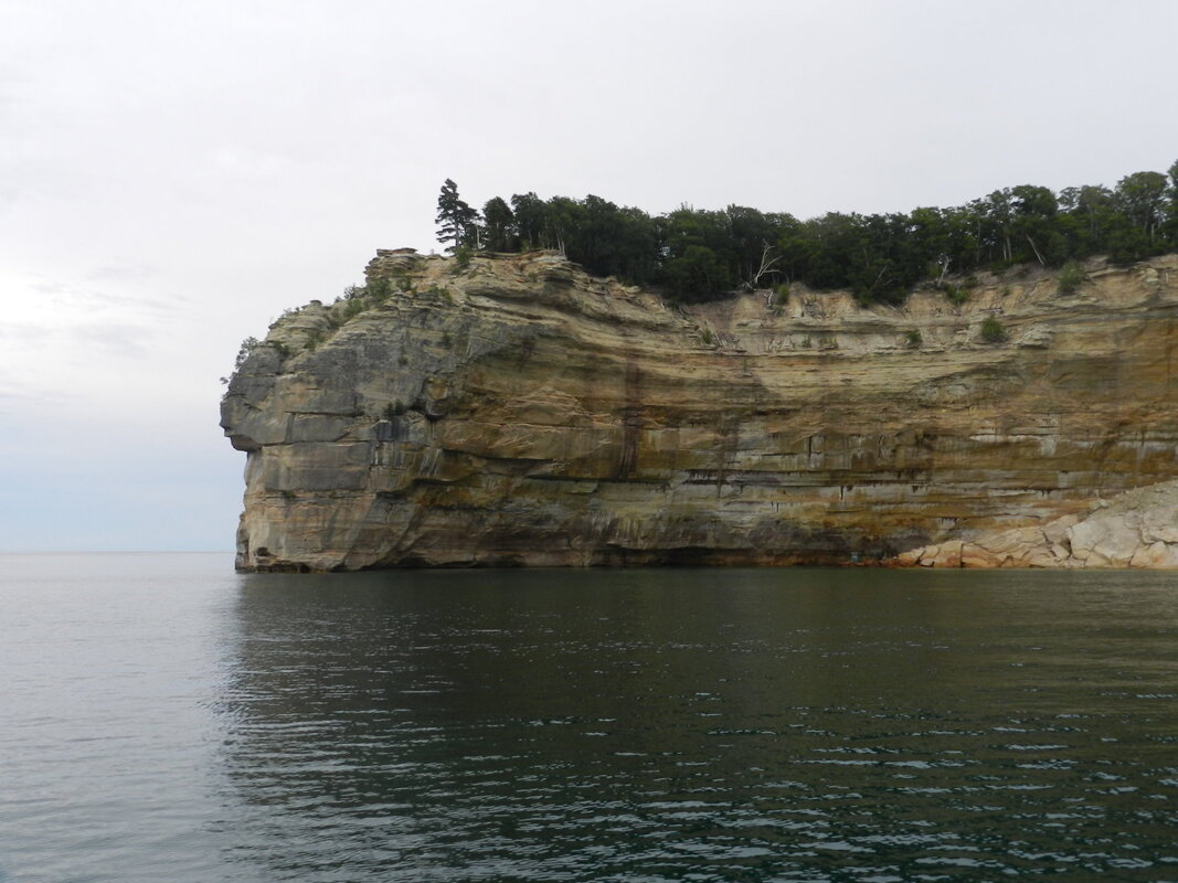
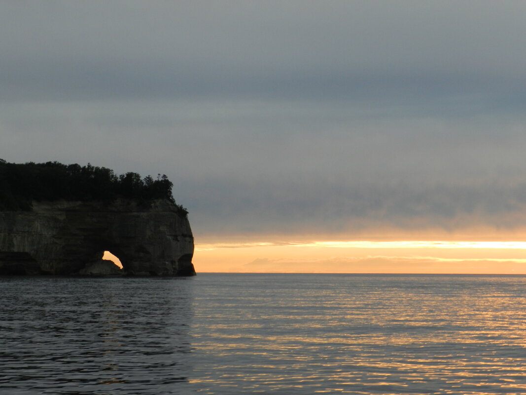
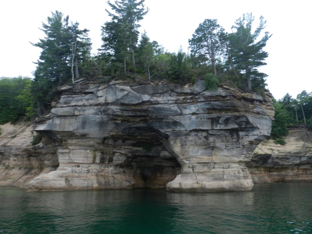
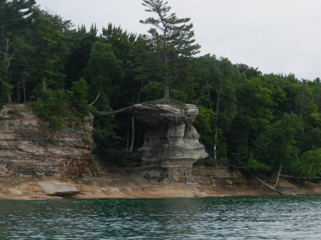
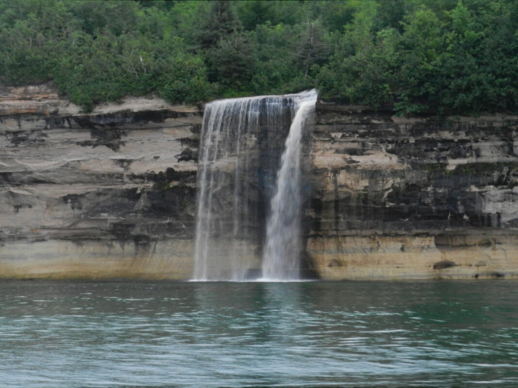
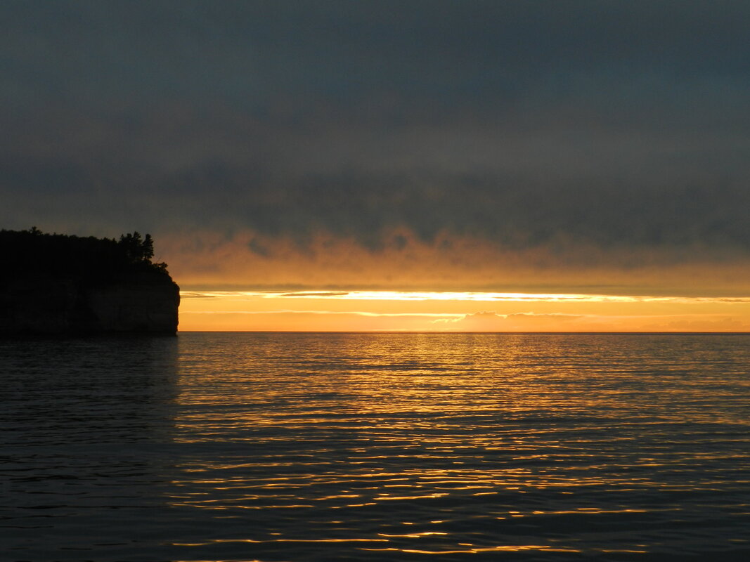
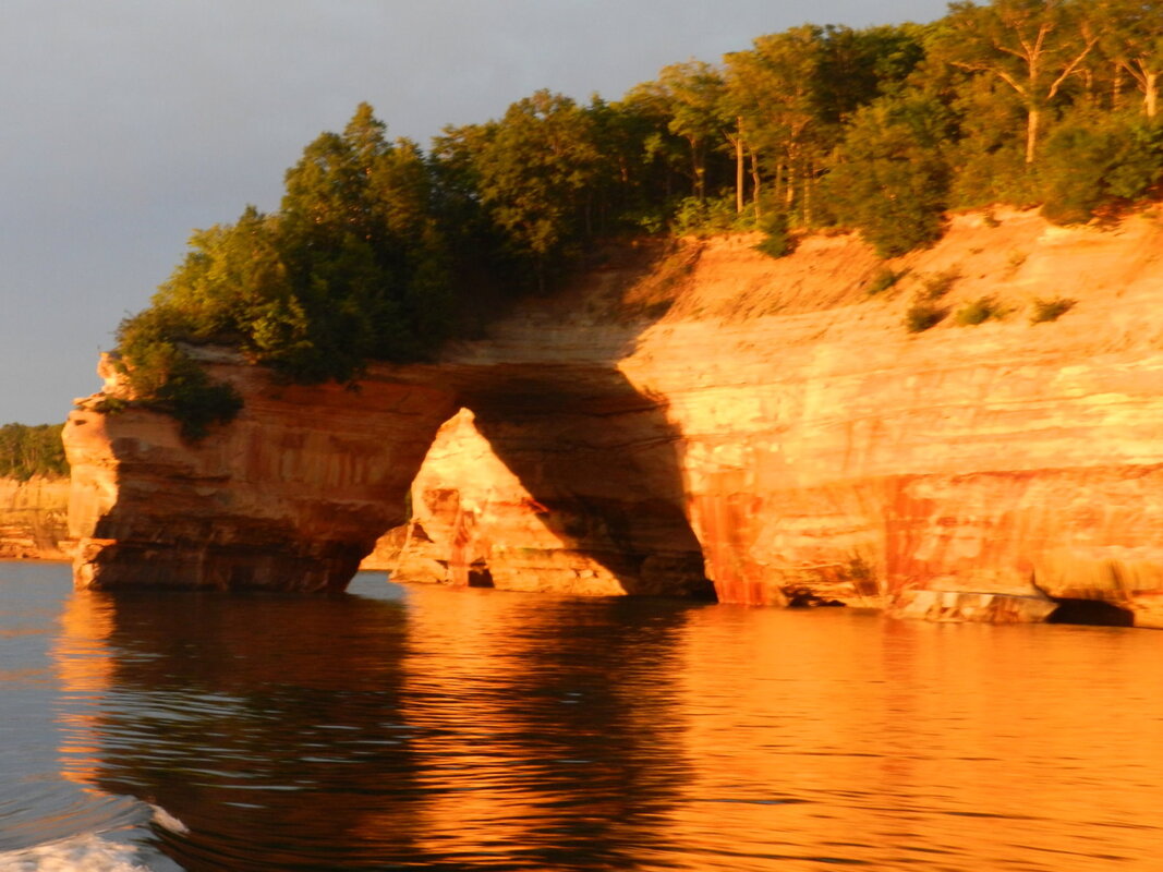
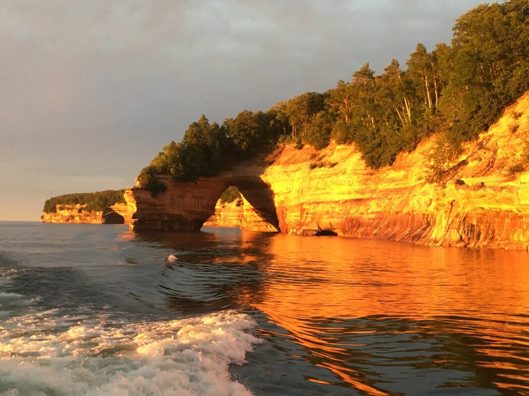
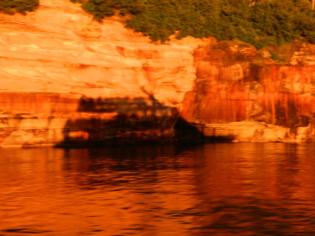
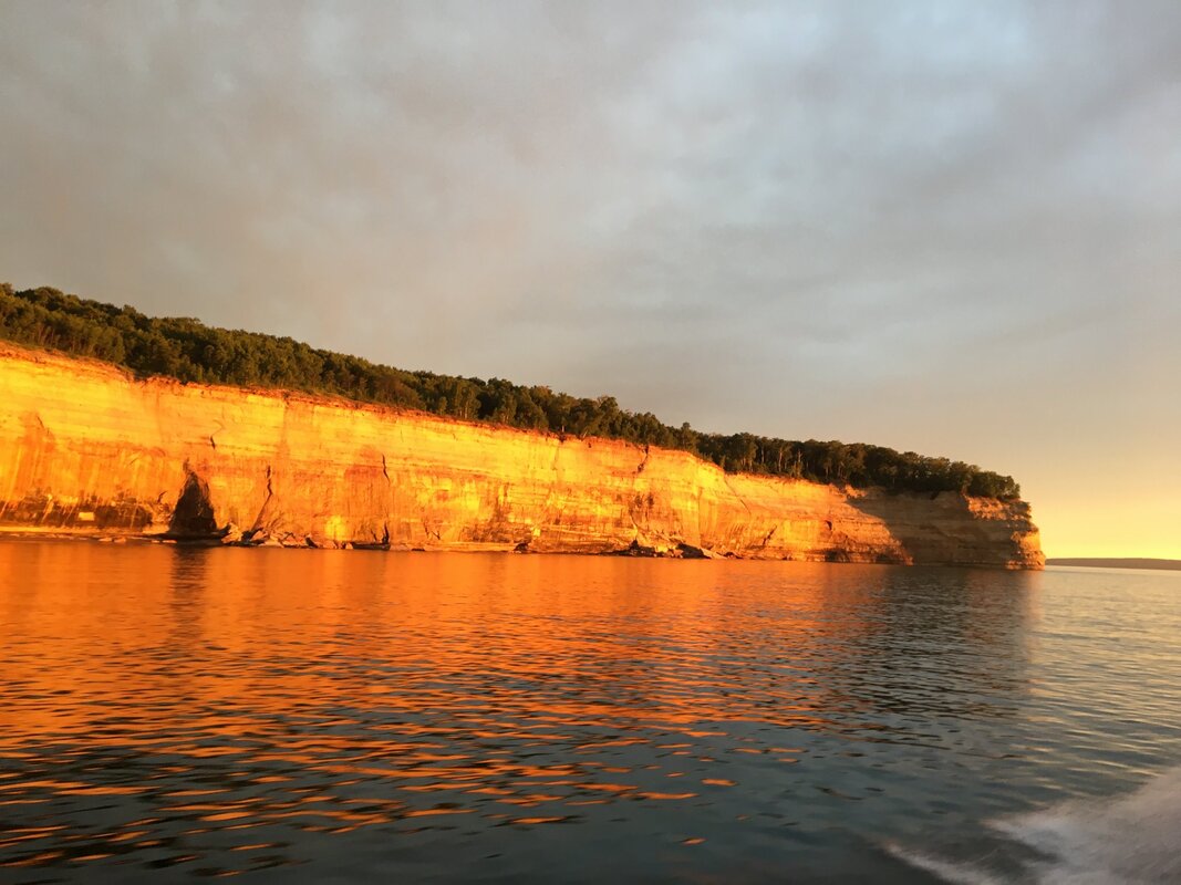
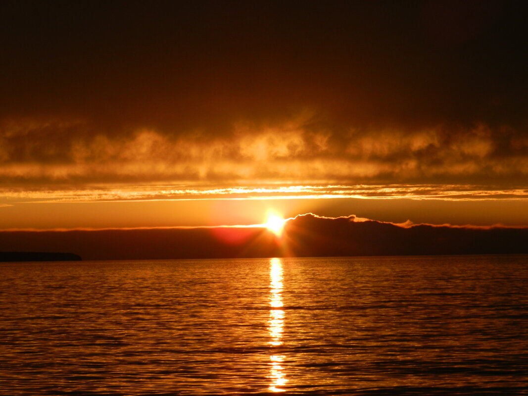
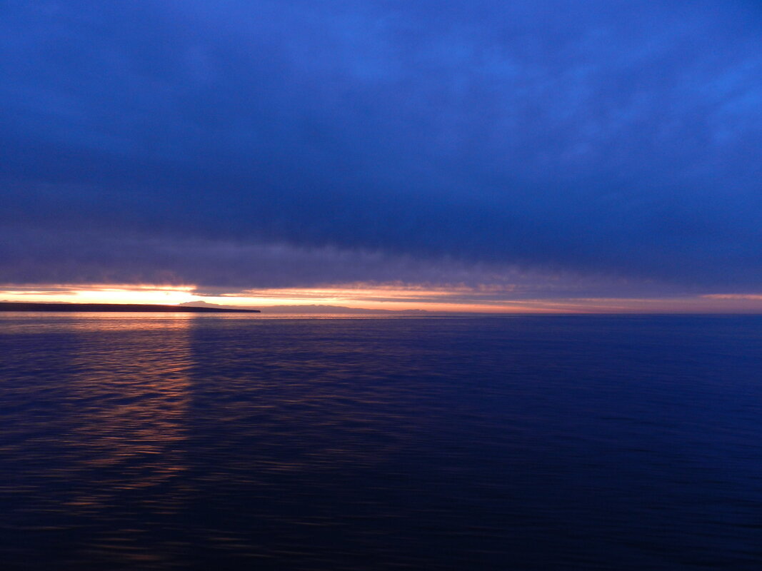
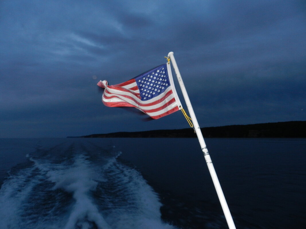
The Beauty of Sunset and Lake Superior On Day #6 of our 30-day, 9376 mile, road trip to see more of America we visited Pictured Rocks National Lakeshore in Munising, Michigan. Pictured Rocks is one of only four National Lakeshores in the United States. Located on Lake Superior, the park stretches for 42 miles along the shore and covers 73,236 acres. Within the park the “pictured rocks” rise between 50 and 200 feet above the lake and stretch for almost fifteen miles. There are also more than 100 miles of hiking trails leading through the forest to remote lakes and streams within the park. In addition, the lakeshore has 12 miles of beaches, 5 miles of sand dunes, several waterfalls, and even a few lighthouses. The name “Pictured Rocks” comes from the mineral stains that can be seen on the face of the cliffs towering over Lake Superior. A wide range of colors occur in the rock face because groundwater seeps through the cracks and trickles down the rock face with Iron (red and orange), copper (blue and green), manganese (brown and black), limonite (white) and other color-producing minerals. Although you can hike to the shoreline, to really see the beauty of the “pictured rocks” you need to take a boat ride. We took a 2-hour trip with Pictured Rock Cruises at sunset – the best time of day to see the spectacular colors. As you can see from the photos below – we were lucky enough to be presented with stunning sights during our trip (click on any photo to start the slideshow): For those of you that know the poem “The Song of Hiawatha” by Henry Wadsworth Longfellow “Gitchee Gumee” is the Ojibwa (Native American) name for Lake Superior. Here’s the first stanza of the poem to jog your memory: "By the shore of Gitche Gumee, By the shining Big-Sea-Water, At the doorway of his wigwam, In the pleasant Summer morning, Hiawatha stood and waited." https://www.hwlongfellow.org/poems_poem.php?pid=296 If you want to see a little more about the Pictured Rocks National Lakeshore, the local light houses, or what to do in the Munising area - here are a couple of links to check out: Road Trip to the Heartland Last Saturday we completed a 30-day “road trip” to see more of America. During our trip we drove 9,376 miles (an average of 312.5 miles per day) and visited 21 States, saw all 5 of the Great Lakes and were fortunate to see friends, family and all sorts of interesting places. Don’t let the MSM - and their nightly disaster telecasts fool you - America is beautiful, clean, peaceful and filled with nice people and wonderful sights. Here’s a high level map of the route that we planned to drive when we started the trip. During the actual trip we made some “on the fly” modifications to add or delete planned sights due to timing and a couple of closures - but nothing major. The only real omission was a very short swing through Canada (Manitoba and Saskatchewan) where it borders North Dakota due to the border closure being extended past 21 July. 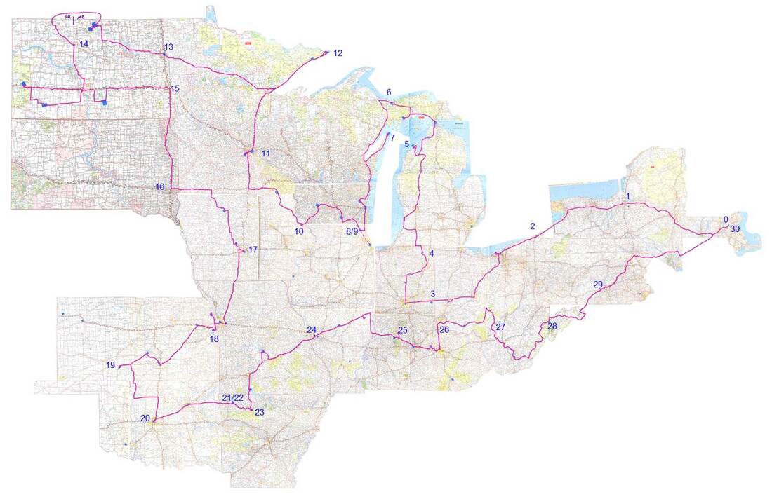 The States that we visited during our trip were:
Needless to say, it was a great trip and we had a wonderful time. During the final miles, as we approached our home, my daughter asked if we could just make a pit stop at home and then hit the road again. What a great idea! Now that we’ve unpacked the car, sorted the mail, washed out clothes, mowed the yard, and downloaded the 10,000+ photos that we collectively took during the trip – I plan to post some of the photos of our adventures and write a few blogs highlighting the special sights that we saw. I’m sure that choosing which places to blog about will be the hard part. |
What's On This Page?Here's where we post reviews, questions, answers, thoughts and other information that's of general interest to our followers in a blog format. Categories
All
Archives
August 2023
|


 RSS Feed