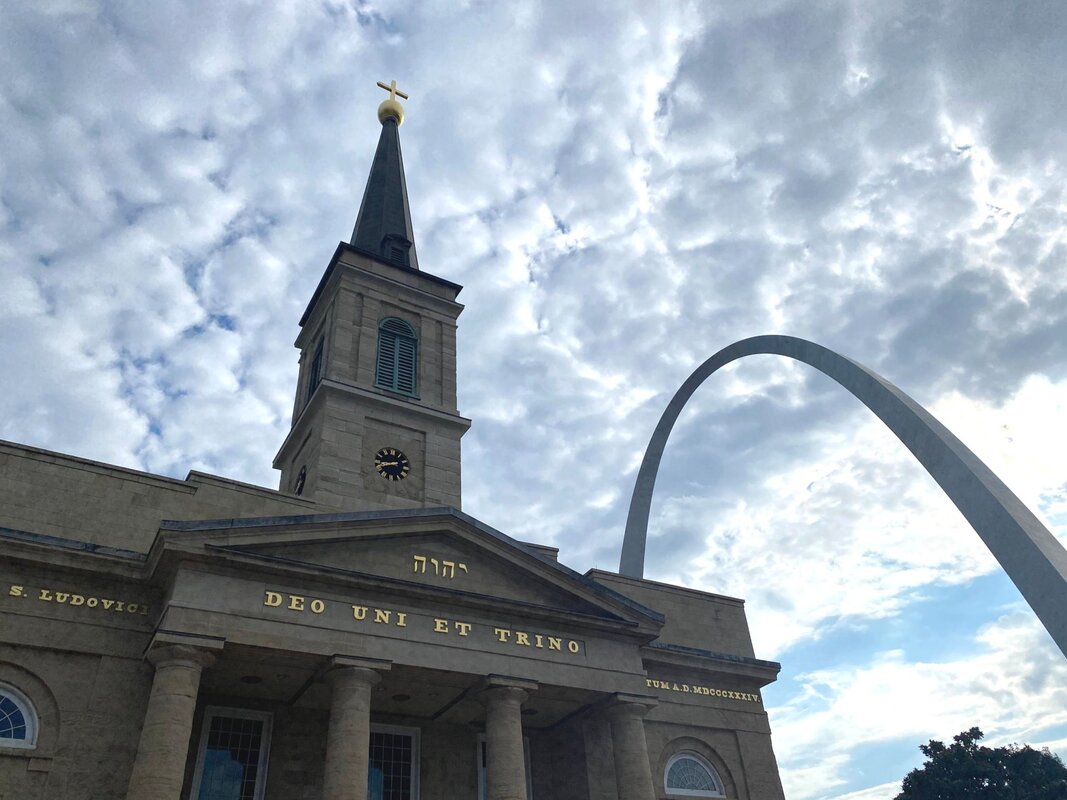
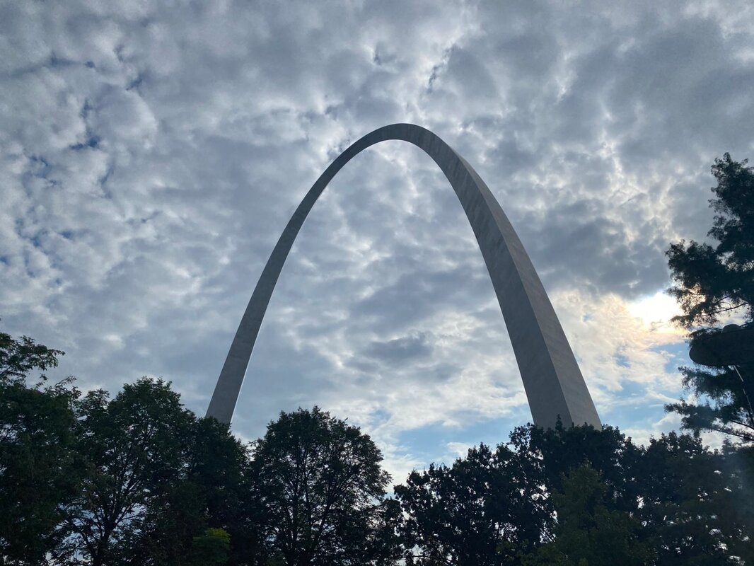
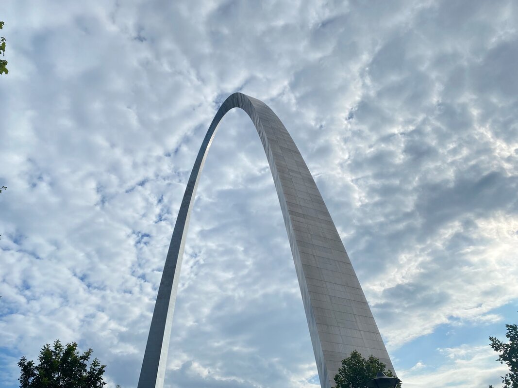
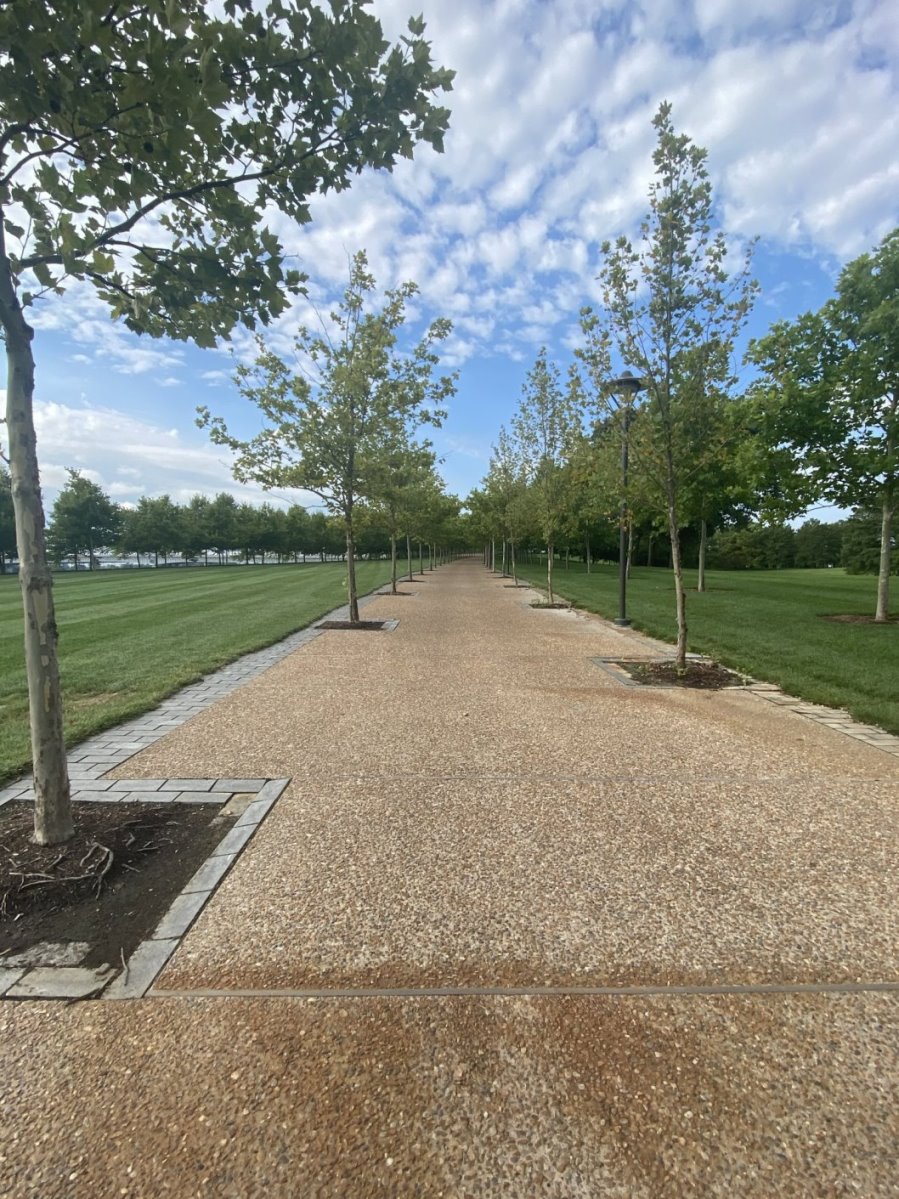
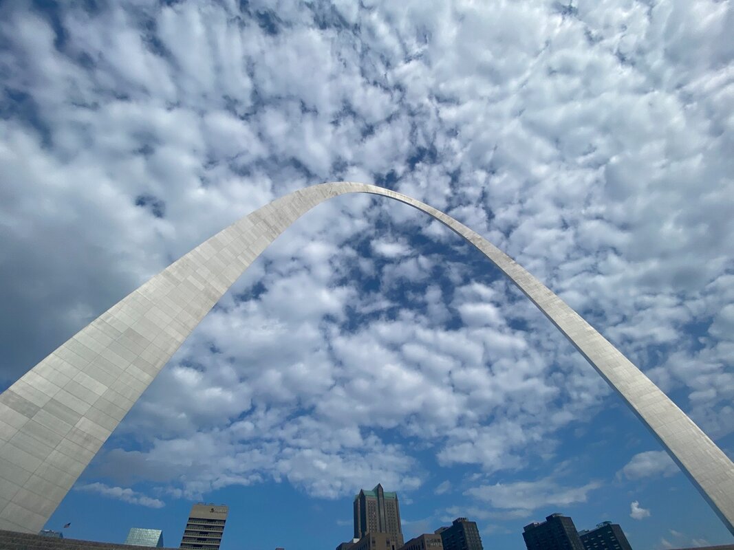
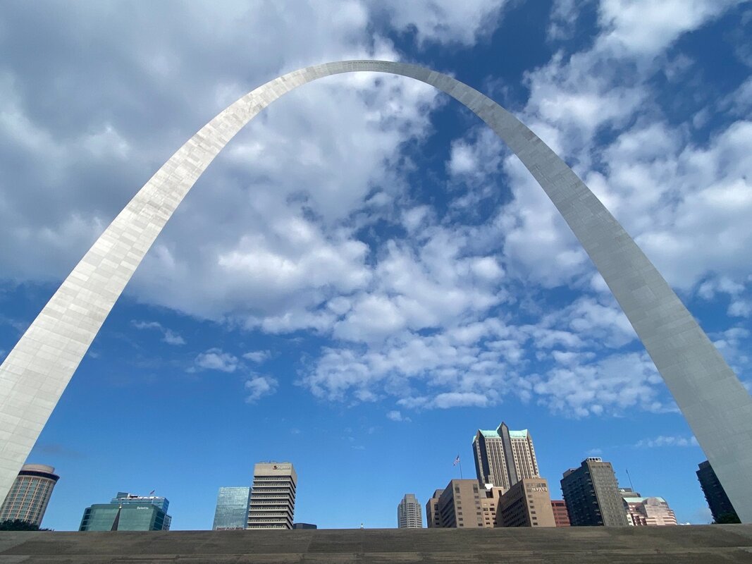
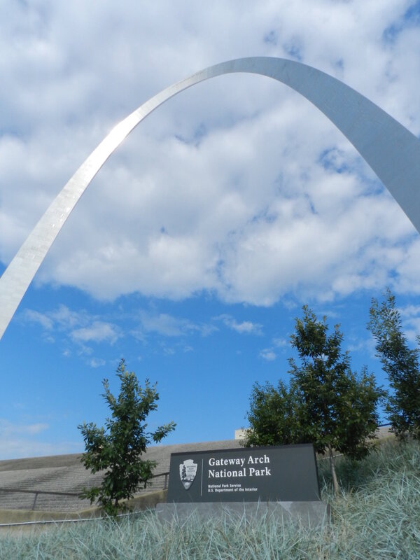
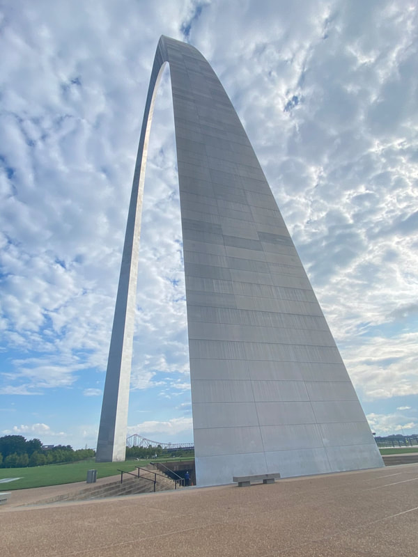
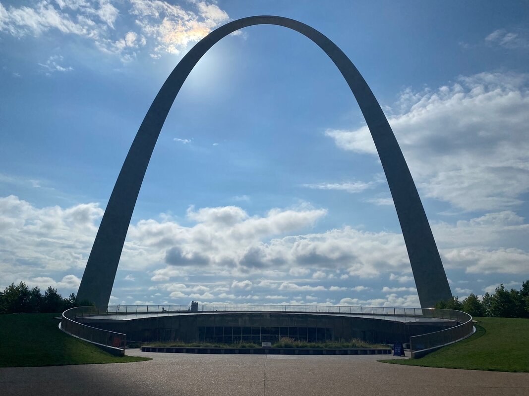
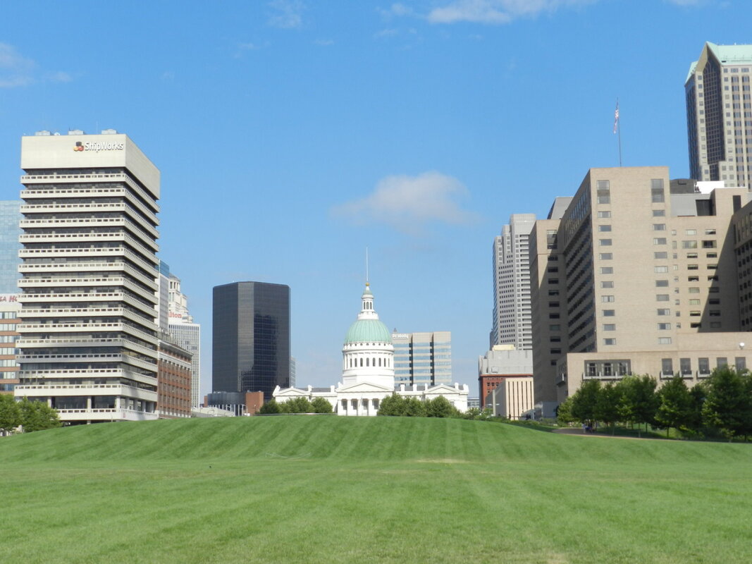
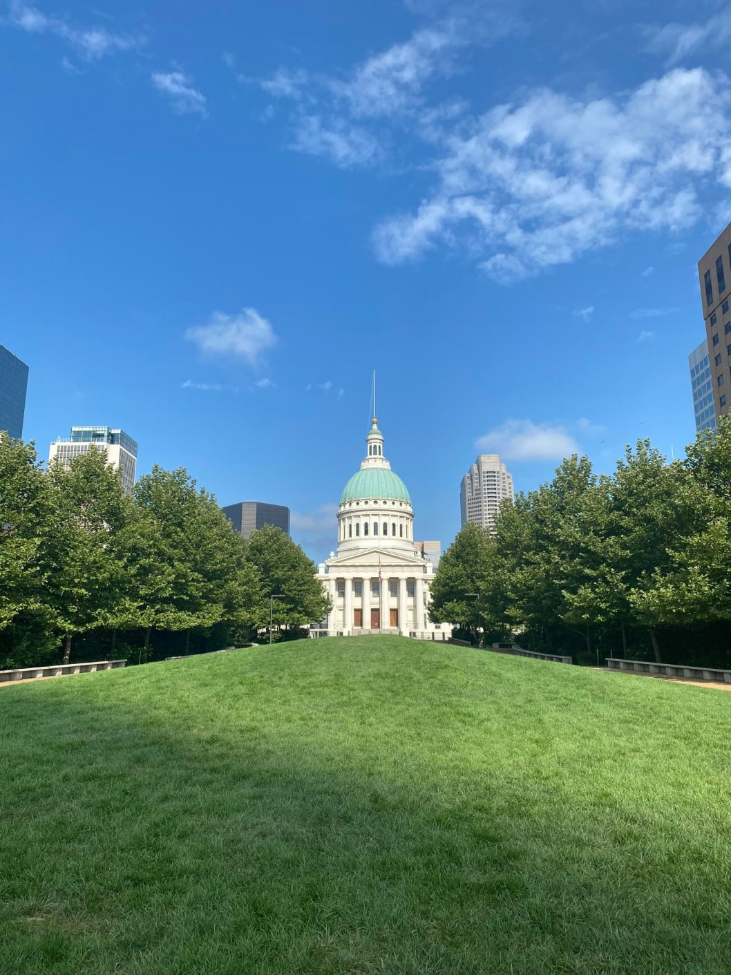
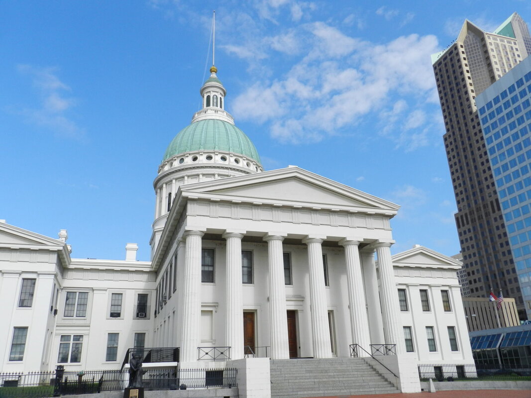
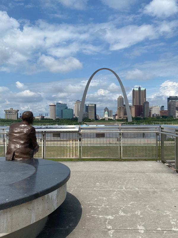
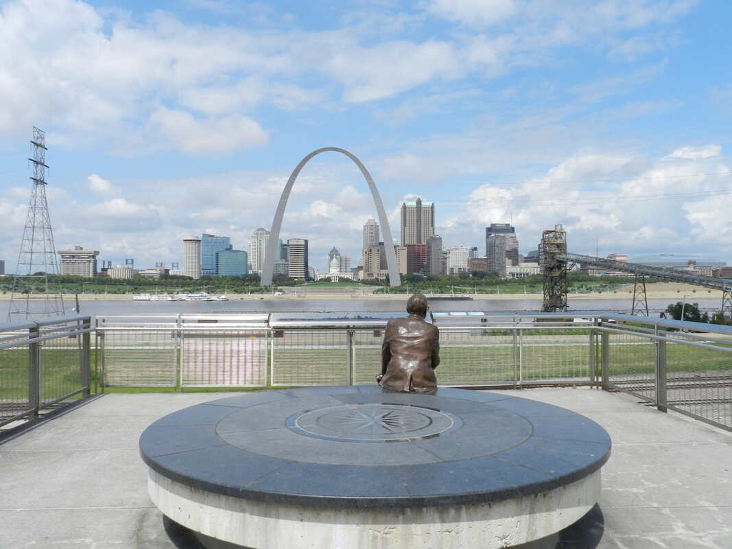
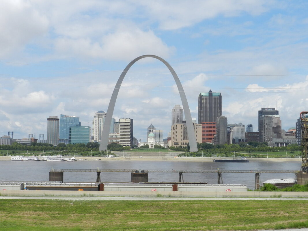
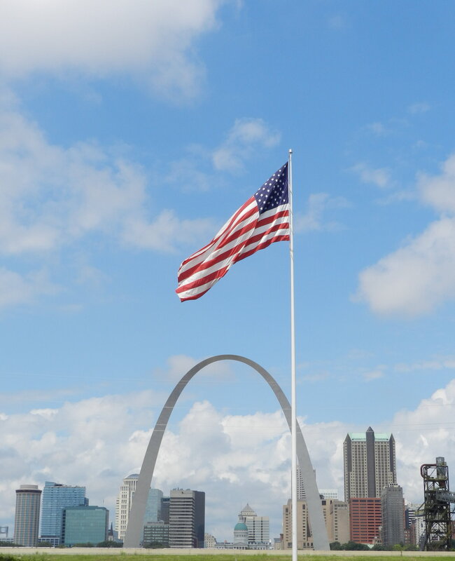
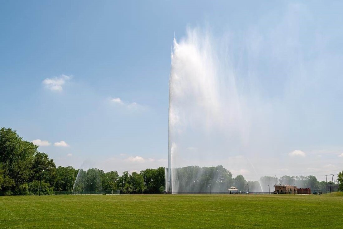
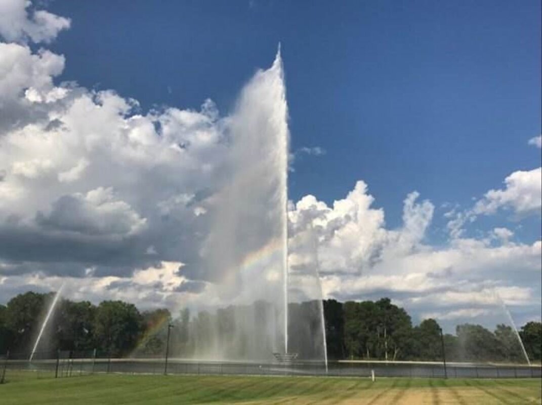
The Road to Westward ExpansionOn Day #24 of our 30-day, 9376 mile, road trip to see more of America we visited the Gateway Arch National Park in Saint Louis Missouri and the Gateway Geyser in East St. Louis Illinois. 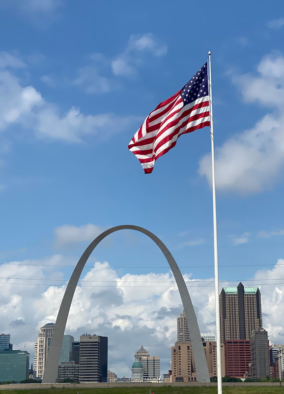 Originally named the “Jefferson National Expansion Memorial” after President Thomas Jefferson and his. 1803 acquisition of the Louisiana Purchase from France which doubled the size of the United States, the name never caught on with the millions of people that visit the Gateway Arch. So the park was renamed as the “Gateway Arch National Park” in February 2018. The Gateway Arch reflects St. Louis' role in the Westward Expansion of the United States during the nineteenth century. The park is also a memorial to Thomas Jefferson's role in opening the West, to the pioneers who helped shape its history and to Dred Scott who sued for his freedom in the Old Courthouse. The entire Park comprises approximately 92 acres. This includes the Gateway Arch and grounds (about 62 acres), plus another ~30 acres encompassing the Old Courthouse, Luther Ely Smith Square and many of the surrounding streets (which are managed as easements). The Gateway Arch structure and the surrounding landscape were designated a National Historic Landmark in 1987. The Arch itself is 630 feet tall (approximately 63 stories) and has 630 feet between its two legs at ground level. Construction of the Arch began on 12 February 1963 and was completed on 28 October 1965. The north tram was opened to the public on 24 July 1967 and the south tram began operations on 19 March 1968. Eero Saarinen, the architect who designed the Gateway Arch in 1947, envisioned twin memorials, one on each side of the river. While the Gateway Arch was built in Missouri, the Arch’s Illinois counterpart was never built due to lack of funding. Instead, directly cross the river from the Gateway Arch National Park, lies the Malcolm W. Martin Memorial Park. Located in East Saint Louis Illinois this park surrounds the Gateway Geyser, the tallest water fountain in the United States and third tallest in the world. The Gateway Geyser began operating on 27 May 1995 and is powered by three 800-horsepower pumps which can blast 7,500 gallons of water per minute straight up at a rate of 250 feet per second. When the wind is less than 4 mph the Gateway Geyser can reach a maximum height of 630 feet, the exact height of the Gateway Arch. From May through September the fountain operates daily for 10 minutes at noon. In addition to the Geyser the park also houses the Mississippi River Overlook (completed in the spring of 2009), which provides spectacular views of both the Gateway Arch and Gateway Geyser. The tiered-ramp structure is approximately 43 feet tall and features illuminated railings so that visitors can enjoy the spectacular views both day and night. The Overlook is actually one of the best places to see the Gateway Arch since it allows you to see the entire Arch surrounded by the city of Saint Louis. No matter the time of day, or the weather, the park’s view of the river is constantly viewed by at least one occupant, a bronze statue of Malcolm W. Martin himself, watching the Mississippi River roll by. As you can see from the photos below – the Gateway Arch and Martin Memorial Park are stunning sights – especially if you are lucky enough to visit on a sunny day when there are few other people in the parks. (click on any photo to start the slideshow): If you want to learn more about the Gateway Arch and the Gateway Geyser here are a couple of links to check out: https://www.nps.gov/jeff/index.htm https://www.gatewayarch.com/ https://www.theparkwithaview.com/gatewaygeyser 
0 Comments
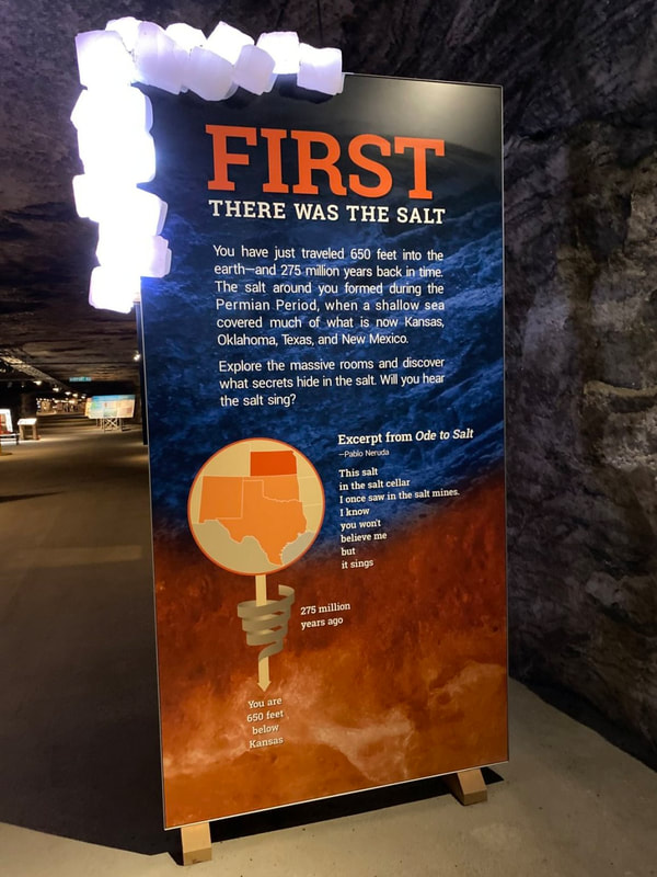
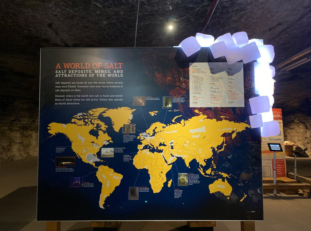
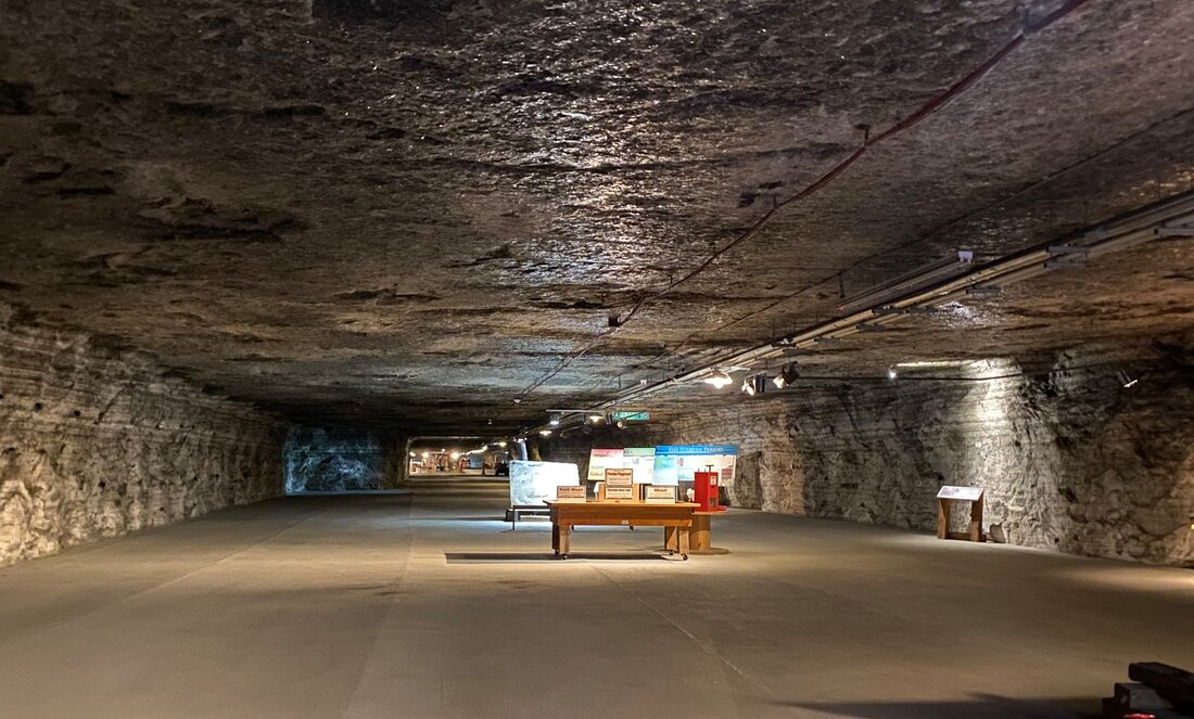
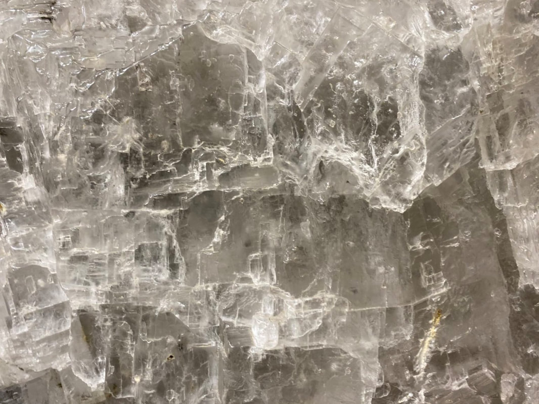
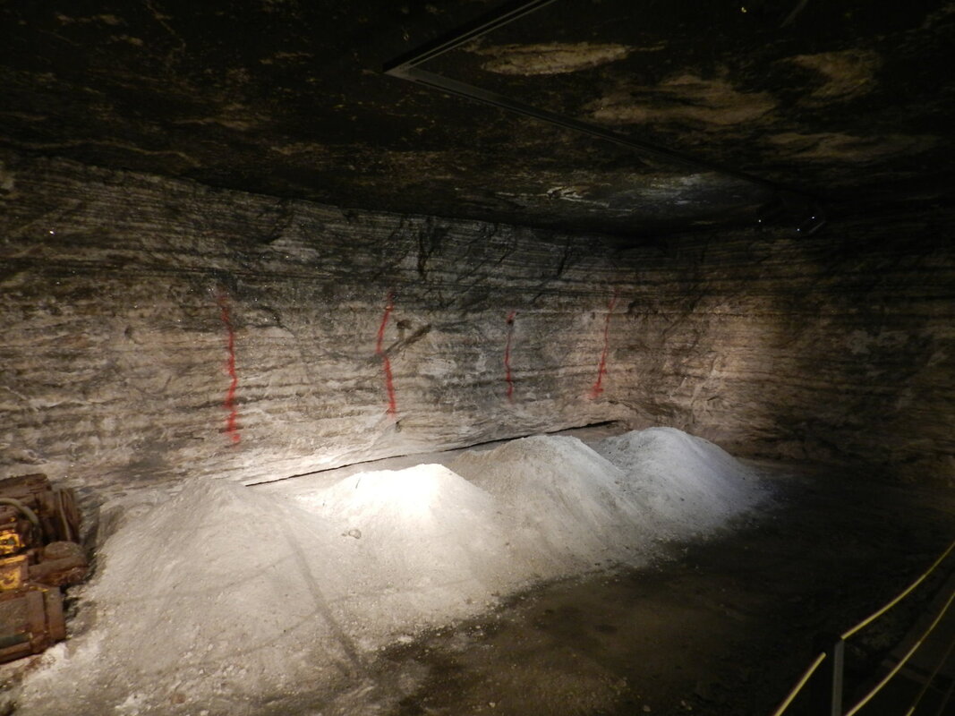
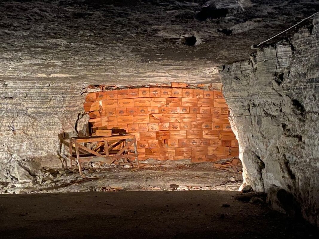
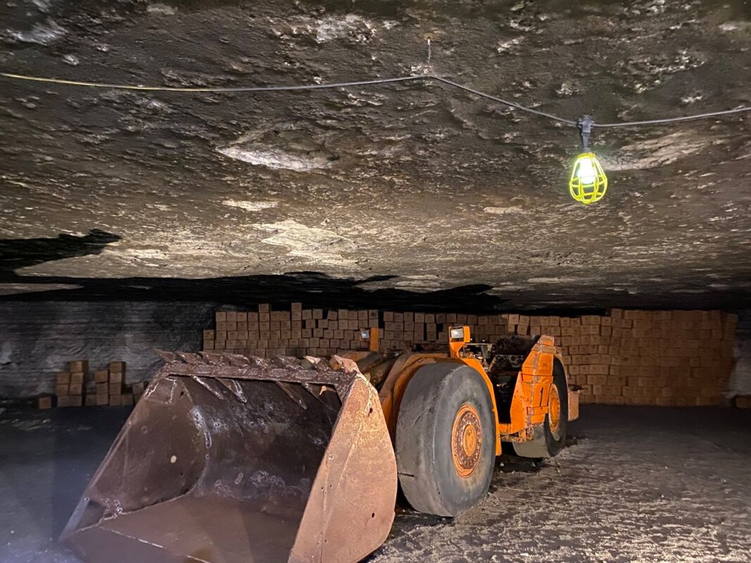
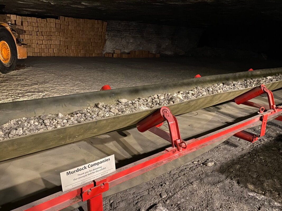
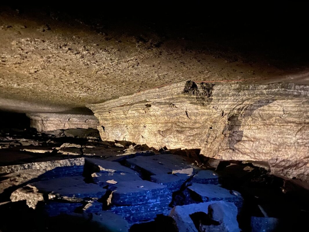
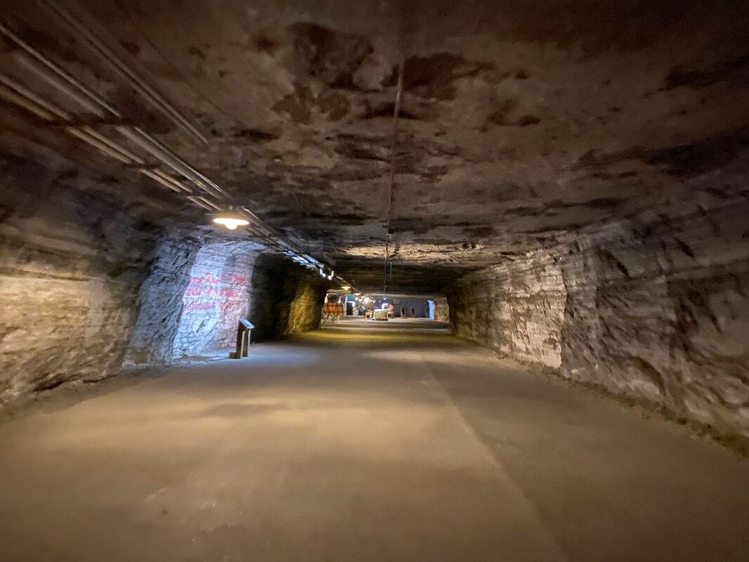
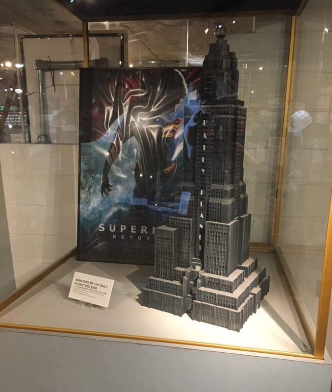
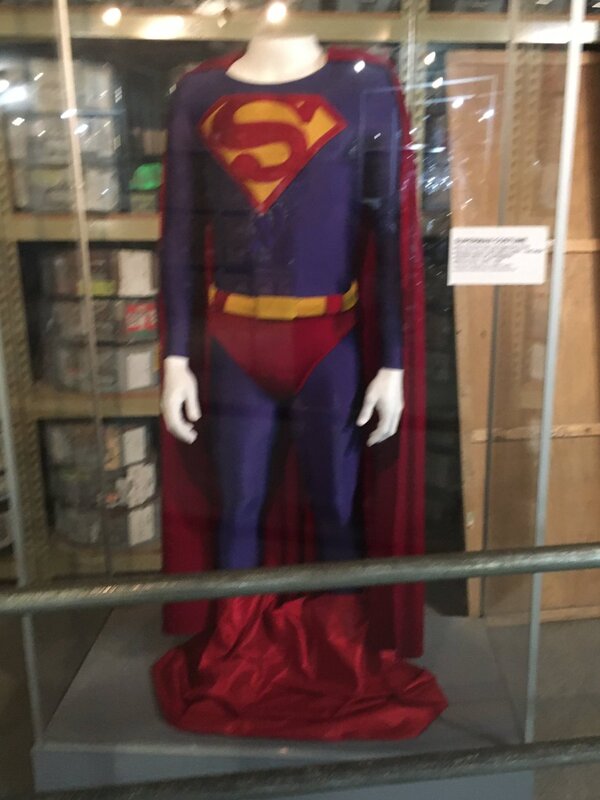
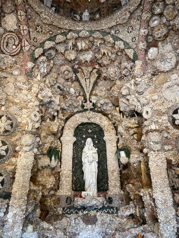
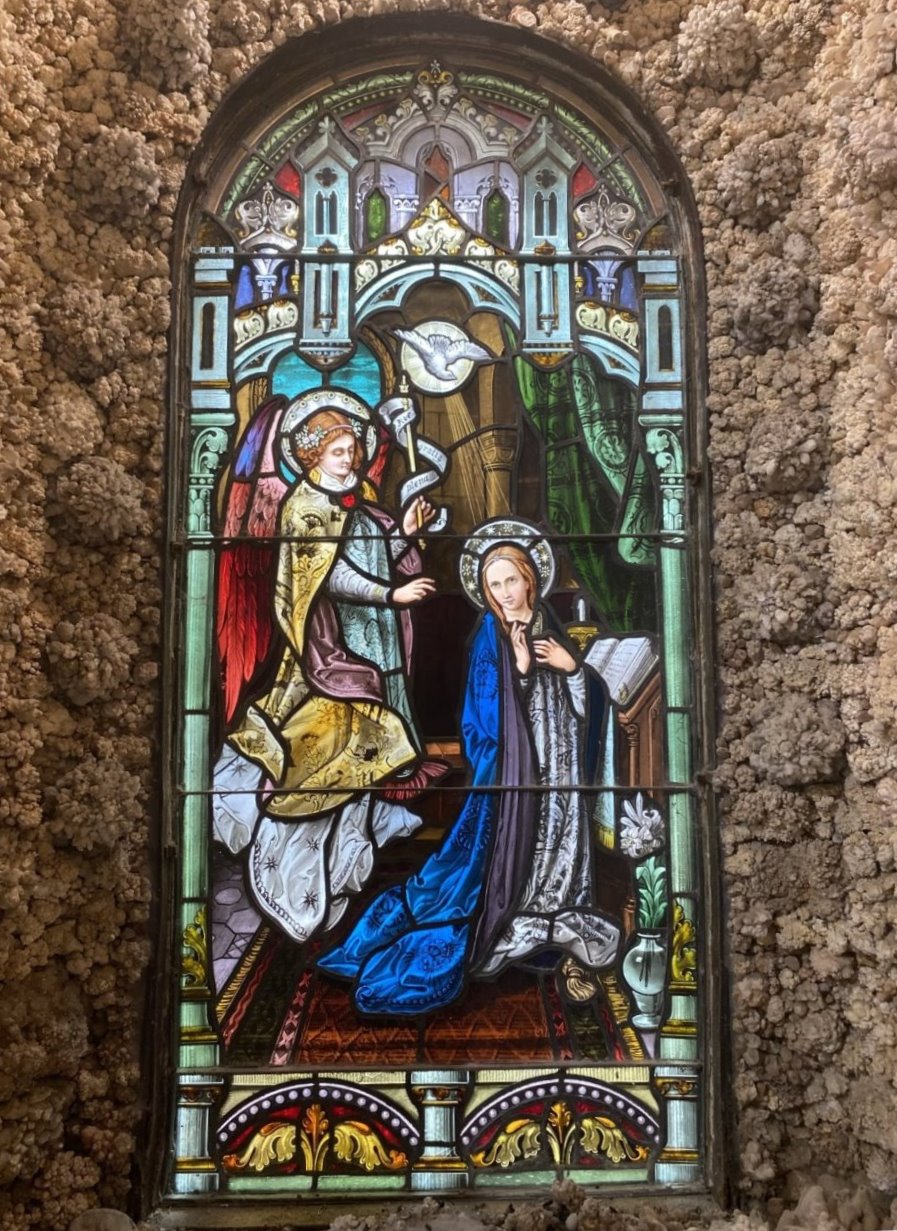
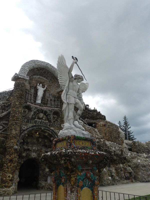
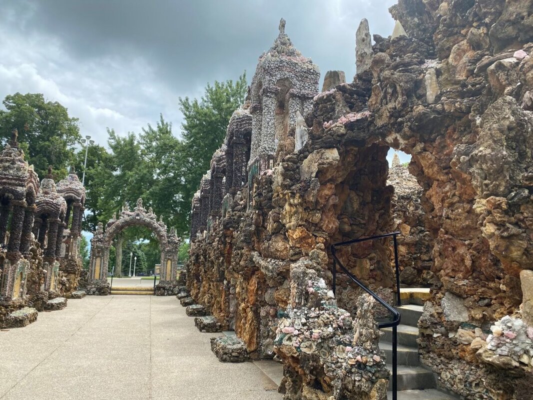
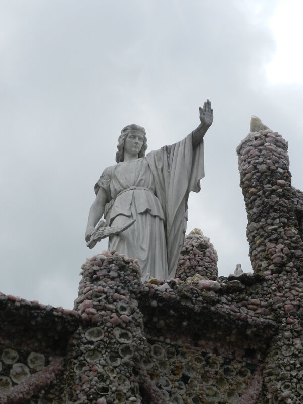
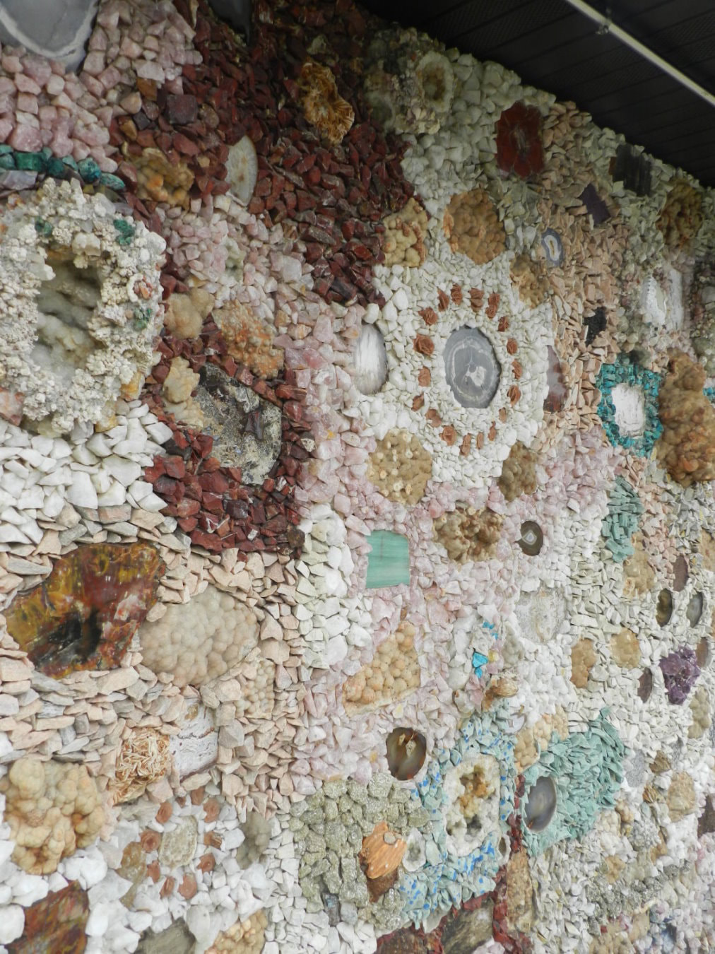
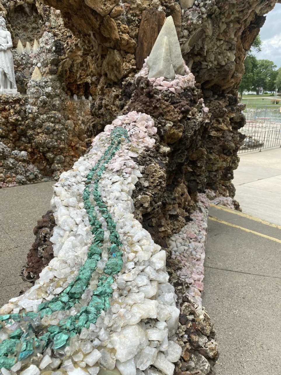
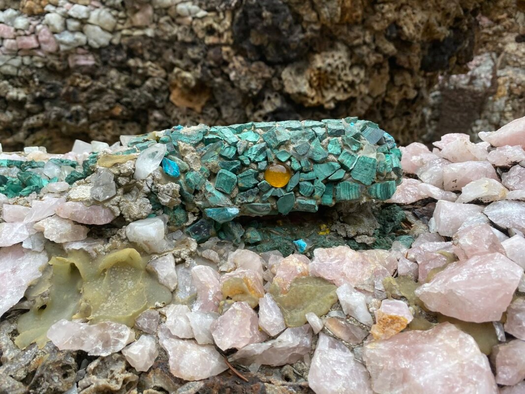
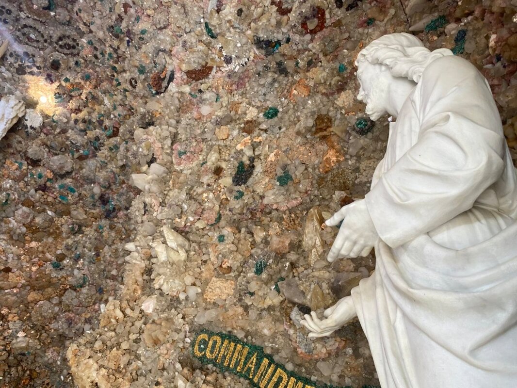
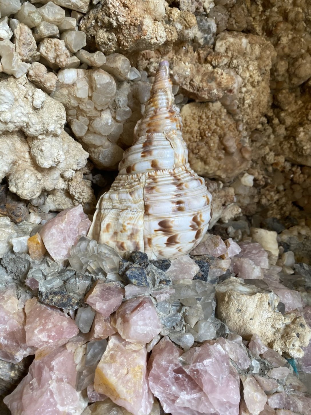
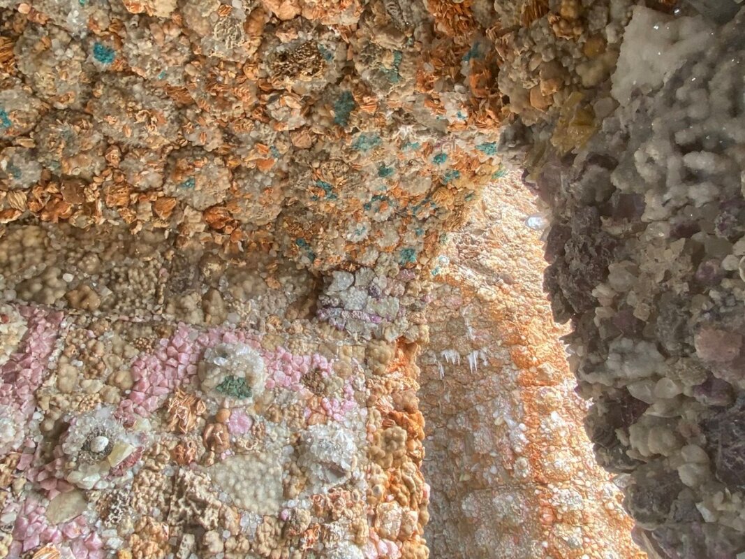
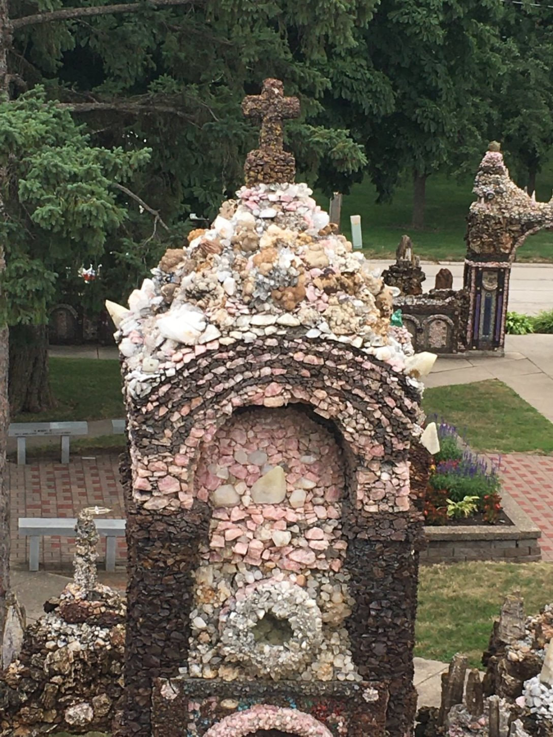
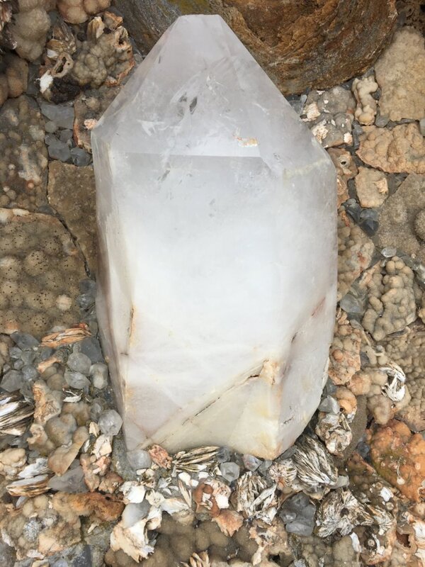
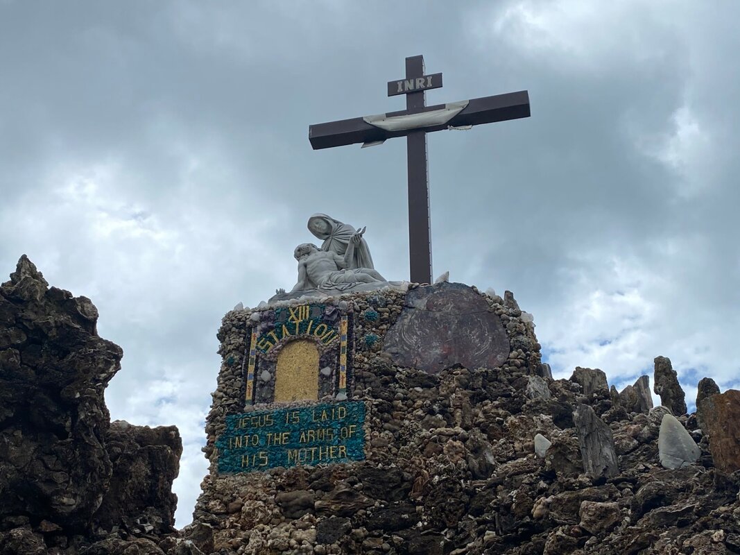
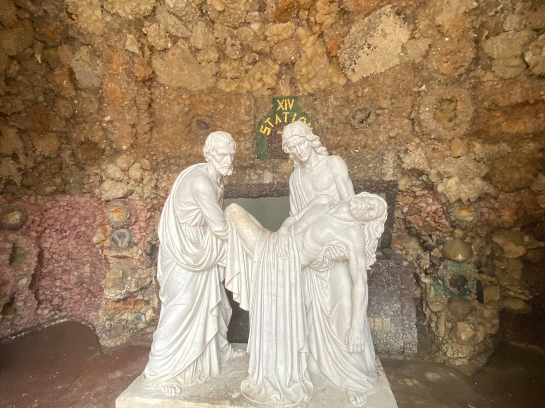
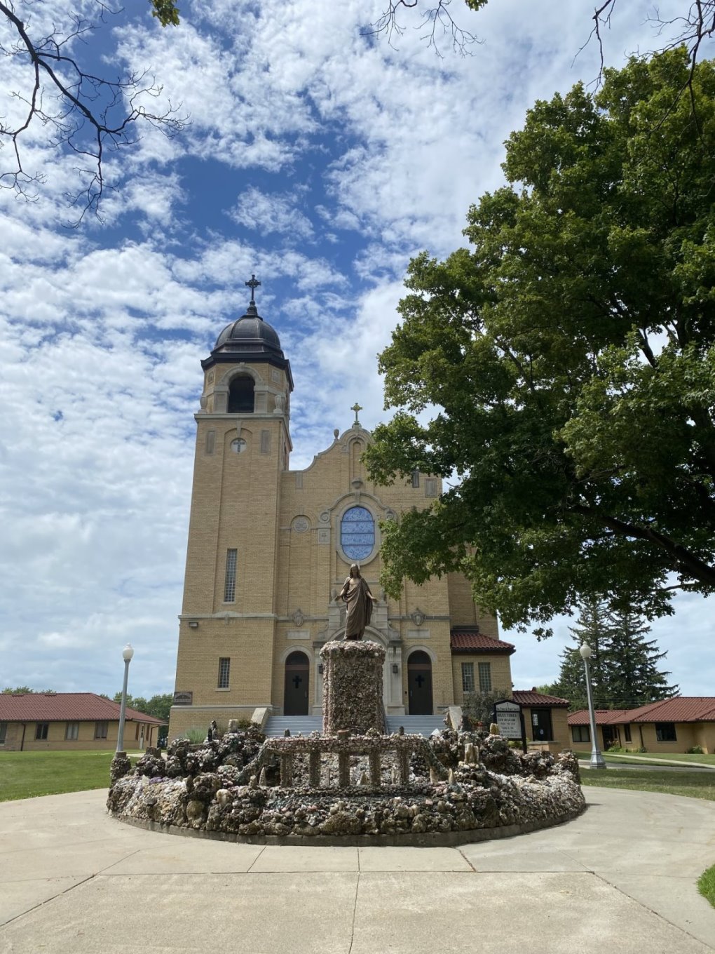
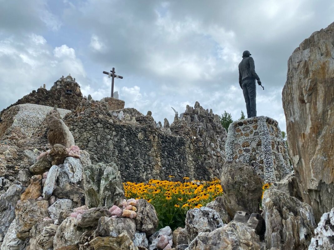
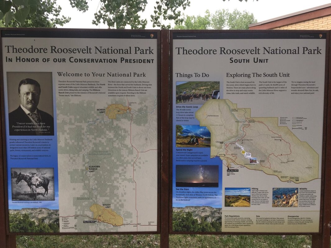
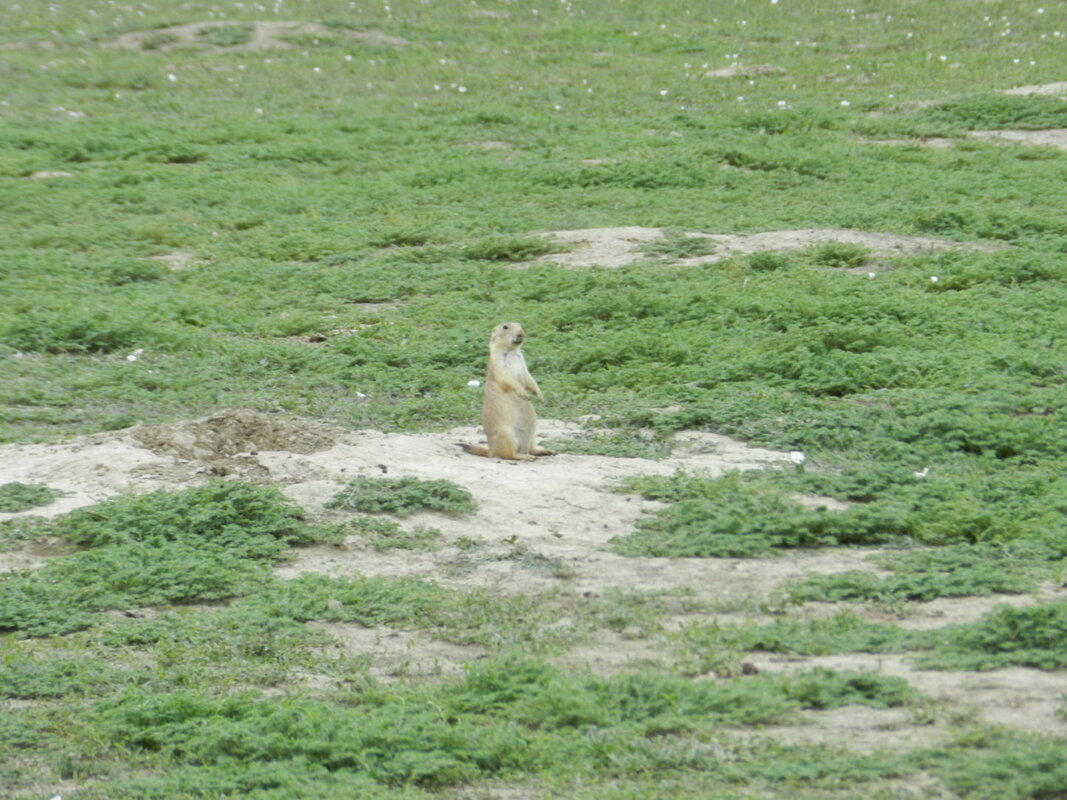
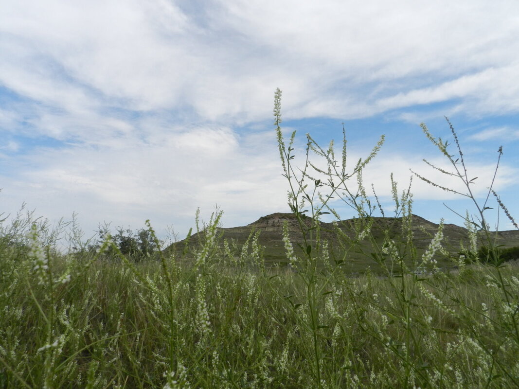
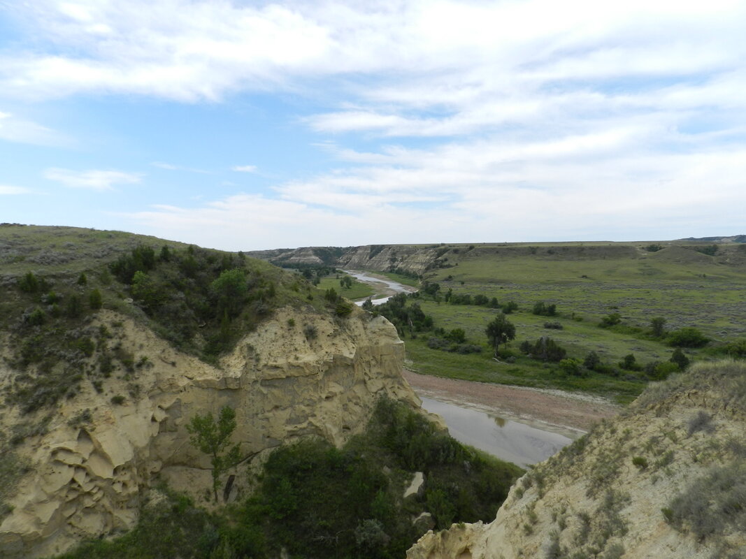
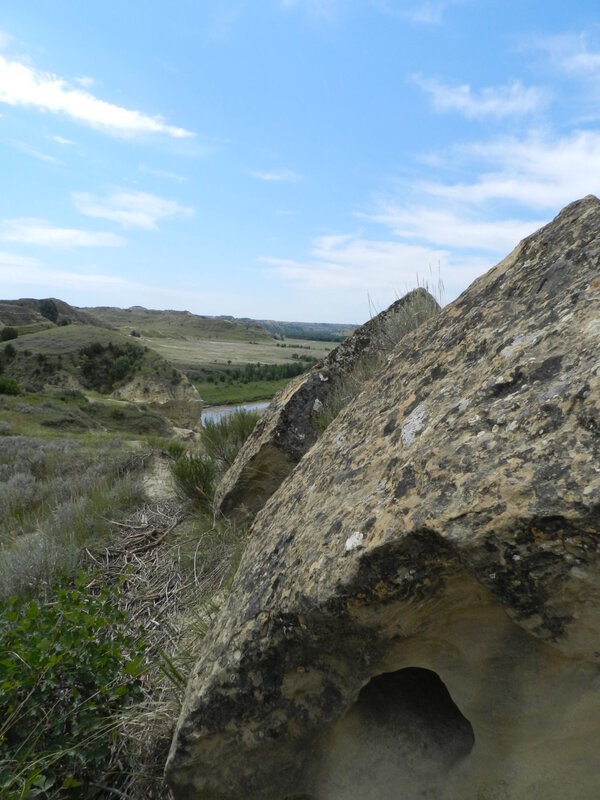
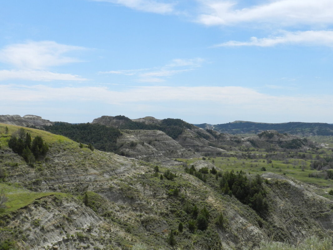
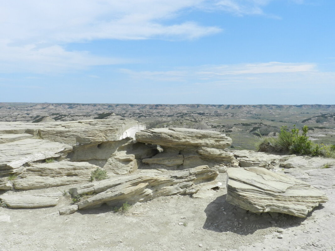
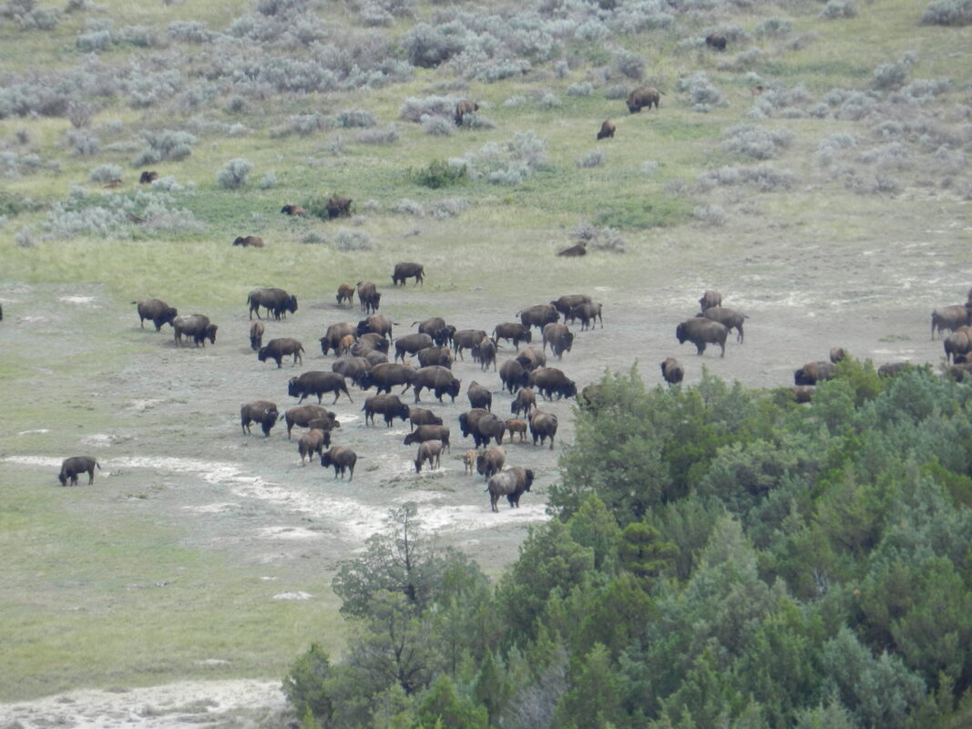
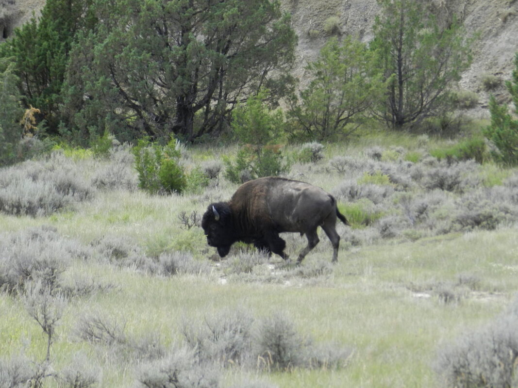
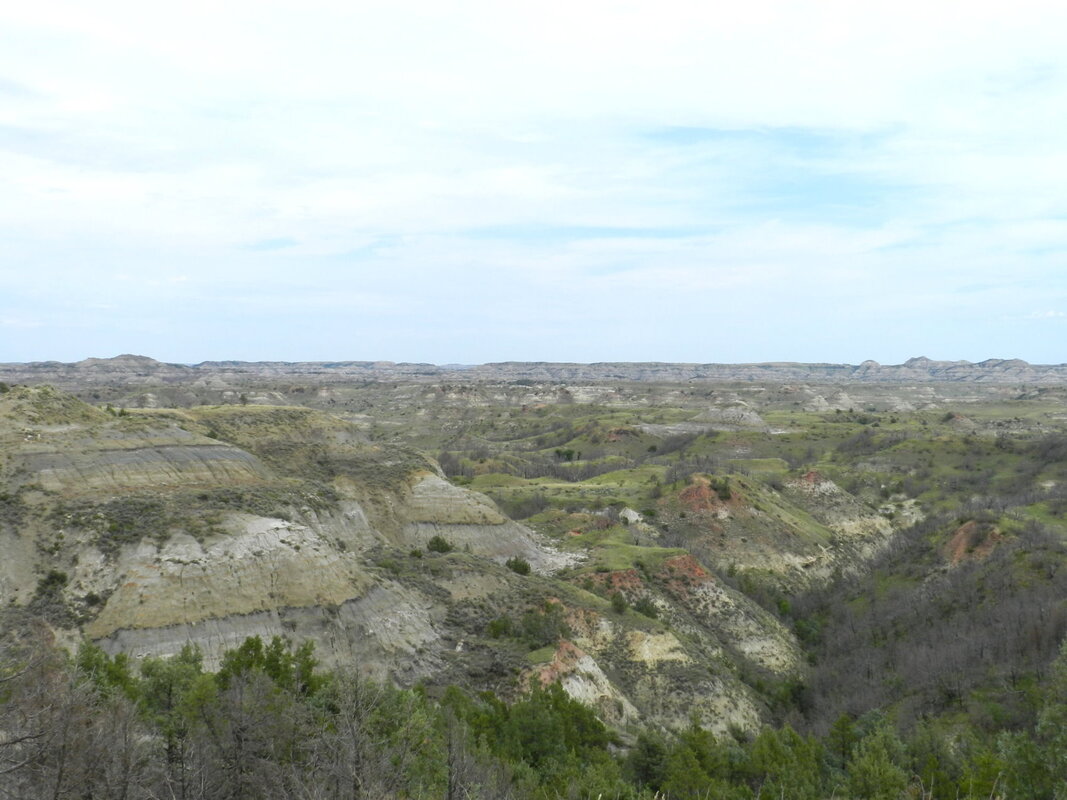
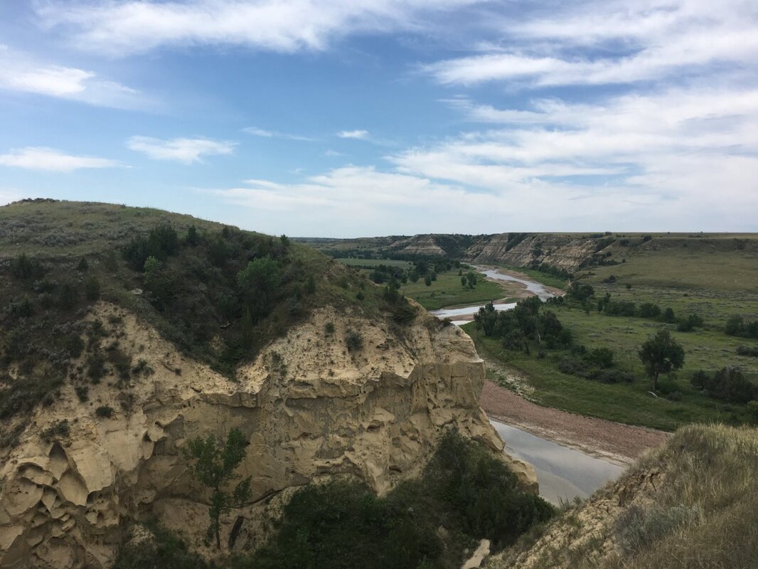
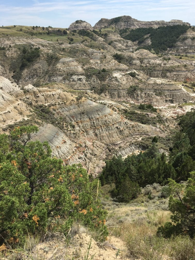
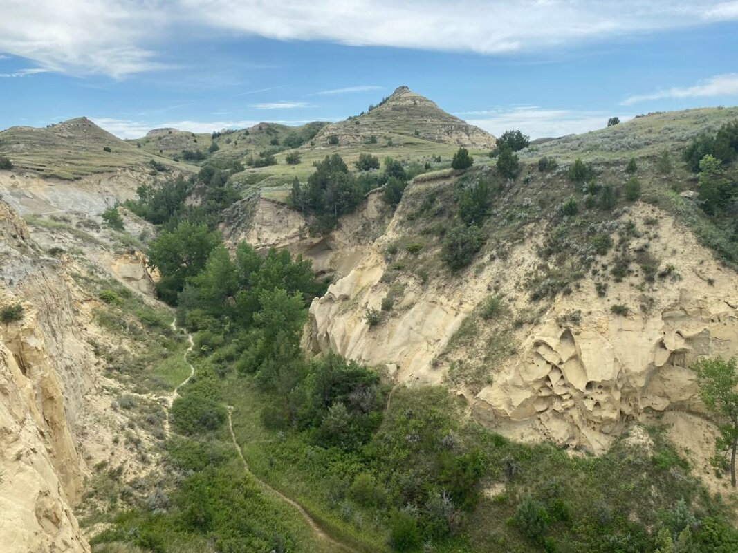
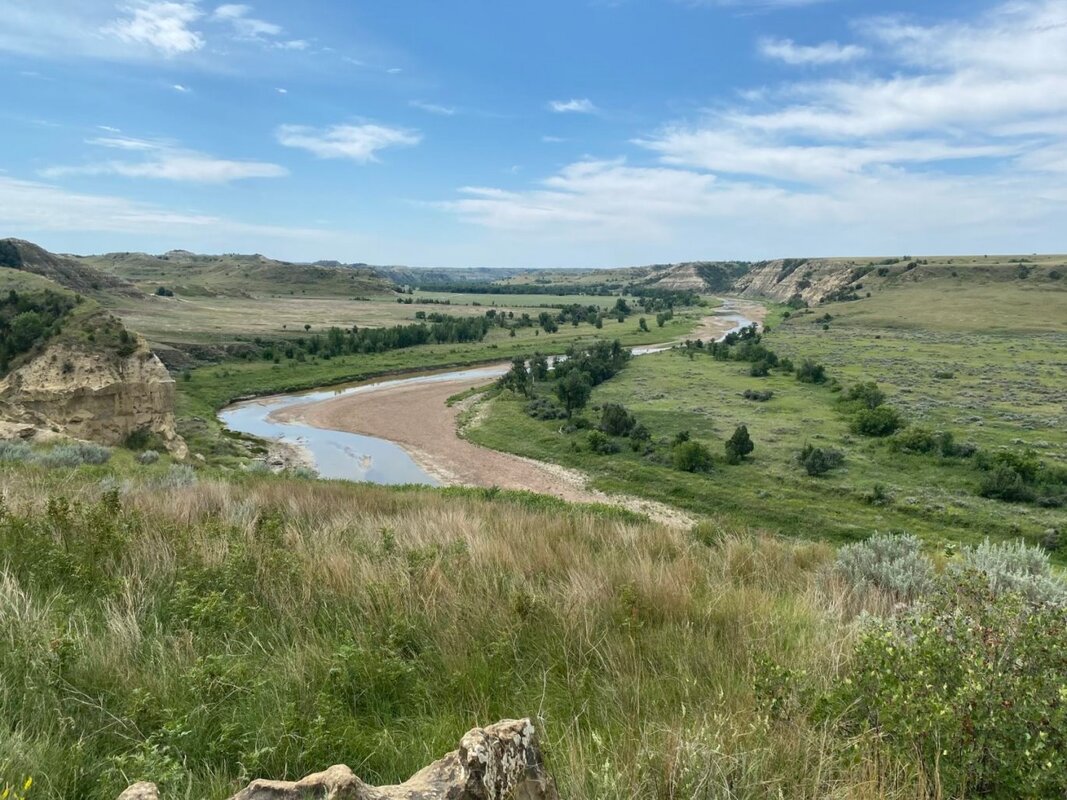
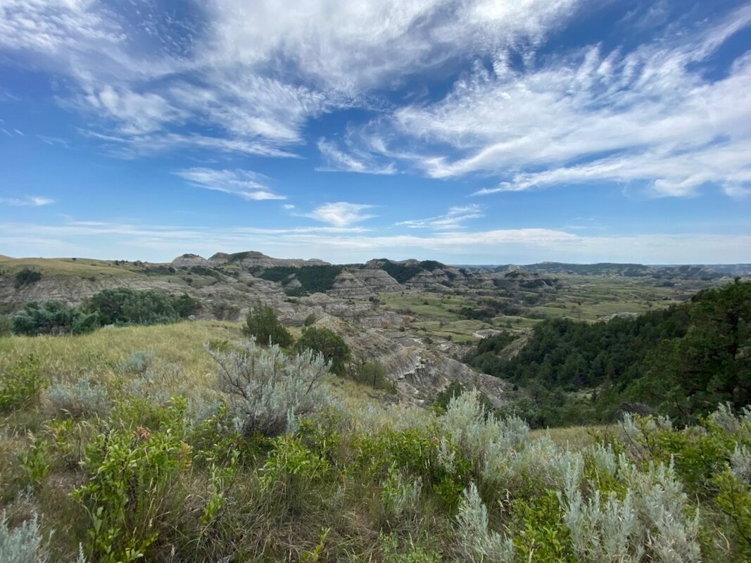
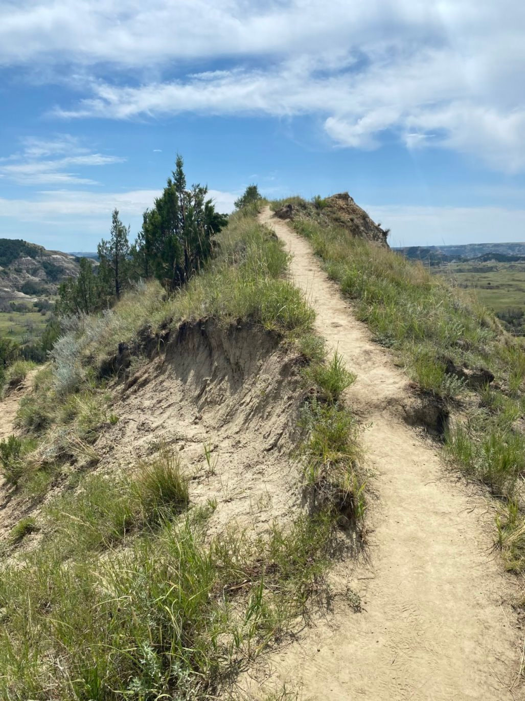
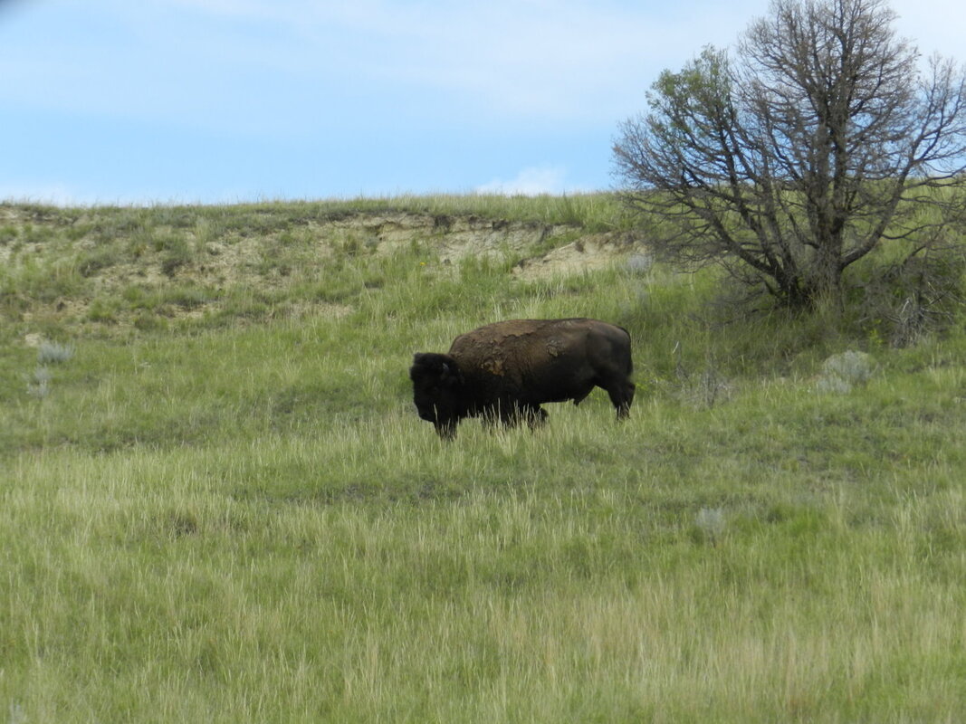
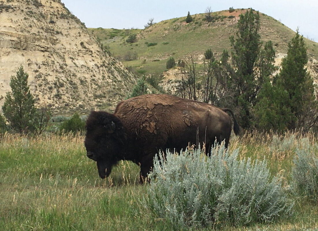
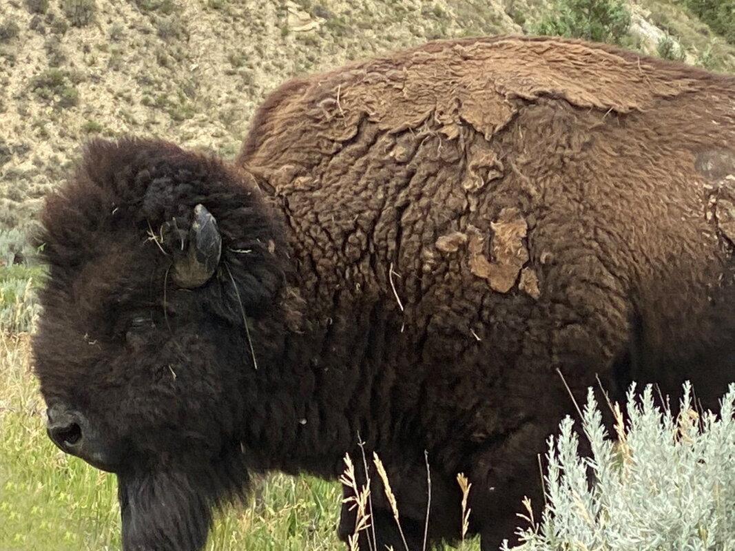
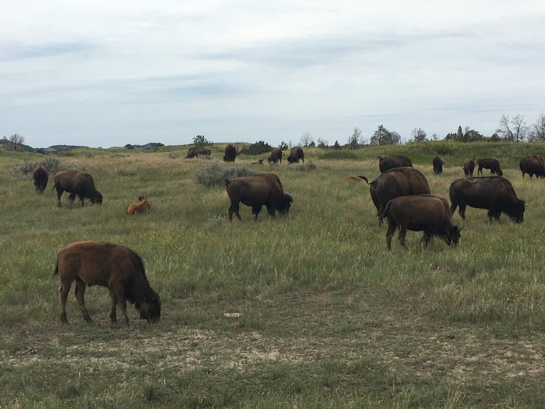
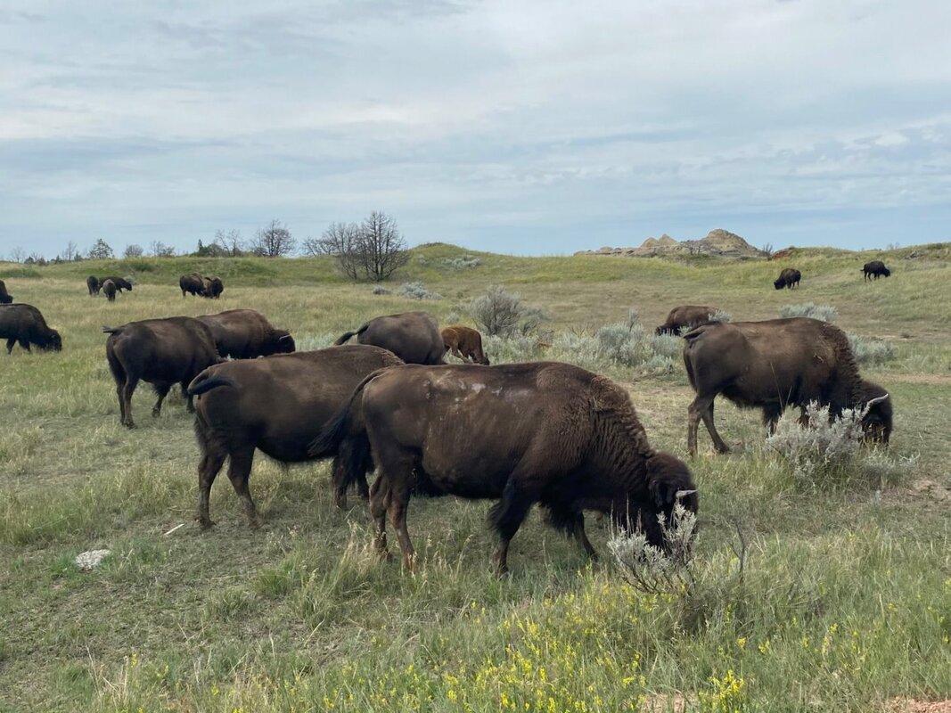
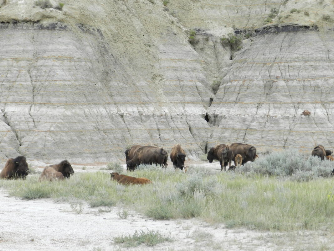
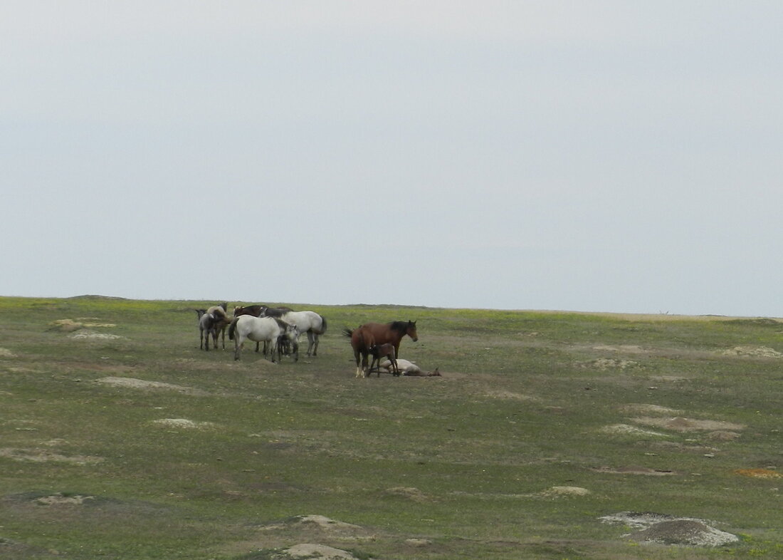
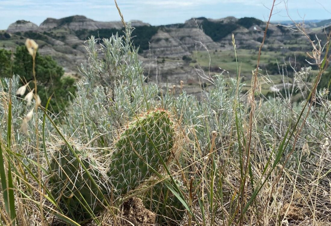
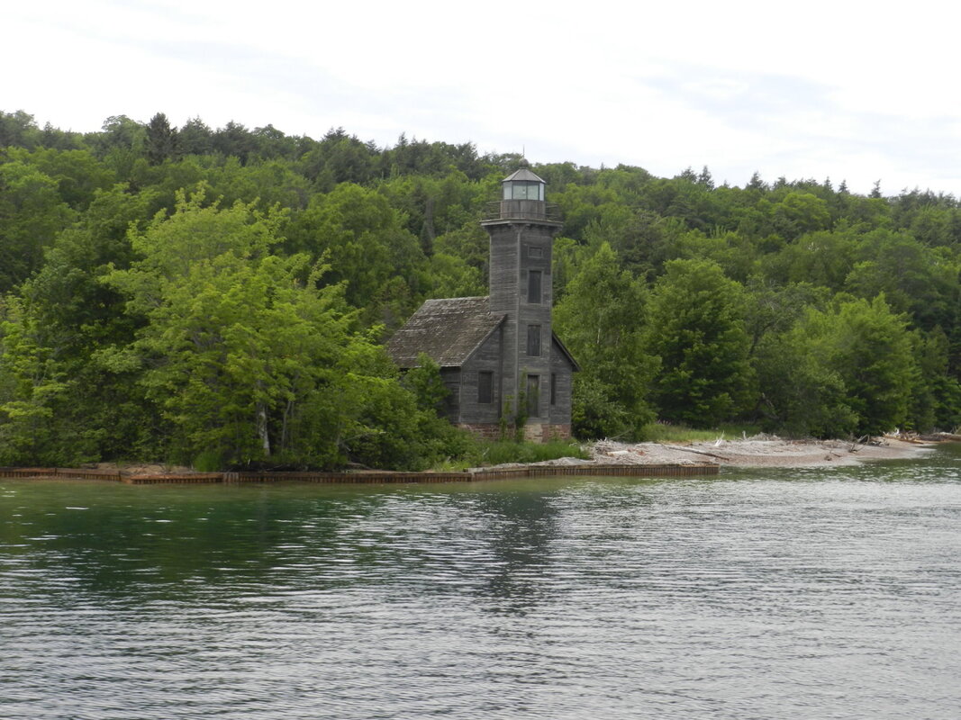
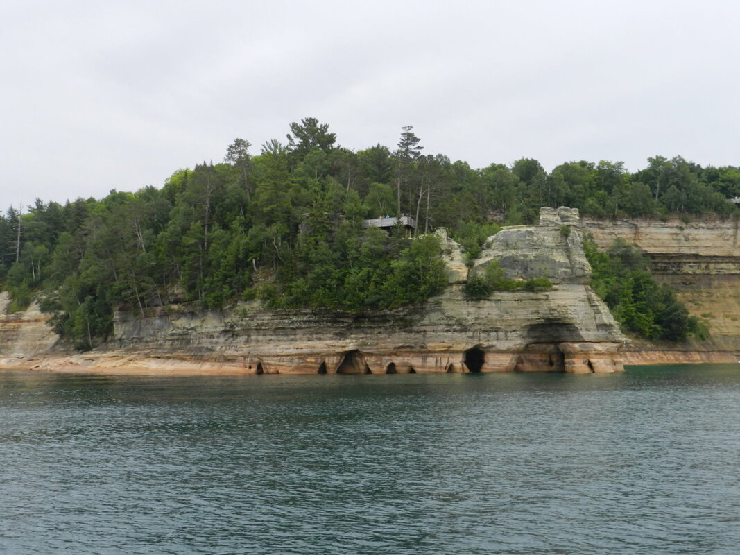
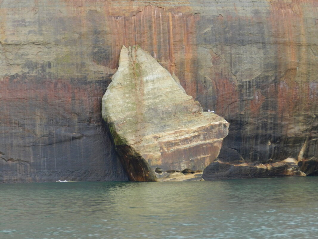
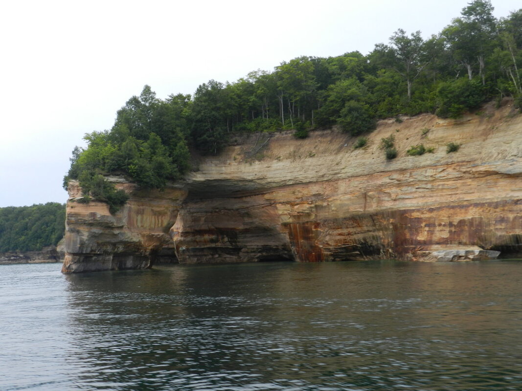
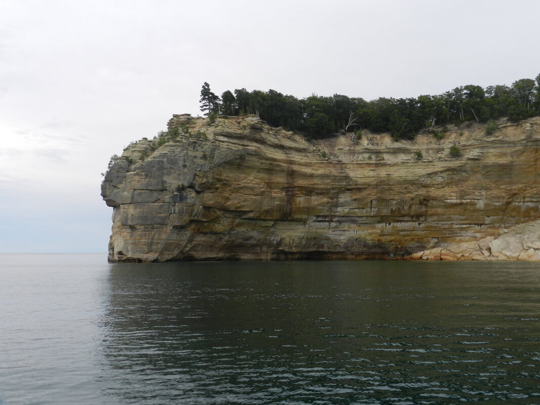
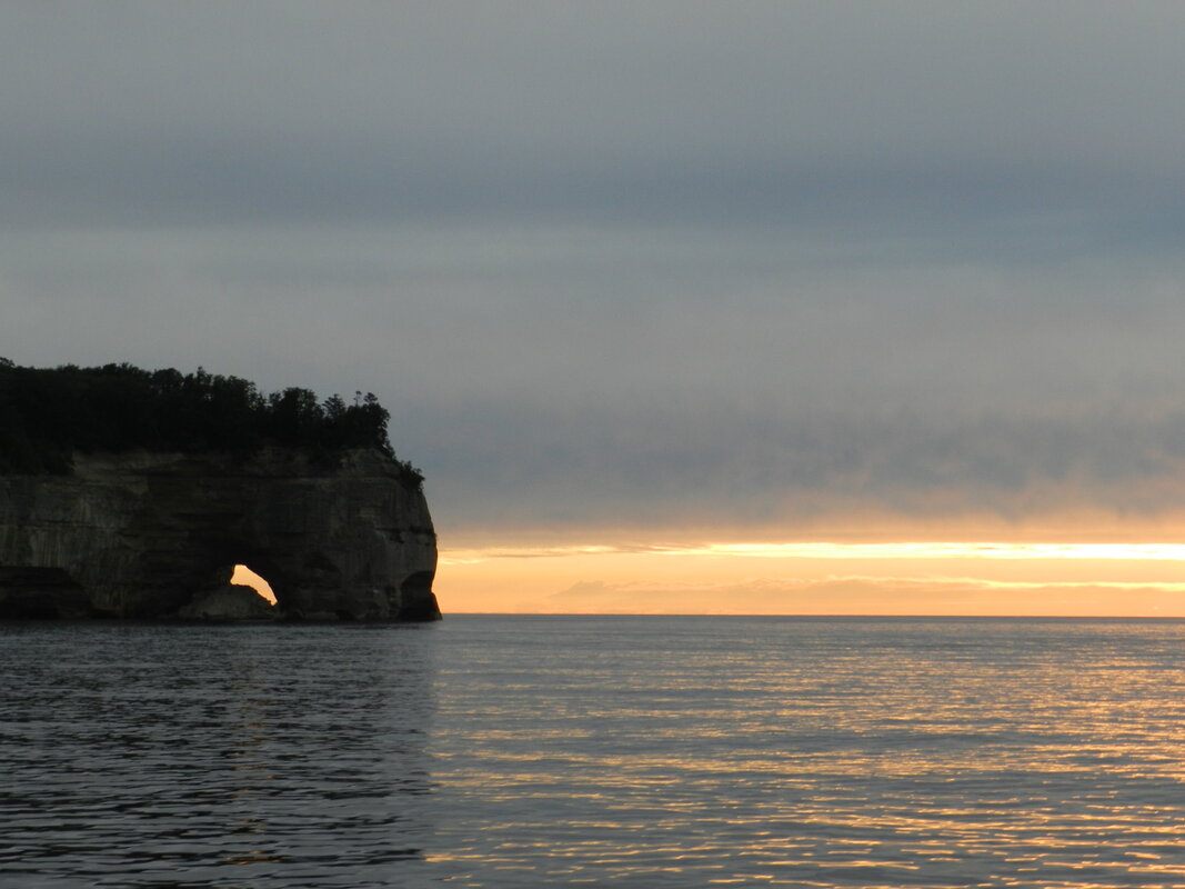
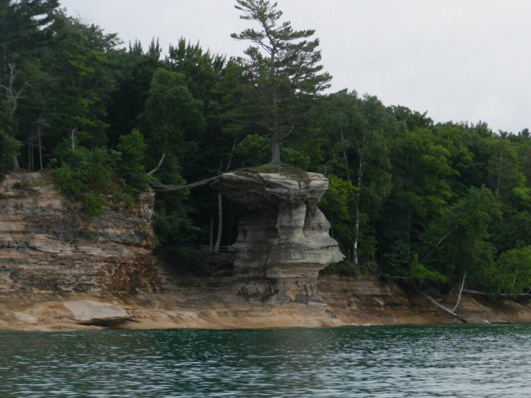
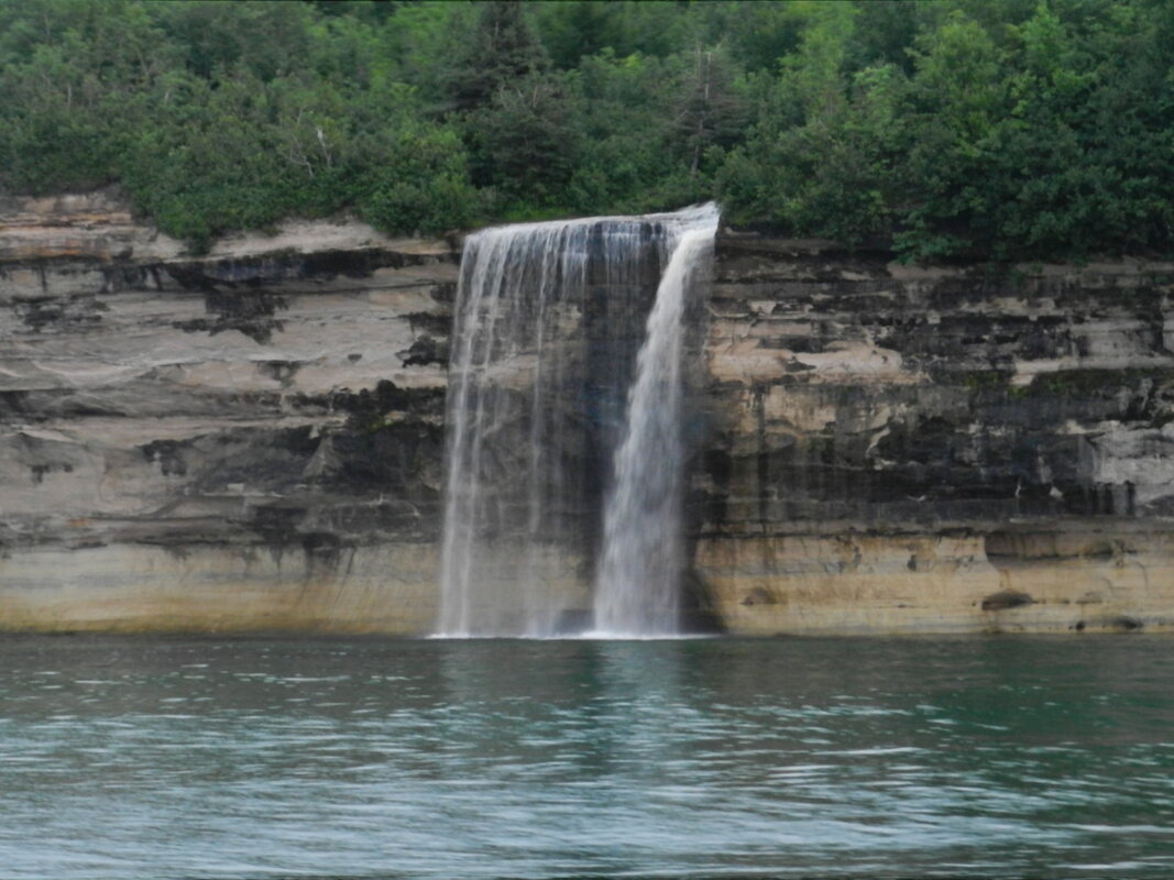
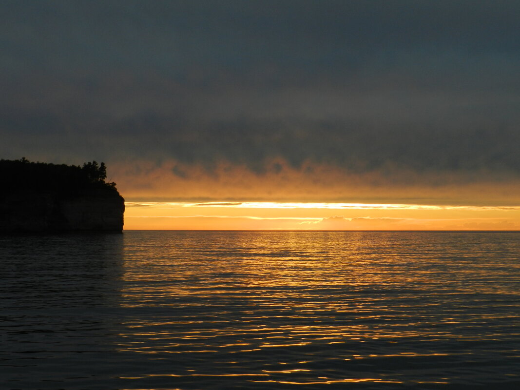
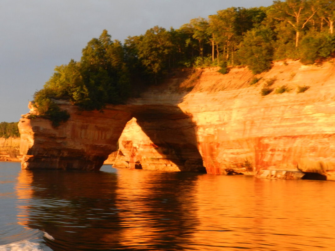
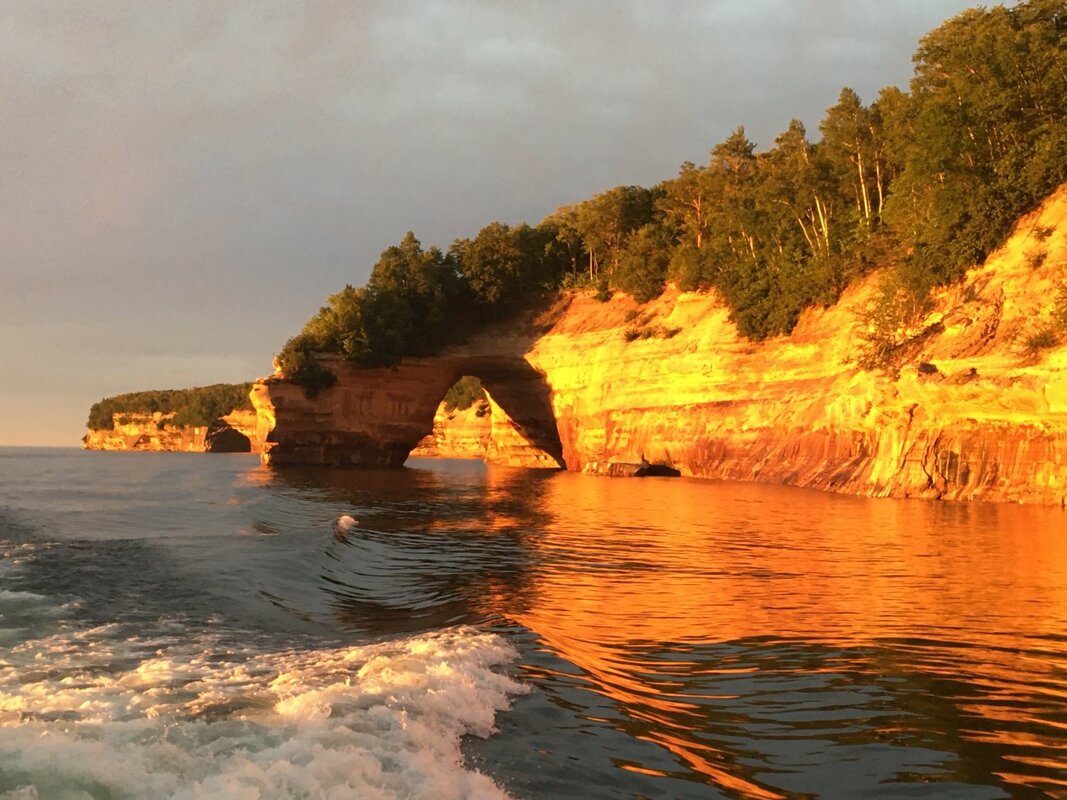
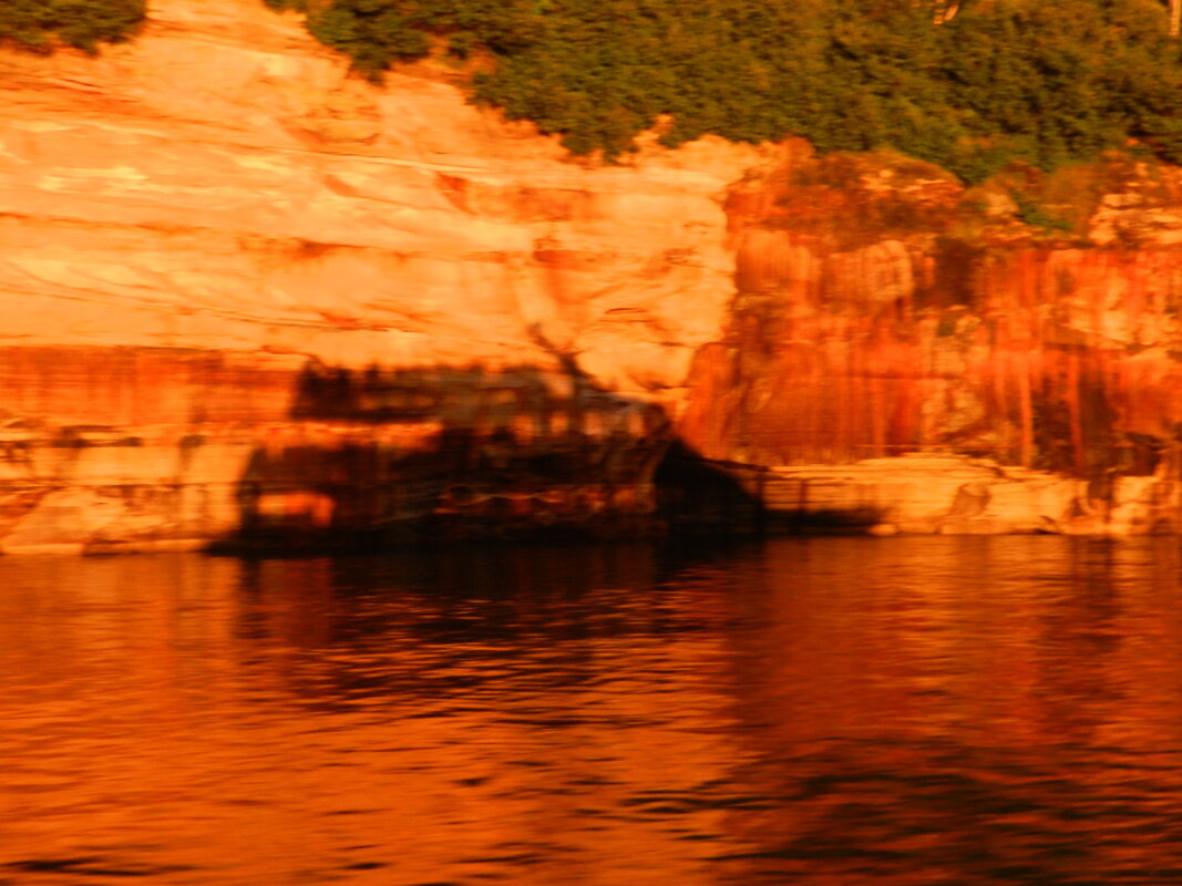
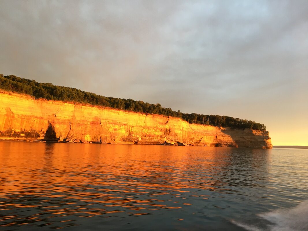
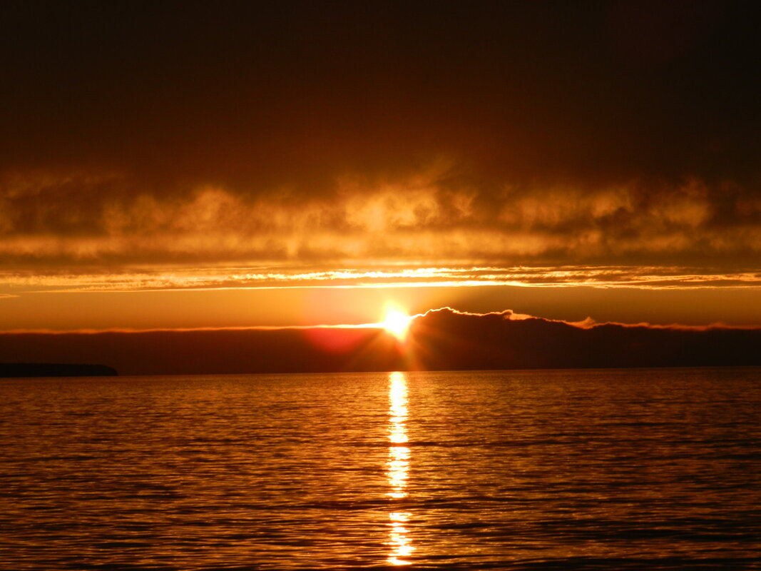
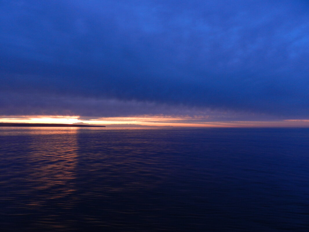
150 Miles of Salt Mines 650 Below Ground On Day #19 of our 30-day, 9376 mile, road trip to see more of America we visited the Strataca salt mine in Hutchinson, Kansas. 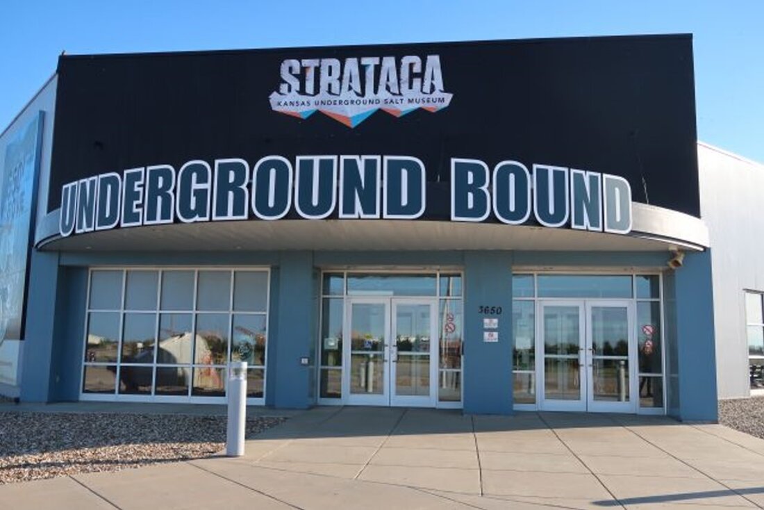 Strataca is a salt mine museum previously known as the Kansas Underground Salt Museum. The mine is built within one of the world's largest deposits of rock salt – with the salt deposit formations dating to over 275 million years ago. Efforts to dig the first shaft to start mine salt began back in June 1922 and operations of the Carey Salt Company began in 1923. Today the mine is still active, producing ~4 tons of “road salt” every 3 minutes. Strataca is the only underground salt mine in the United States accessible to tourists – so it’s a sight to behold if you like mines and have at least 2 hours to take the tour. To reach the underground mine you take a ride in a double-deck shaft elevator (that holds fifteen people on each level) that travels down 650 feet in 90 seconds. Once at the mine level there are ~150 miles of mined caverns; many of them still being actively mined. If you’re worried about being claustrophobic – don’t be – since the mine’s ceiling heights range from 11 to 17 feet. Concerned about being in a cold damp cave – there’s no issue there either since the mine temperature stays at ~68 degrees and has a relative humidity of ~45%. The floor of the part of the mine that you’ll visit is even paved – with “Saltcrete” – a material similar to concrete but with salt substituted for the normal sand. In addition to seeing the mine, and how the mining operation works, there’s also a small exhibit from Underground Vaults & Storage (UV&S) – a company that uses the mine’s security and stable environment to store valuable documents, medical records, TV show masters, film negatives and movie artifacts. The current exhibit includes the Batman and Mr. Freeze costumes from the “Batman & Robin” movie, items from the Superman TV show and Agent Smith’s costume from The Matrix. As you can see from the photos below – Strataca is an operation that you have to see to really get the feel of the size and scope (click on any photo to start the slideshow): If you want to learn more about the Strataca here are a couple of links to check out: https://www.underkansas.org/ http://www.kansastravel.org/hutchinson/kansasundergroundsaltmuseum.htm https://www.visithutch.com/things-to-do/attractions/p/item/658/strataca In addition, back on 5 November 2013 Mike Rowe and the crew of “Dirty Jobs” spent a day in the mines at Strataca and you can see what they found here: The Largest Man-made Grotto in the World On Day #17 of our 30-day, 9376 mile, road trip to see more of America we visited the Grotto of the Redemption in West Bend, Iowa. The Grotto of the Redemption is a religious shrine built over a 42-year period by Father Paul Dobberstein, a Roman Catholic priest who served as the Pastor for Saints Peter and Paul Church, that includes rocks, semi-precious stones, and minerals from all over the world. The entire structure is so large that it covers approximately one city block. 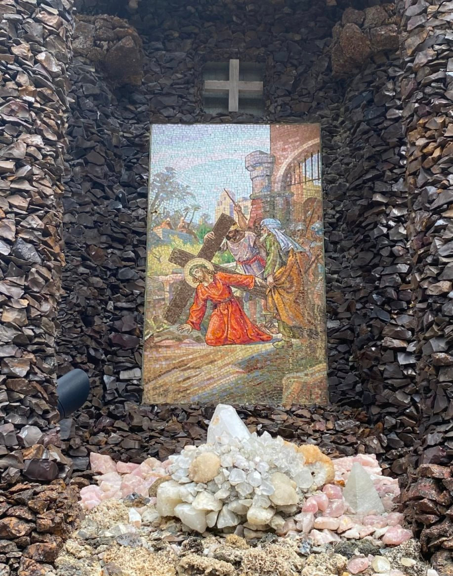 The Grotto was built because as a young seminarian Father Dobberstein became critically ill with pneumonia. As his illness progressed he prayed to the Blessed Virgin Mary and promised to build a shrine in her honor if he lived. Fortunately his health improved and, after his ordination as a Priest, Father Dobberstein was assigned to West Bend as the church Pastor in 1898. Once in Iowa Father Dobberstein spent a decade stockpiling rocks and precious stones for the shrine that he planned to build. The actual work of planning and building the grotto began in 1912 – with a design telling the story of man’s fall and his redemption by Christ. After Father Dobberstein passed away in 1954 his life's work on the grotto was continued by his long-time assistant, Matt Szerensce, until he retired in 1959, and for 50 years Father Louis Greving, Father Dobberstein's colleague and replacement, continued to build and care for the Grotto until 1996. The semi-precious stones embedded in the grotto walls are amazing: petrified wood, malachite, azurite, agates, geodes, jasper, quartz, topaz, calcite, and even stalagmites taken from Carlsbad Canyons before it became a National Park. In addition to the actual stone grotto there are numerous statues, most made out of white Carrara Italian marble, depicting St. Michael crushing the devil, Adam and Eve being driven out Eden, the Holy Family in the stable in Bethlehem, Jesus preaching the Sermon on the Mount, Judas sneaking out of the Garden of Gethsemane, and other religious figures. As you can see from the photos below – the Grotto of the Redemption is a little overwhelming and the work to build it by hand is almost unfathomable (click on any photo to start the slideshow): If you want to learn more about the Grotto of the Redemption here are a couple of links to check out: https://www.westbendgrotto.com/ https://www.traveliowa.com/destination/shrine-of-the-grotto-of-the-redemption/6642/ https://www.spiritualtravels.info/spiritual-sites-around-the-world/north-america/iowas-grotto-of-the-redemption/ Where the Buffalo Roam and the Skies are Not Cloudy All Day On Day #15 of our 30-day, 9376 mile, road trip to see more of America we visited the Theodore Roosevelt National Park in Medora, North Dakota. Named after the 26th President of the United States because of his ties to the region, the Theodore Roosevelt National Park is a national park located in the western North Dakota badlands with three geographically separated areas; the North Unit, the South Unit, and the Elkhorn Ranch Unit. The park has 70,446 acres (110.072 square miles) of land. Teddy Roosevelt first came to the North Dakota to hunt bison in 1883 and subsequently fell in love with the rugged lifestyle and the "perfect freedom" of the West. While in Medora Roosevelt invested in the Maltese Cross Ranch. Then in 1884, following the death of both his wife and mother, Roosevelt returned to North Dakota and purchased the Elkhorn Ranch, located 35 miles north of Medora. A life-long outdoorsman and hunter, Roosevelt's time in the badlands impacted him deeply and helped shape many of the policies that he implemented during his years as President of the United States (1901-1909). We visited the South Unit of the park on a perfect day – great weather and not many people. During our visit we hiked many of the trails and were able to see, up close and personal, bison, turkeys, prairie dogs, and wild horses (click on any photo to start the slideshow): If you want to learn more about the Theodore Roosevelt National Park, or other things to do in the Medora area, here are a couple of links to check out: https://www.nps.gov/thro/index.htm https://www.ndtourism.com/best-places/8-things-see-and-do-theodore-roosevelt-national-park https://medora.com/do/outdoor/theodore-roosevelt-national-park/ As a side note, to get to the Theodore Roosevelt National Park we drove the Killdeer Mountain Four Bears Scenic Byway. The terrain and sights were stunning. This drive is certainly one of the prettiest in North Dakota. (click on any photo to start the slideshow): Here’s are links to all of North Dakota’s scenic highways and some of the specific sights on the Killdeer Byway: https://www.ndtourism.com/best-places/north-dakota-scenic-byways-and-backways-and-more https://www.ndtourism.com/best-places/5-stops-killdeer-mountain-four-bears-scenic-byway https://www.beautifulbadlandsnd.com/history-and-landscape-in-the-mid-section-of-this-badlands-scenic-highway-22-part-2/ The Beauty of Sunset and Lake Superior On Day #6 of our 30-day, 9376 mile, road trip to see more of America we visited Pictured Rocks National Lakeshore in Munising, Michigan. Pictured Rocks is one of only four National Lakeshores in the United States. Located on Lake Superior, the park stretches for 42 miles along the shore and covers 73,236 acres. Within the park the “pictured rocks” rise between 50 and 200 feet above the lake and stretch for almost fifteen miles. There are also more than 100 miles of hiking trails leading through the forest to remote lakes and streams within the park. In addition, the lakeshore has 12 miles of beaches, 5 miles of sand dunes, several waterfalls, and even a few lighthouses. The name “Pictured Rocks” comes from the mineral stains that can be seen on the face of the cliffs towering over Lake Superior. A wide range of colors occur in the rock face because groundwater seeps through the cracks and trickles down the rock face with Iron (red and orange), copper (blue and green), manganese (brown and black), limonite (white) and other color-producing minerals. Although you can hike to the shoreline, to really see the beauty of the “pictured rocks” you need to take a boat ride. We took a 2-hour trip with Pictured Rock Cruises at sunset – the best time of day to see the spectacular colors. As you can see from the photos below – we were lucky enough to be presented with stunning sights during our trip (click on any photo to start the slideshow): For those of you that know the poem “The Song of Hiawatha” by Henry Wadsworth Longfellow “Gitchee Gumee” is the Ojibwa (Native American) name for Lake Superior. Here’s the first stanza of the poem to jog your memory: "By the shore of Gitche Gumee, By the shining Big-Sea-Water, At the doorway of his wigwam, In the pleasant Summer morning, Hiawatha stood and waited." https://www.hwlongfellow.org/poems_poem.php?pid=296 If you want to see a little more about the Pictured Rocks National Lakeshore, the local light houses, or what to do in the Munising area - here are a couple of links to check out: Road Trip to the Heartland Last Saturday we completed a 30-day “road trip” to see more of America. During our trip we drove 9,376 miles (an average of 312.5 miles per day) and visited 21 States, saw all 5 of the Great Lakes and were fortunate to see friends, family and all sorts of interesting places. Don’t let the MSM - and their nightly disaster telecasts fool you - America is beautiful, clean, peaceful and filled with nice people and wonderful sights. Here’s a high level map of the route that we planned to drive when we started the trip. During the actual trip we made some “on the fly” modifications to add or delete planned sights due to timing and a couple of closures - but nothing major. The only real omission was a very short swing through Canada (Manitoba and Saskatchewan) where it borders North Dakota due to the border closure being extended past 21 July. 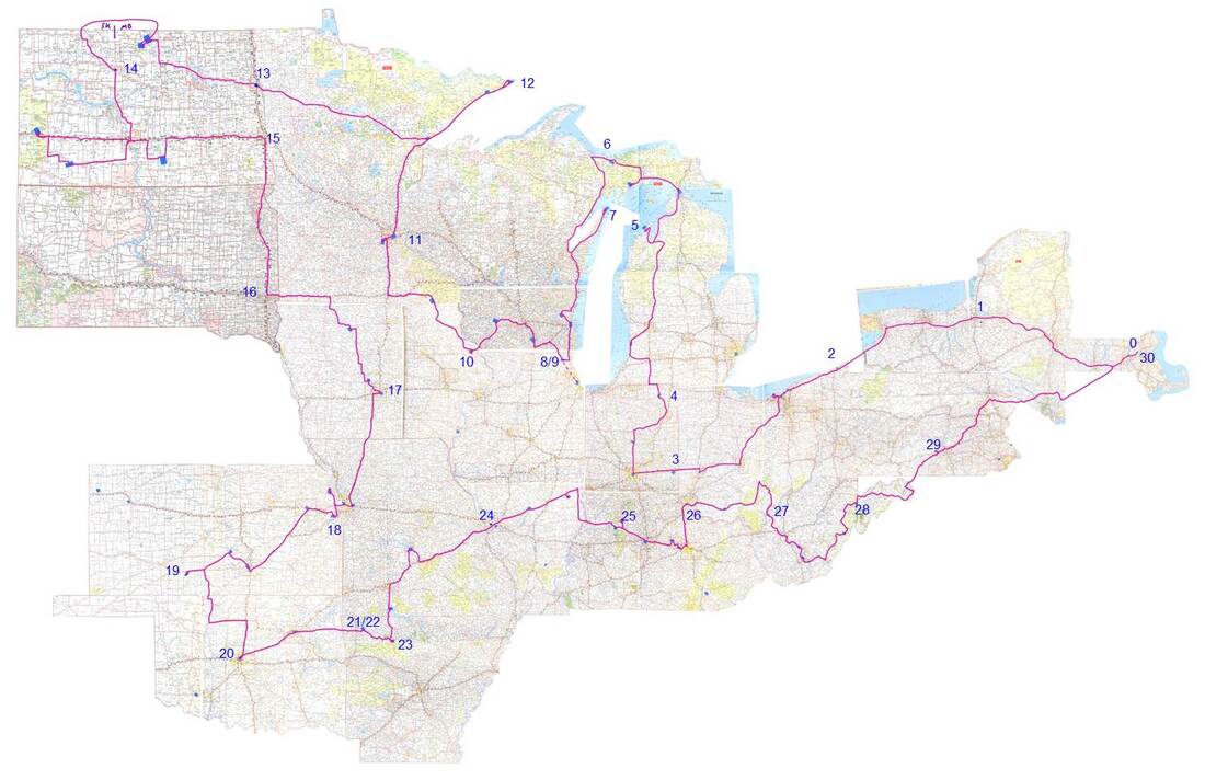 The States that we visited during our trip were:
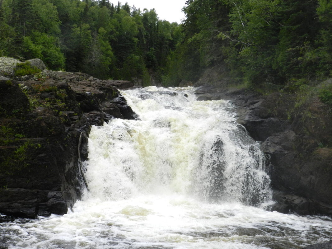
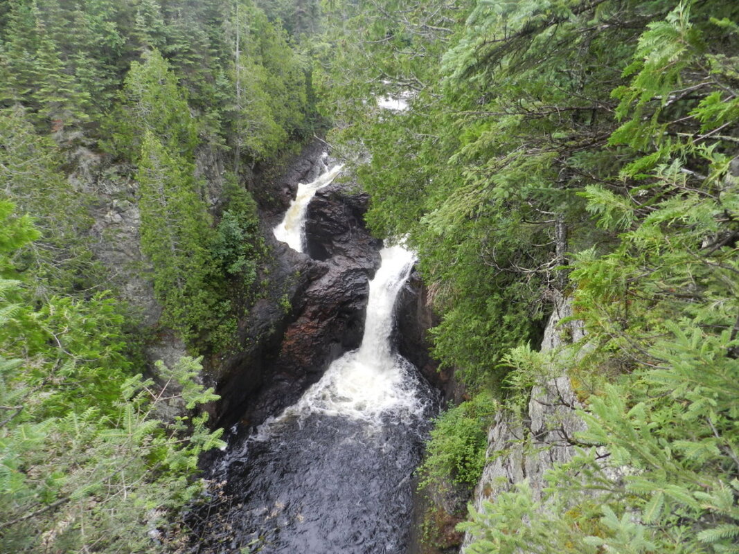
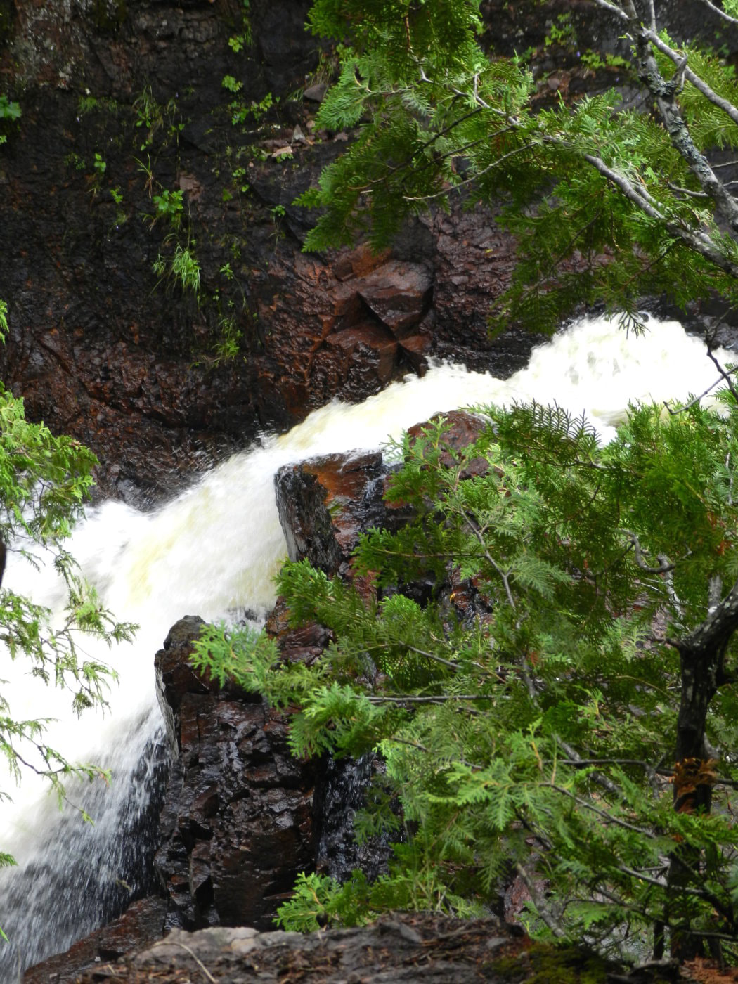
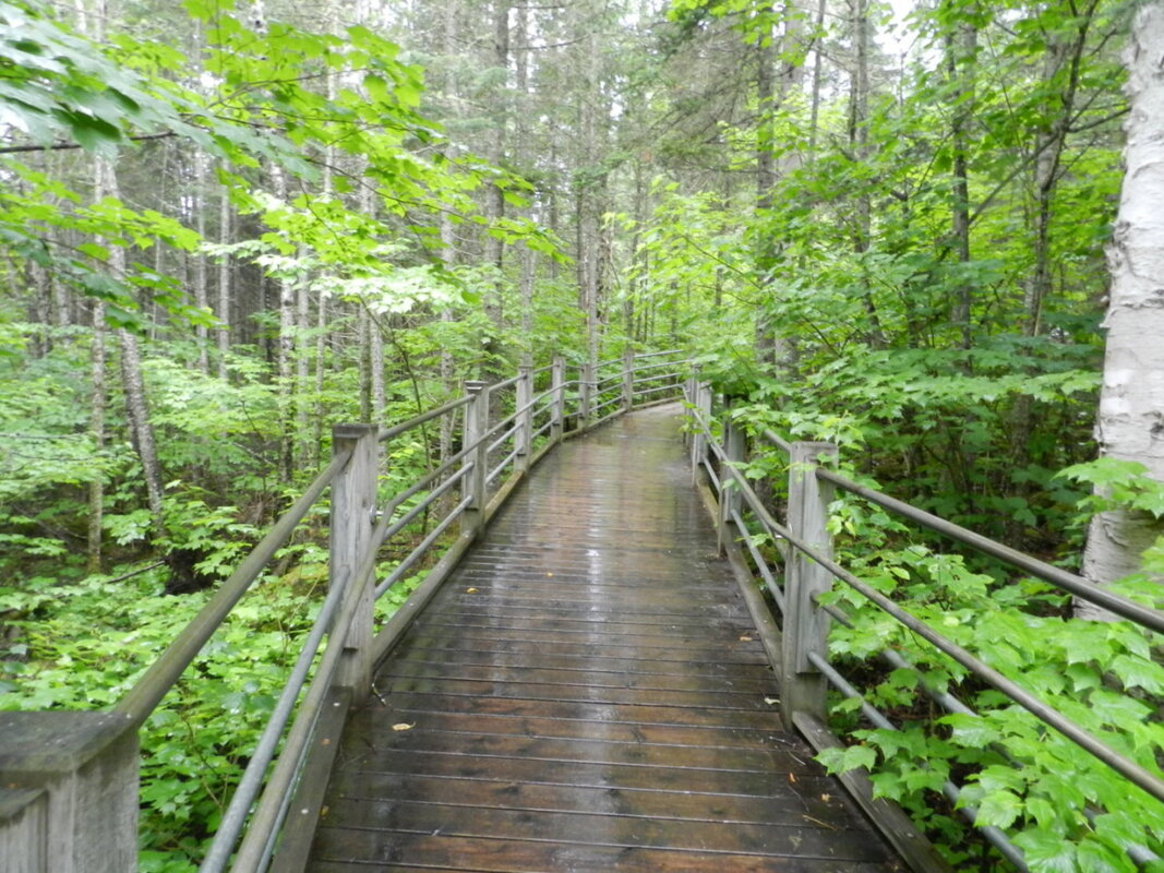
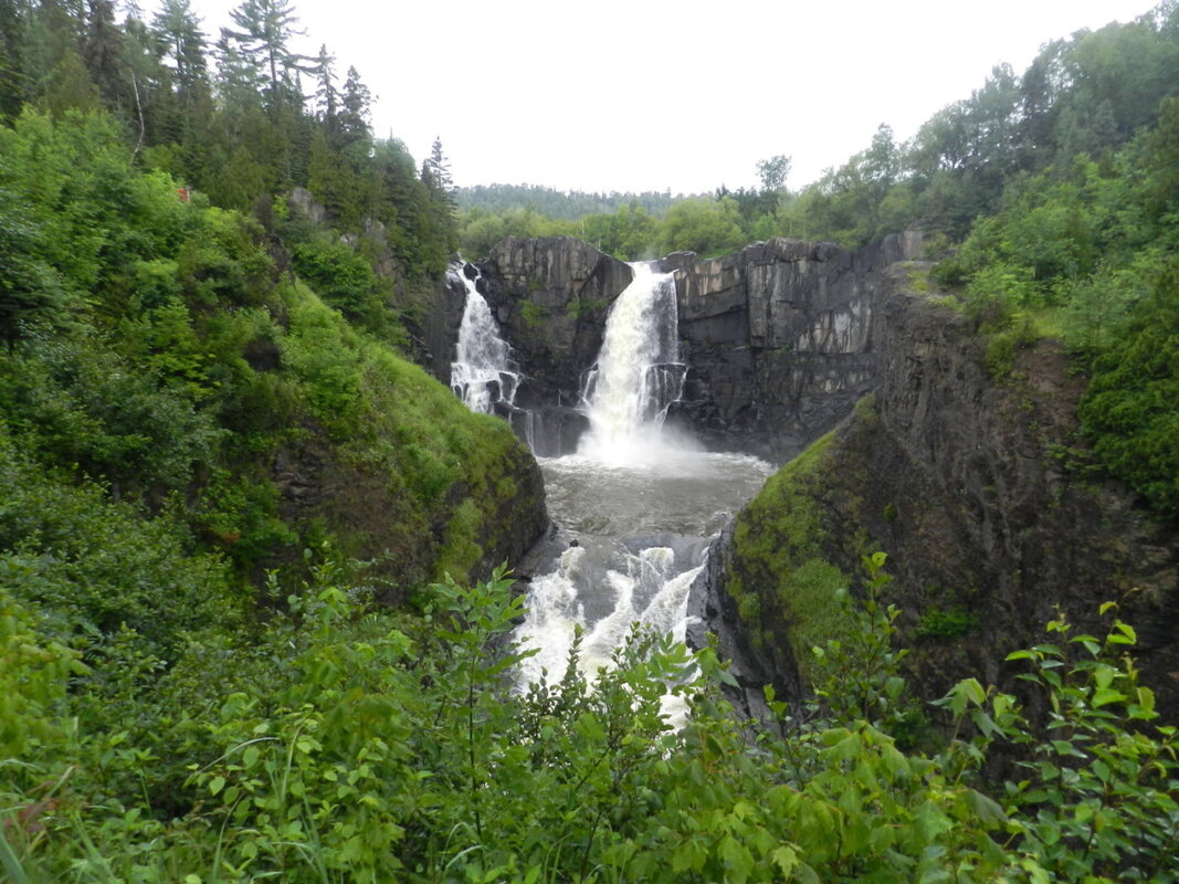
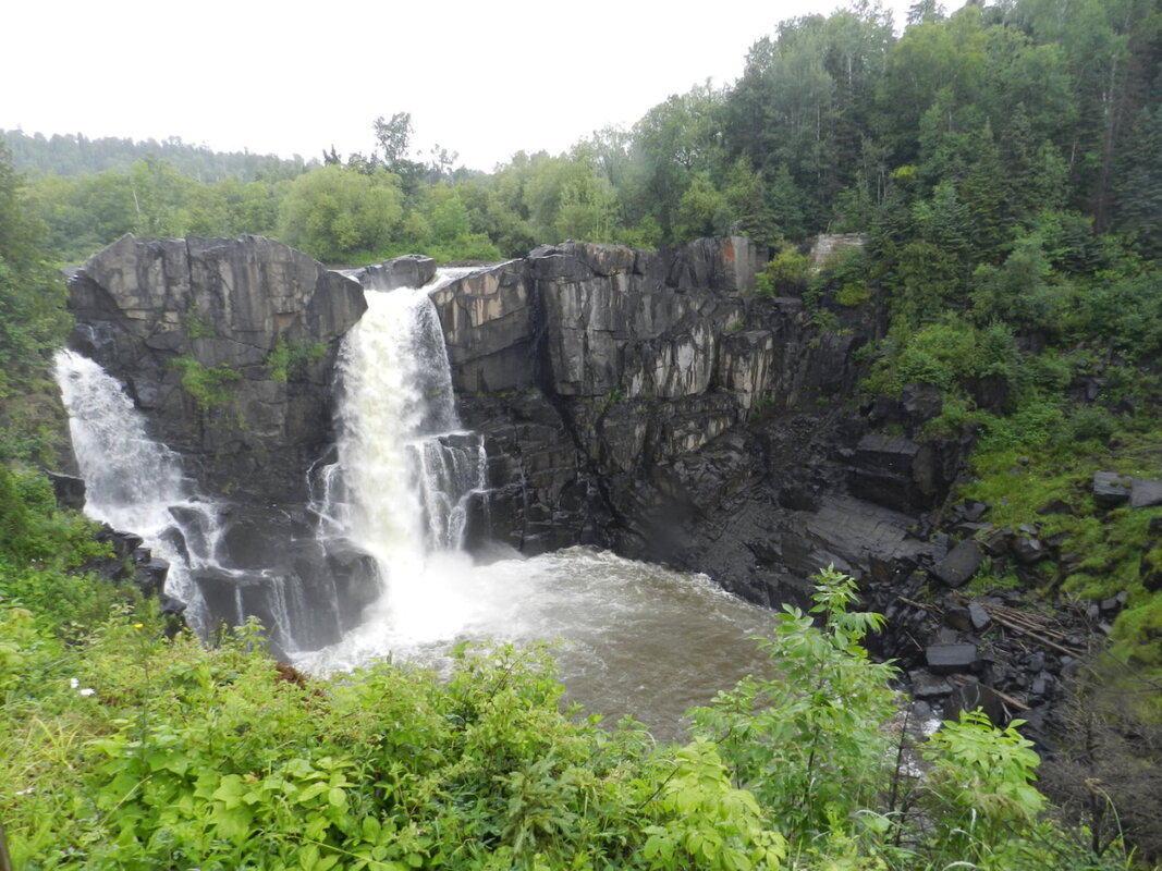
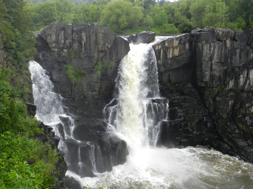
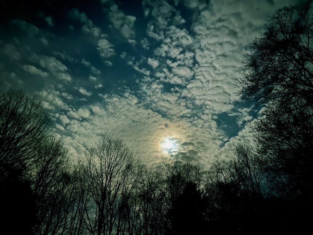
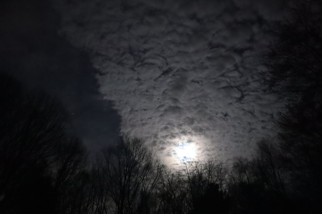
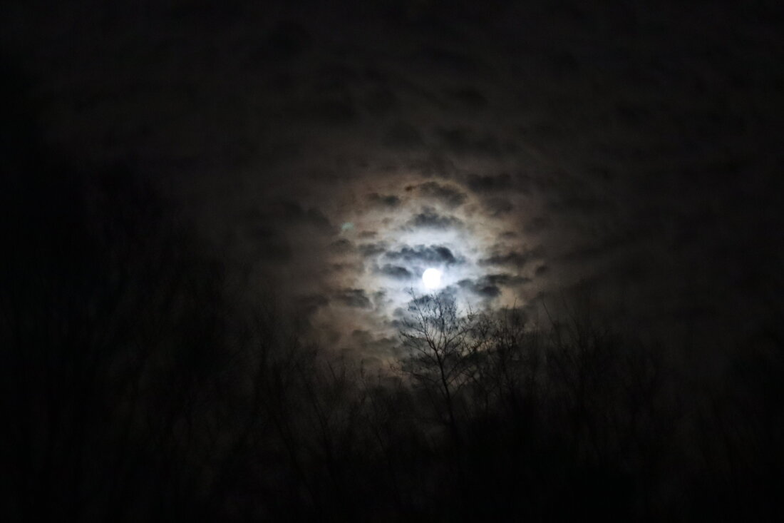
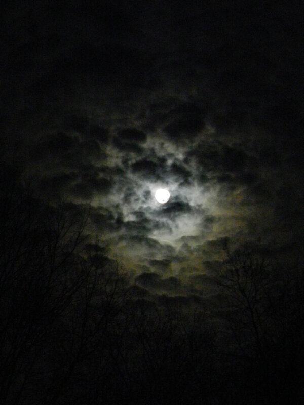
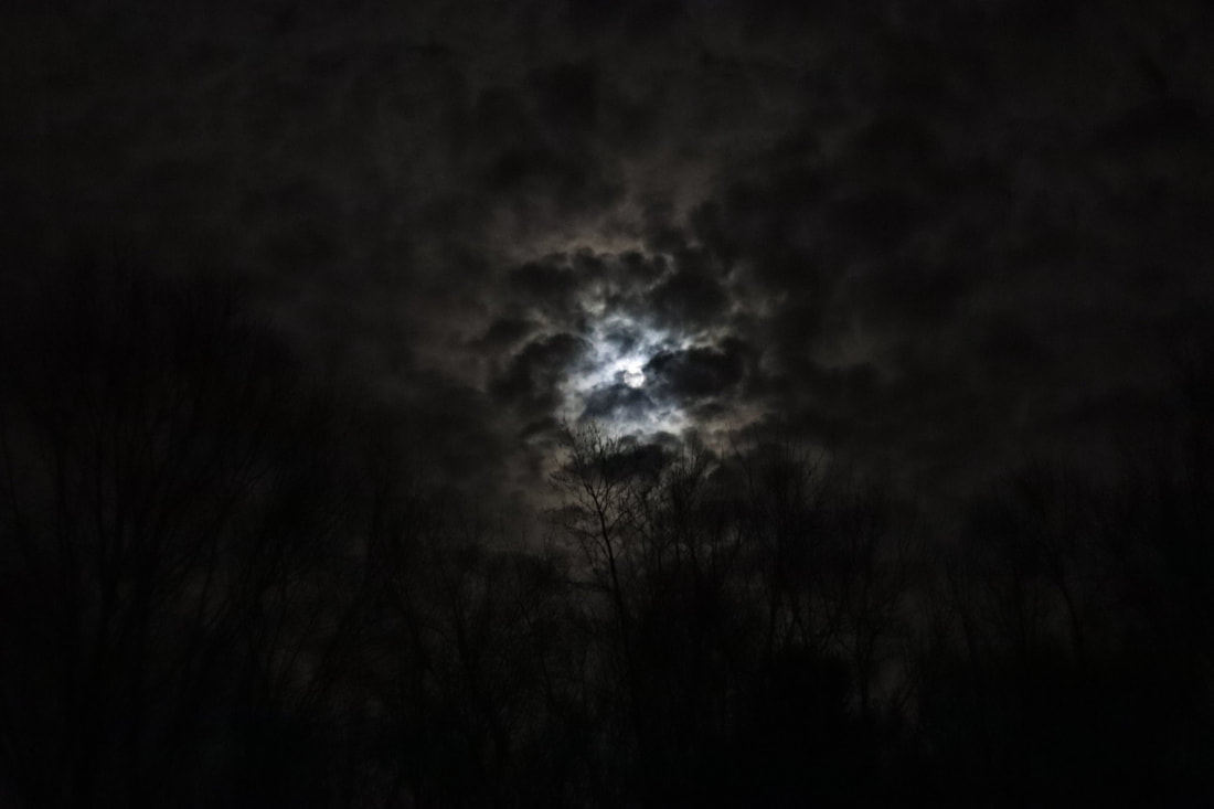
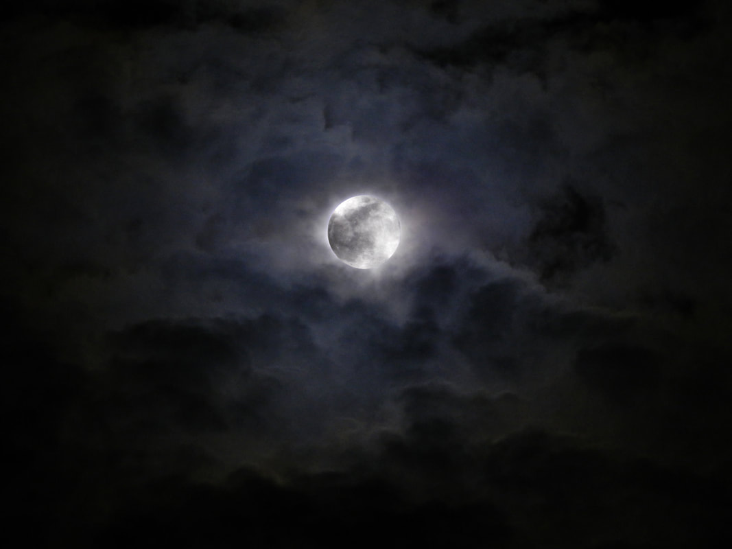
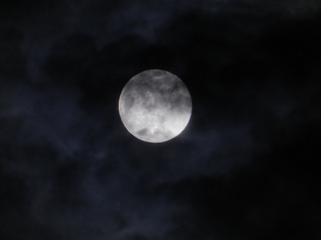
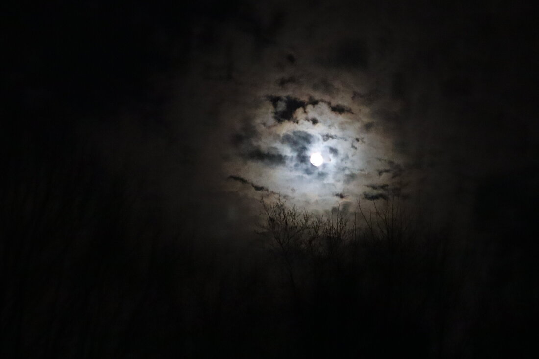
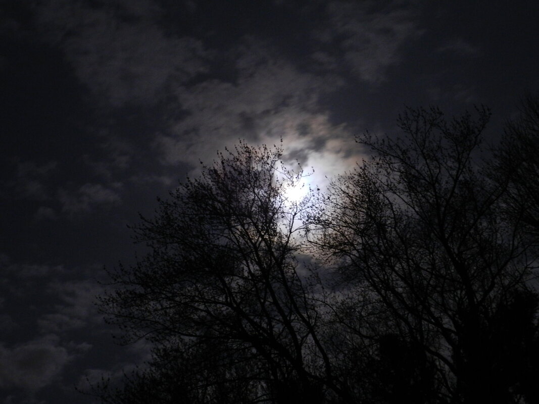
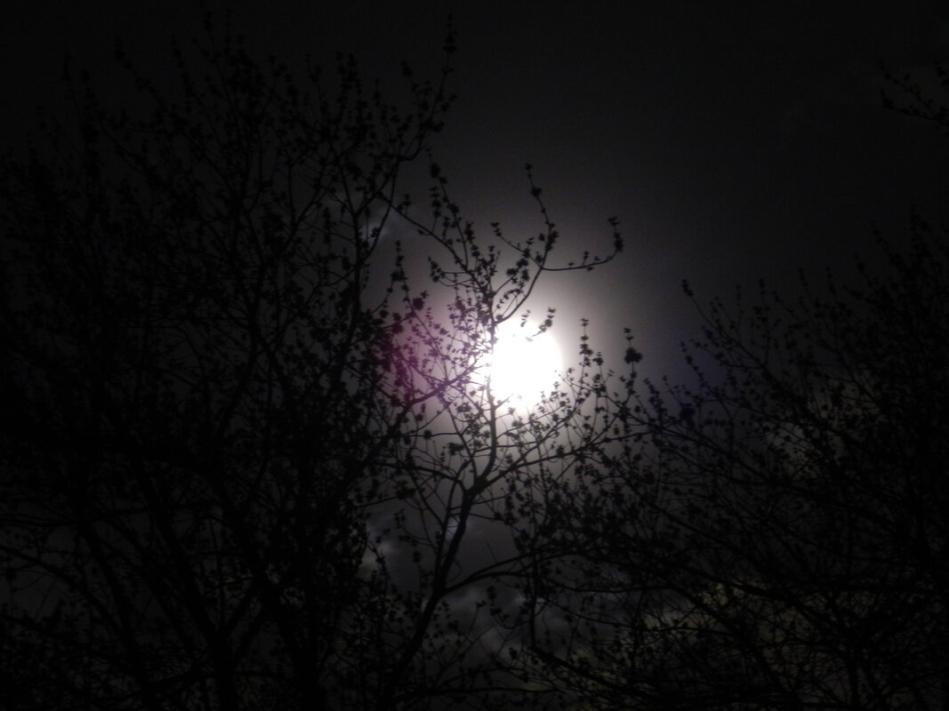
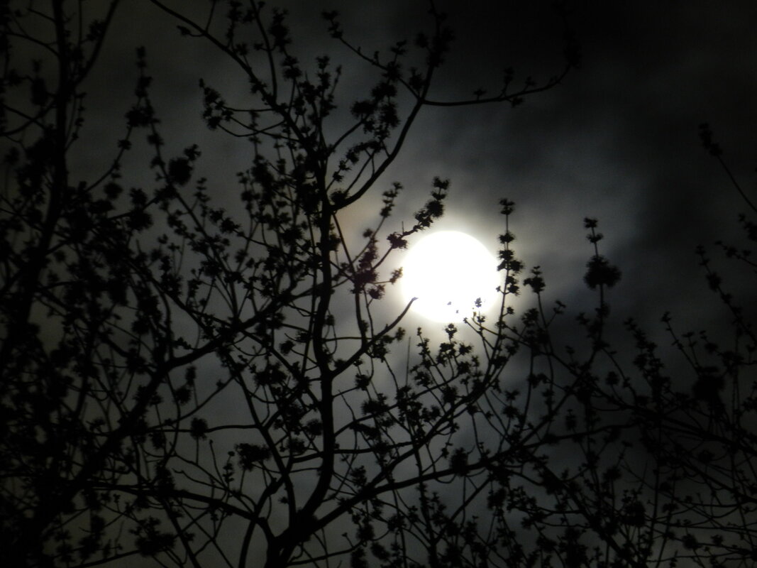
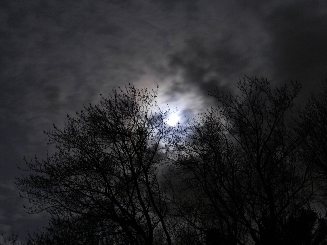
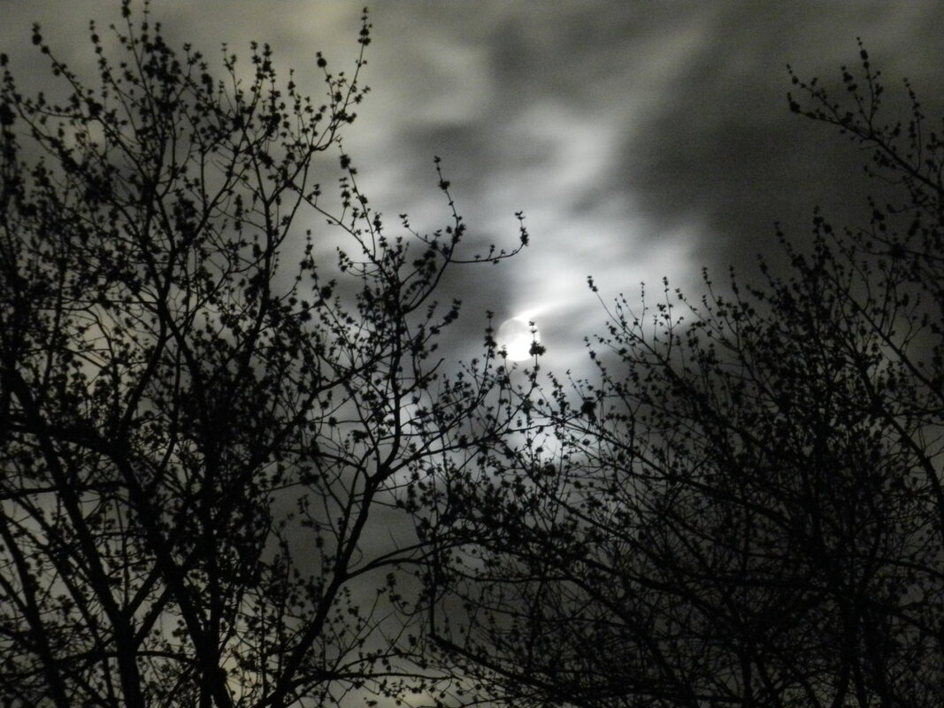
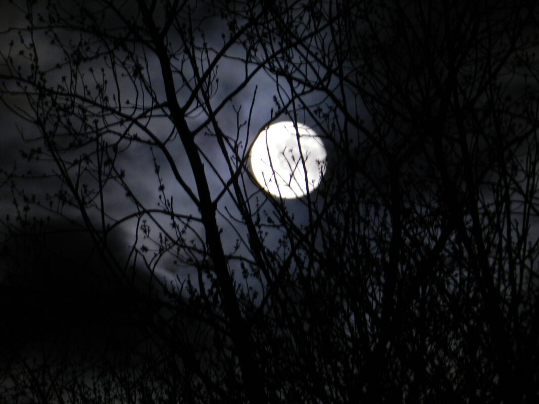
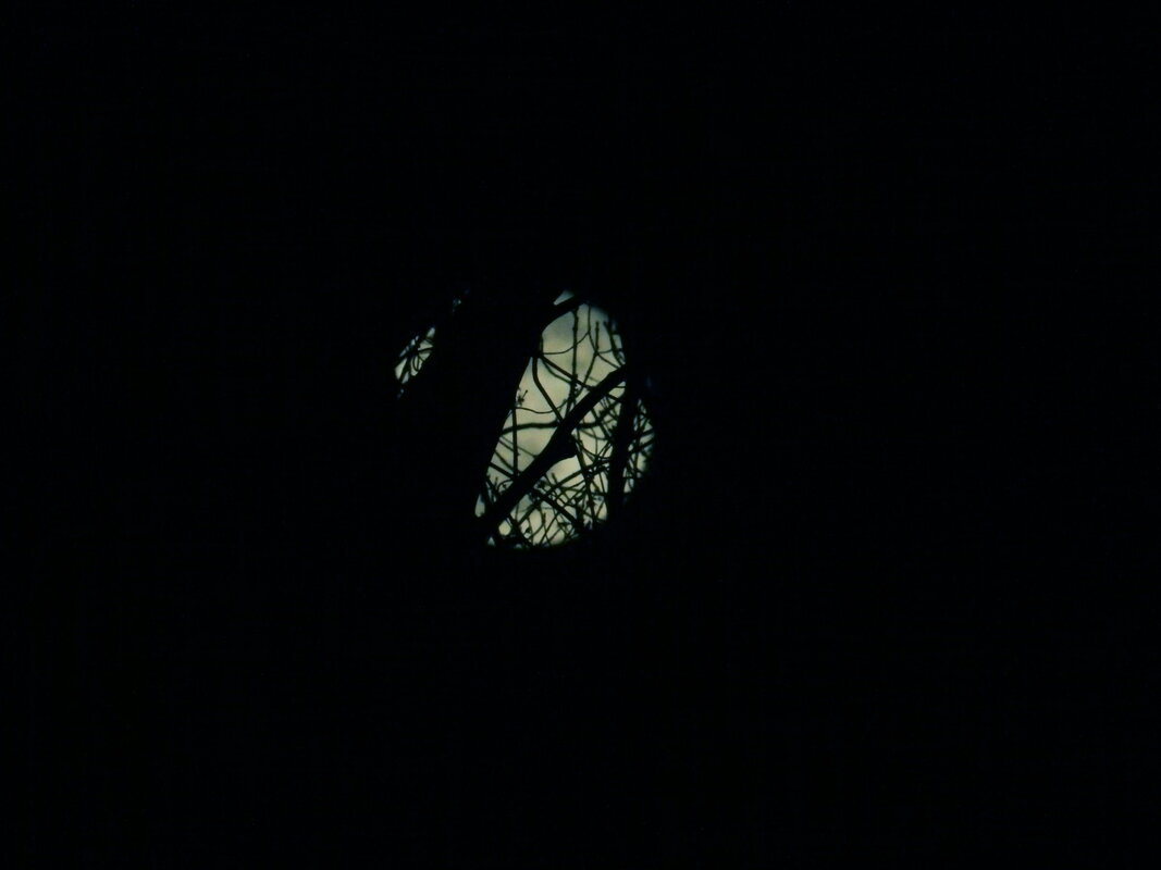
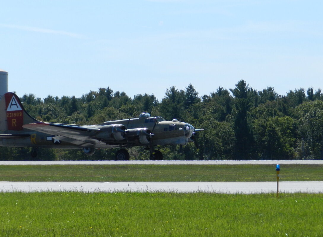
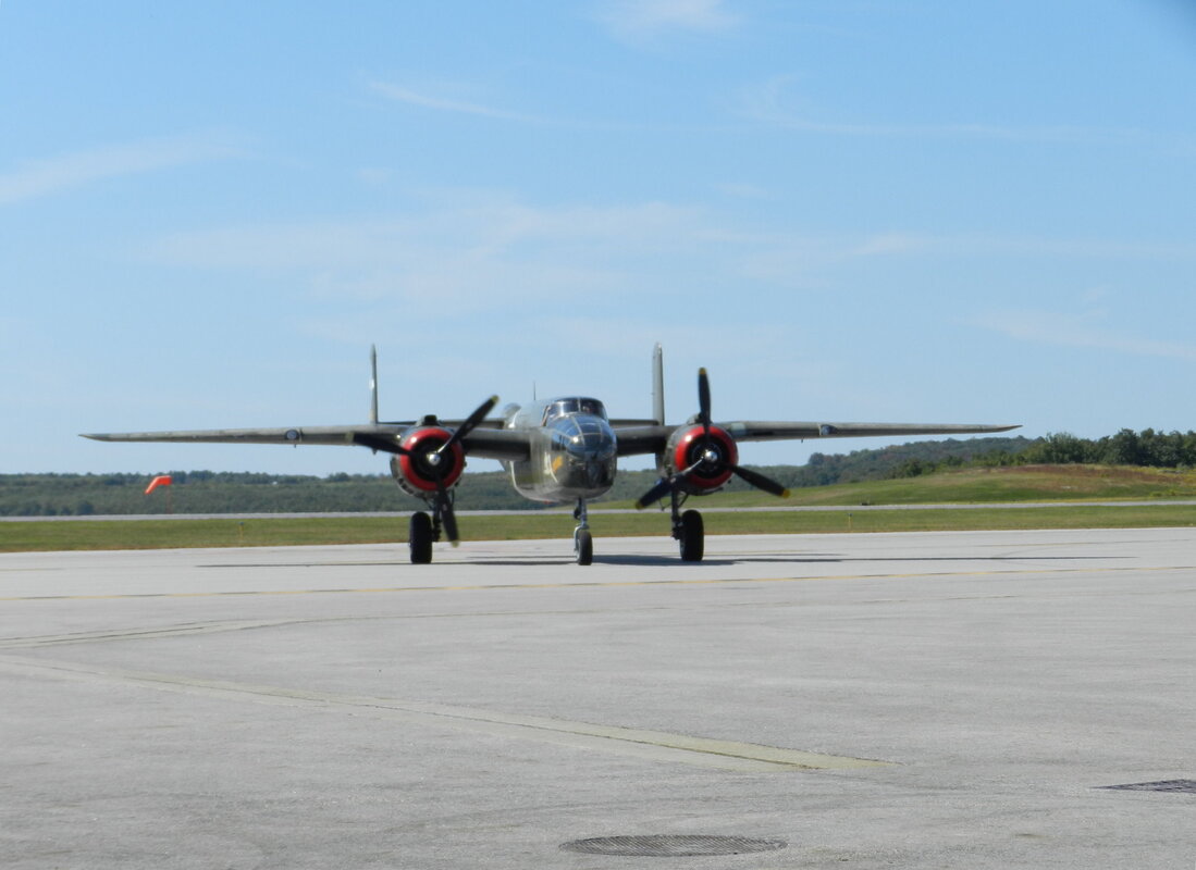
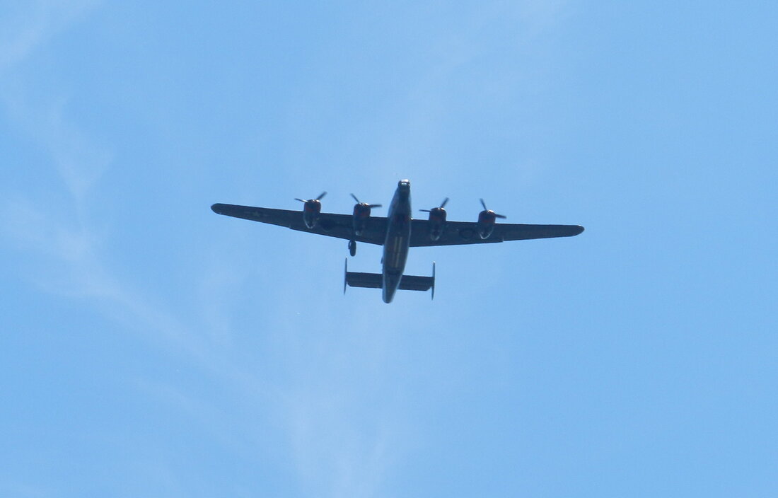
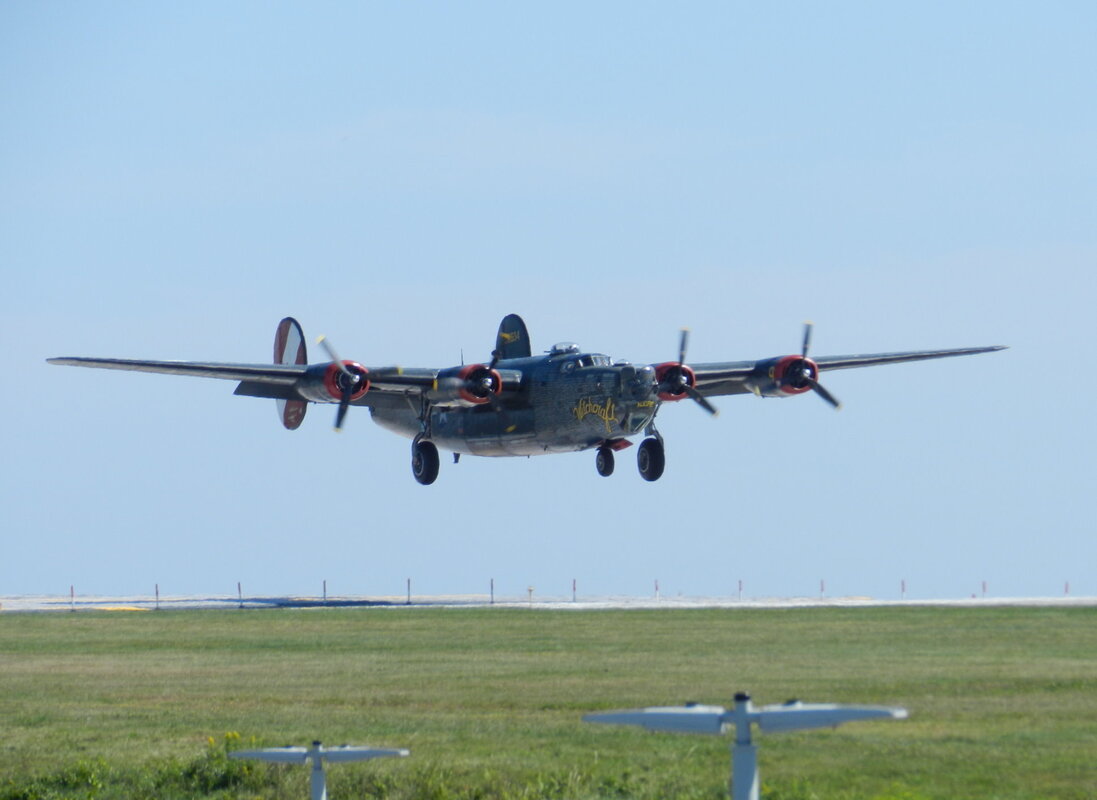
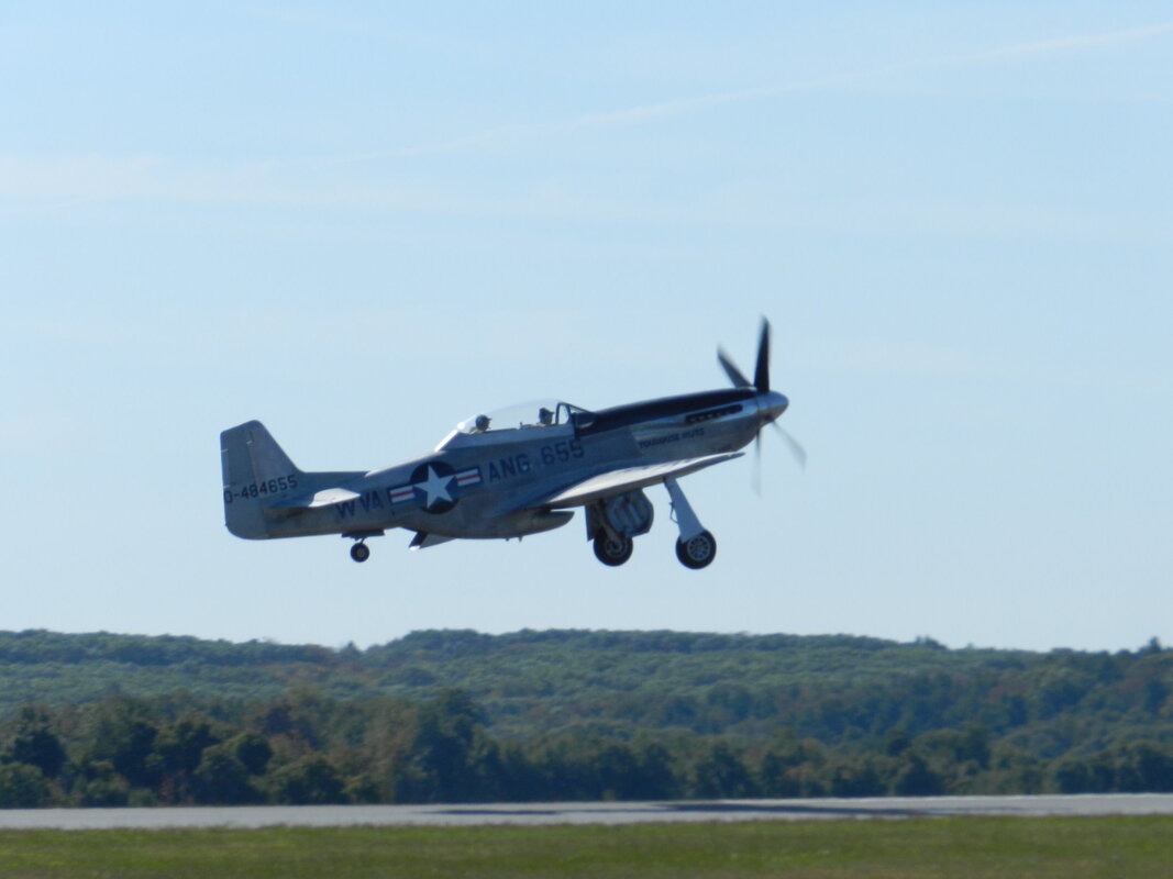
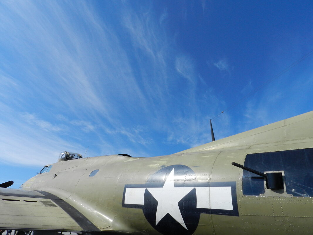
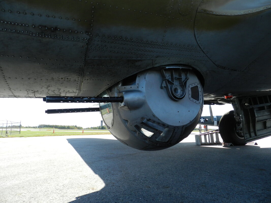
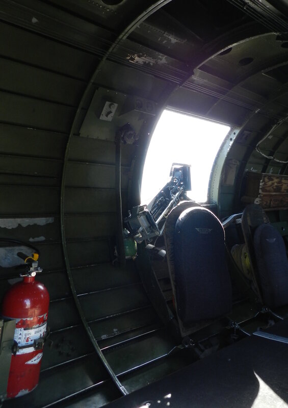
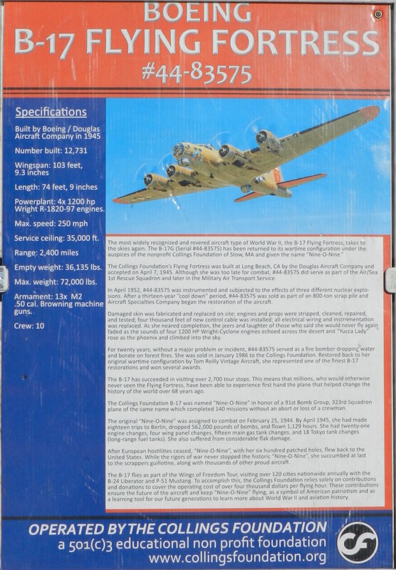
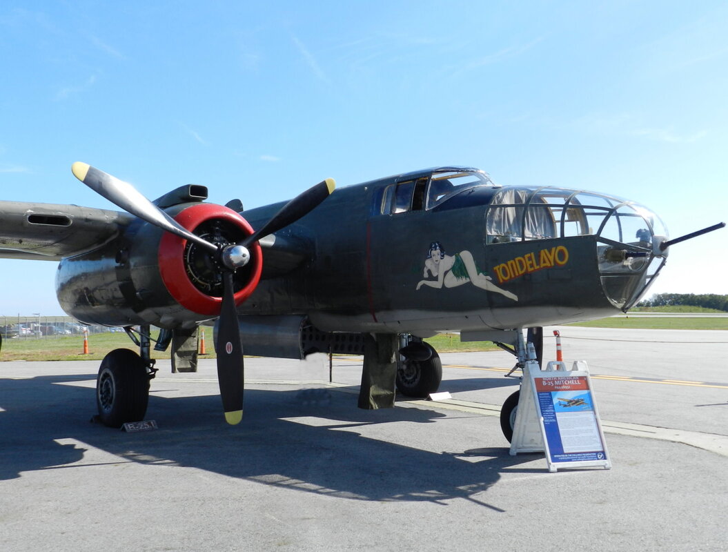
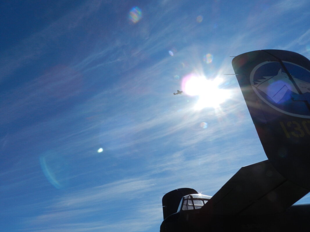
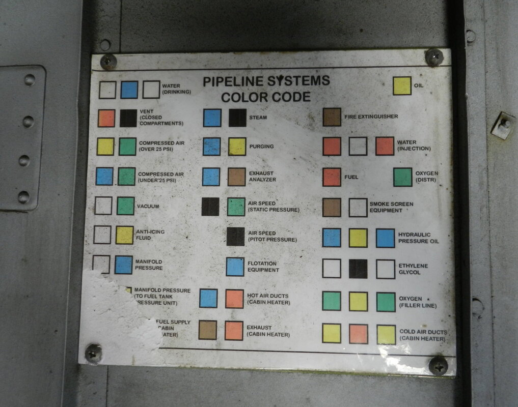
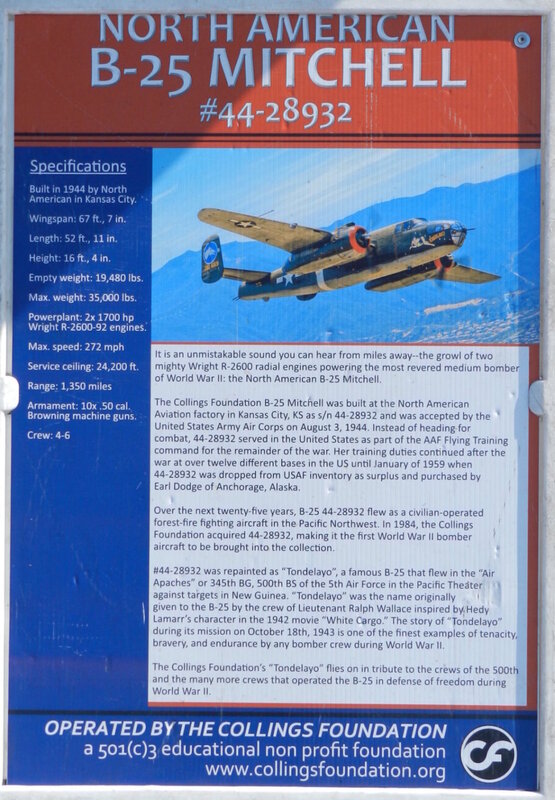
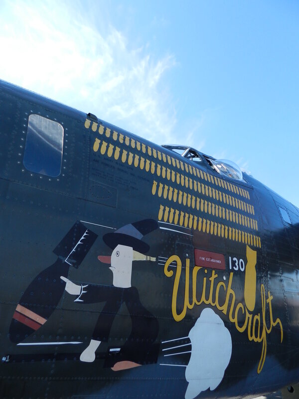
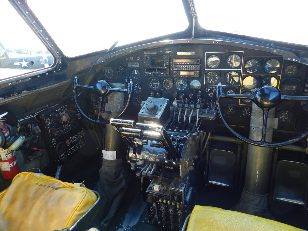
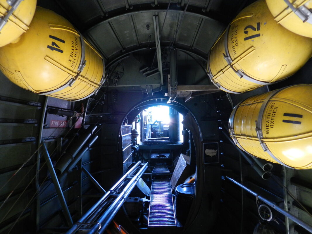
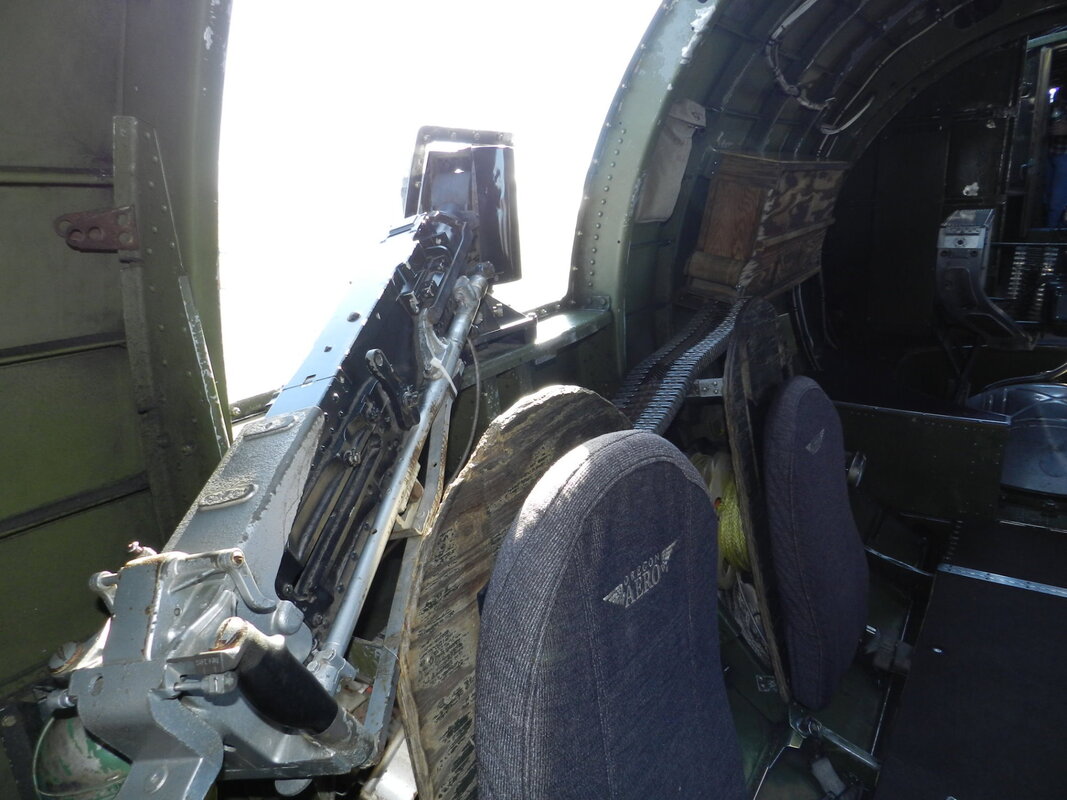
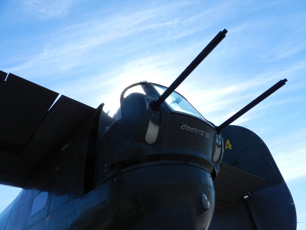
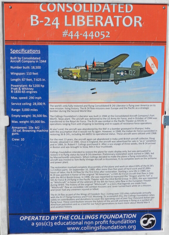
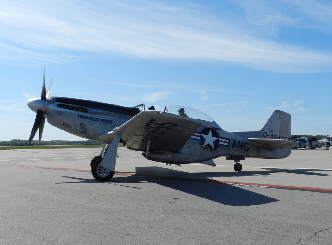
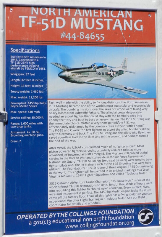
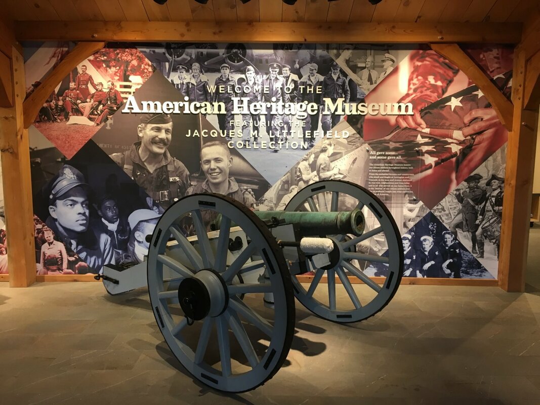
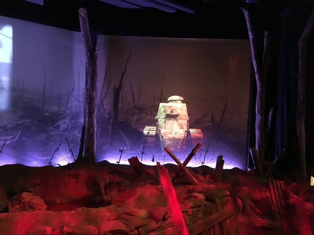
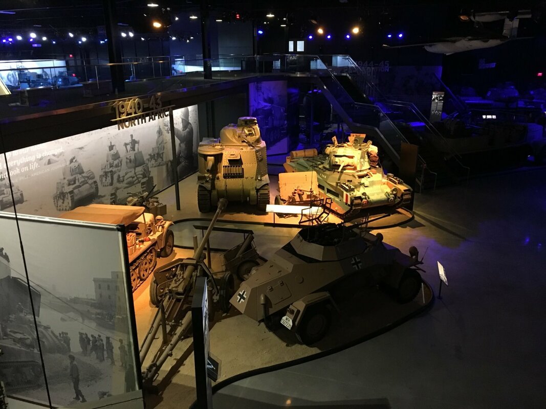
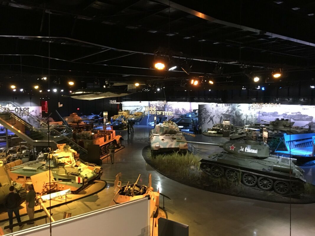
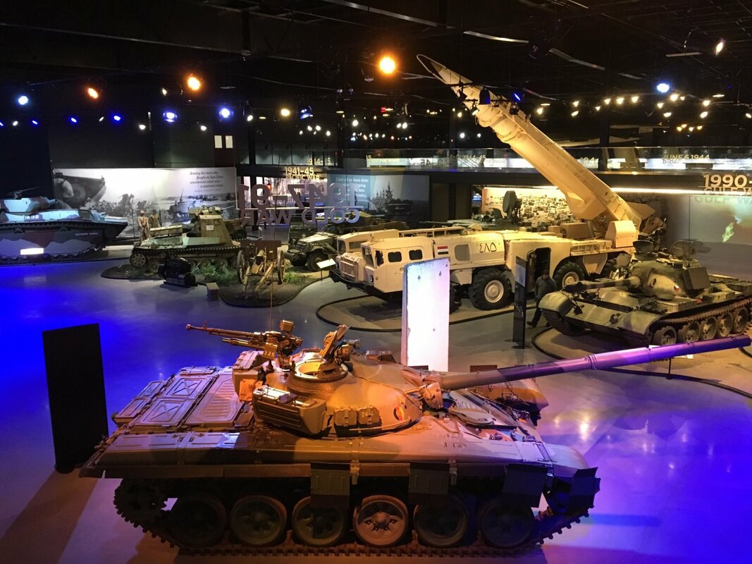
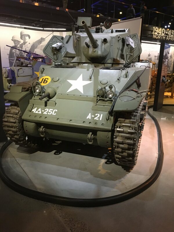
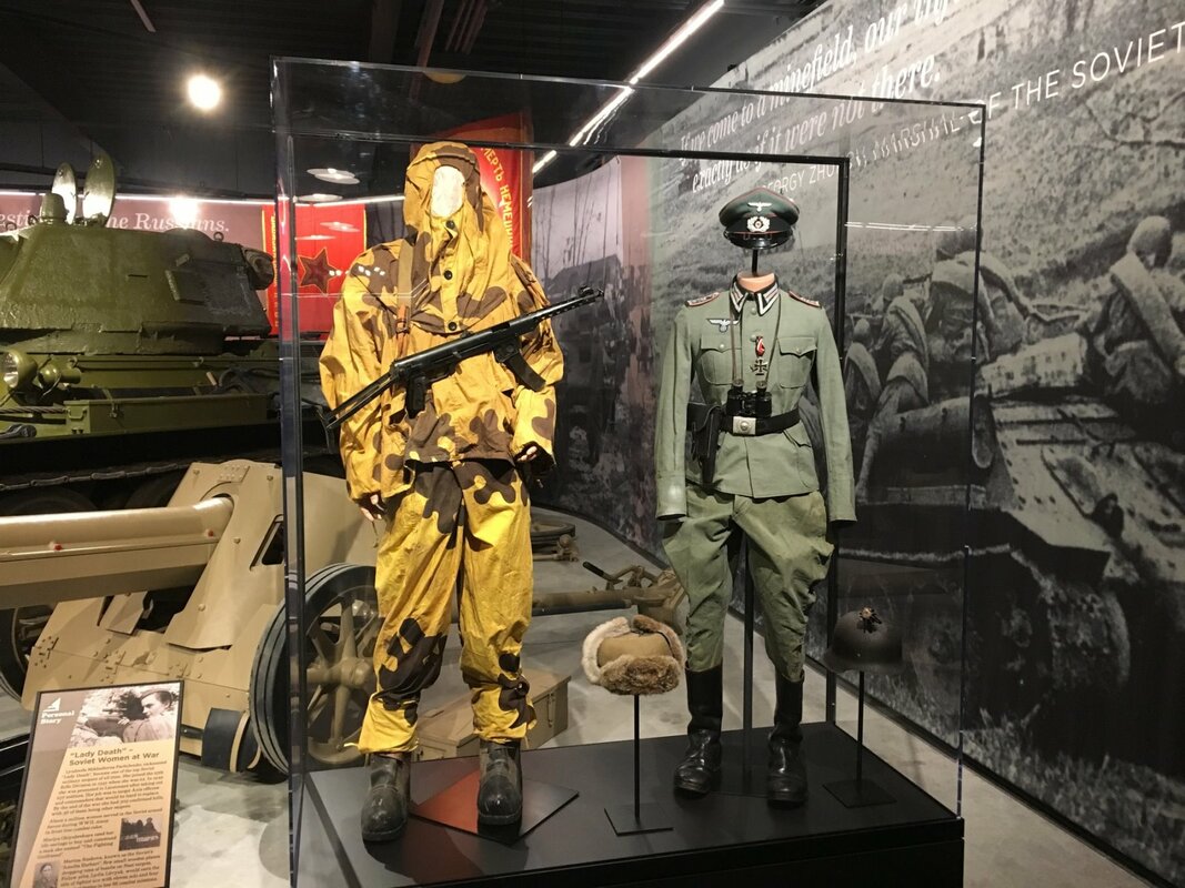
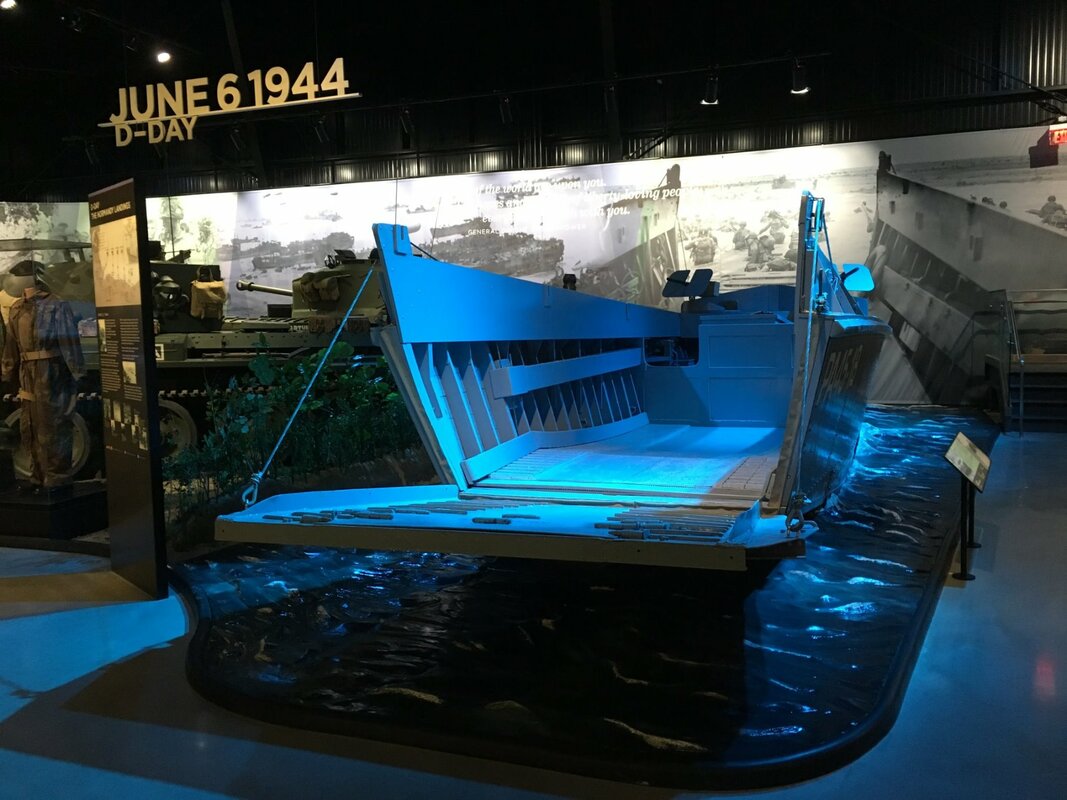
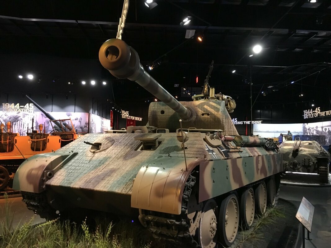
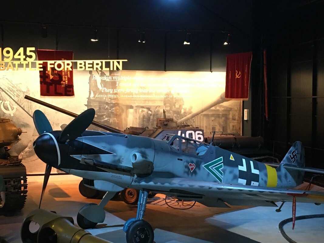
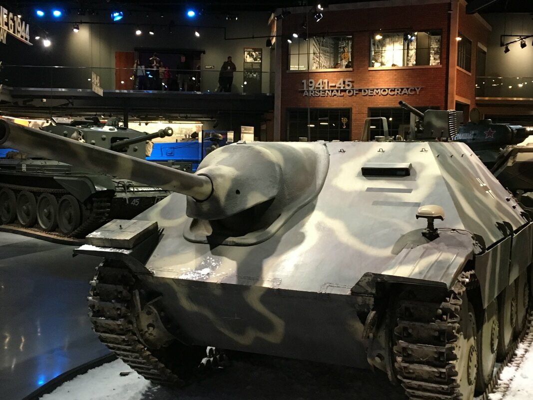
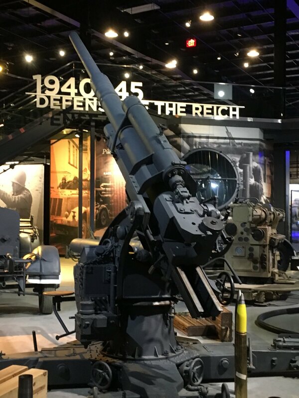
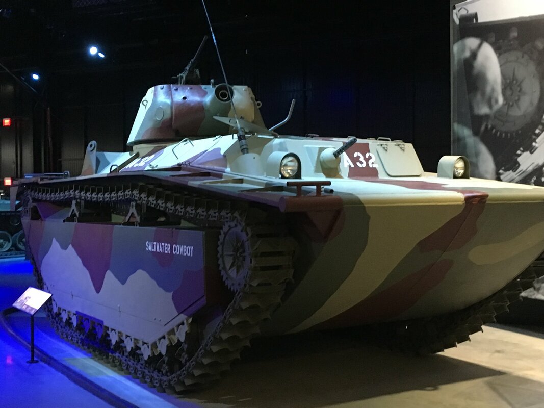
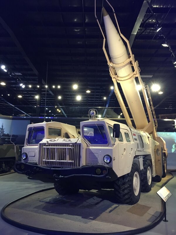
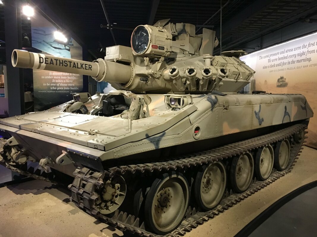
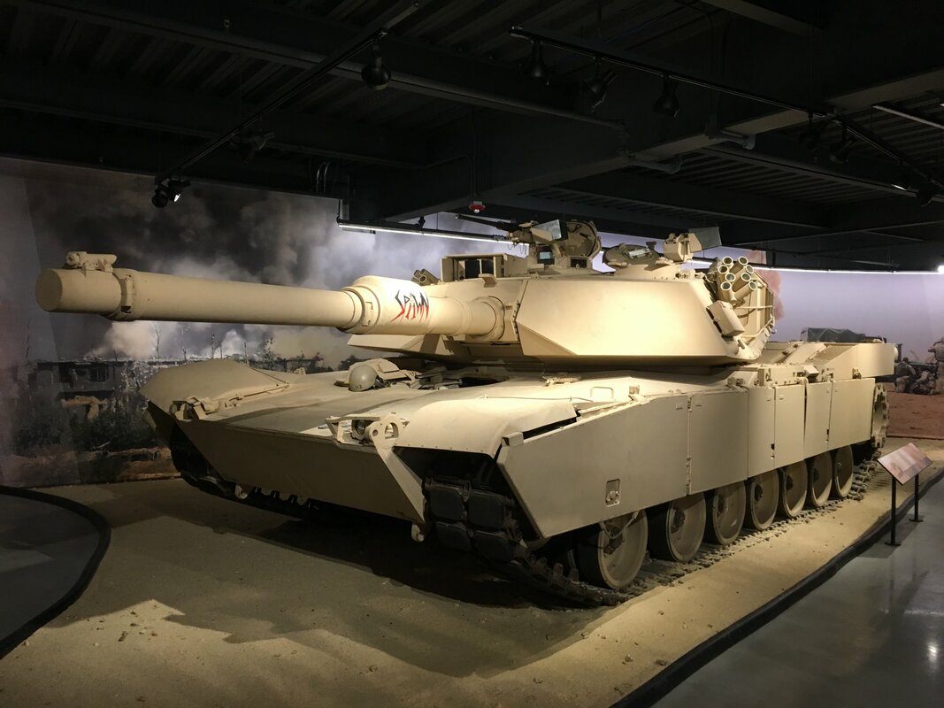
Needless to say, it was a great trip and we had a wonderful time. During the final miles, as we approached our home, my daughter asked if we could just make a pit stop at home and then hit the road again. What a great idea! Now that we’ve unpacked the car, sorted the mail, washed out clothes, mowed the yard, and downloaded the 10,000+ photos that we collectively took during the trip – I plan to post some of the photos of our adventures and write a few blogs highlighting the special sights that we saw. I’m sure that choosing which places to blog about will be the hard part. Grand Marais and Grand PortageWe're currently on a 30-day road trip to see more of America. While in Minnesota we specifically drove to the upper North East corner of the state on Lake Superior to hike the waterfalls at both Grand Marais and Grand Portage. You have to be going there to get there - but, in our opinion, it was worth the drive – just watch out for the mosquitoes. 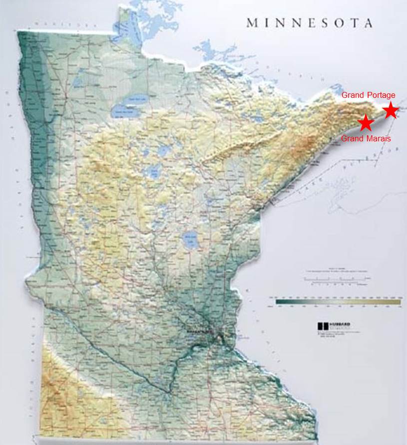 The first hike that we took was to see the waterfalls located in the Judge C.R. Magney State Park; the "Lower Falls", the "Upper Falls" and the "Devil's Kettle". The roundtrip hike to the Devil's Kettle falls is ~2 1/4 miles. At the Upper Falls you can stand directly in front of the falls and get a refreshing shower. At the Devil’s Kettle Falls half of the Brule River flows into a giant pothole and disappears into the Earth. But where does all that water go? Experiments conducted in fall 2016 by the Minnesota Department of Natural Resources indicated that the disappearing water simply flows back into the Brule River shortly below the falls. However, folklore still maintains that the water disappears underground and heads to Lake Superior since people have dropped sticks, ping pong balls, and GPS trackers into the Devil's Kettle without seeing them resurface downstream. Here are a few photos and a short video of the sights we saw at Grand Marais (click on any photo to start the slideshow): In addition, here's a link to the Park's website if you want a little more information: https://www.dnr.state.mn.us/state_parks/park.html?id=spk00193#homepag The second waterfall hike that we took was to see the "High Falls" located on the Pigeon River in Grand Portage State Park; essentially at the US-Canadian border. The High Falls waterfall is the largest waterfall (120 foot drop) in Minnesota and has a lookout platform ~100 feet from the falls; close enough to get some great photos and feel the spray. The hike to the falls is quite easy since the there's a path and a boardwalk all the way. In the 17th century Grand Portage became a major center of the fur trade in North America because it was the point where the fur trappers left the great lakes and headed into the outback. Grand Portage got its name because the route began with a 9 mile portage where the canoes and equipment had to be carried over land to a safe location on the Pigeon River above the waterfalls and rapids. Here are a few photos and a short video of the sights we saw at Grand Portage (click on any photo to start the slideshow): In addition, here's a link to the Park's website if you want a little more information: https://www.dnr.state.mn.us/state_parks/park.html?id=spk00173#homepag How Beautiful Are These Night Sky Photos? Last night, 7 April 2020, was the night of the “Pink Super Moon”. What’s a Pink Super Moon you ask? Well there are two components – the “pink moon” and the “super moon”. A “pink moon” is the name given to the April full moon – even though it isn’t pink in color. This historic name comes from the fact that the April moon coincided with the Spring blooming of the ground phlox, a pink flower common in North America. When the pink moon appeared people knew that it was time to start planting their crops for the year.  The second component of the phrase is “Super Moon”. This term refers to the position of the Moon with respect to the Earth – specifically perigee; when the Moon makes its closest approach to the Earth. At perigee, because of its proximity to the Earth, the moon appears bigger and brighter in the night sky. In terms of astronomical measurement the diameter of a Super Moon can appear 7% larger than an average-size full moon and 14% larger than the diameter of a mini-moon - the year’s most distant and smallest full moon. With respect to their brightness, Super Moons can be up to 15% brighter than an average-size full moon and 30% brighter than a mini-moon. To have a Super Moon the moon's perigee must coincide with the phase of the moon being “Full”. On average, a Super Moon only occurs 3 or 4 times each year. Last night’s Pink Super Moon is the closest that the Moon will get to the Earth all year - 221,851 miles (357,035 km). In an interesting calendar event, the three Super Moons of 2020 all fall in consecutive months: on 9 March, 8 April and 7 May. Here are a few of the photos that we took last night of the beautiful sights that we saw as the moon transited through the sky and local clouds rolled by. Note that the photos were taken using a variety of camera settings, and in a variety of light conditions throughout the night, so there’s some intentional color variation across the photos. (click on any photo to start the slideshow):  Collings Foundation “Wings of Freedom” Airplanes Every year the Collings Foundation flies a "Wings of Freedom Tour" with their vintage WWII airplanes. This weekend they were in our area, so we went early so that we could to see the planes fly in. Here are some photos of the B-17 Flying Fortress, B-25 Mitchell, B-24 Liberator and P-51 Mustang as they arrived (click on any photo to start the slideshow). Once the planes were parked on the ramp we got to take a closer look at them – both from the outside and the inside. Here are some of those close-up views (click on any photo to start the slideshow). If you want to see these magnificent examples of living history, here's a link to the Wings of Freedom website with lots more detail and the complete tour schedule: https://www.collingsfoundation.org/events/category/wings-of-freedom-tour/   You Really Must Visit the New American Heritage Museum – Especially if You Like Armor Last week we went to the Grand Opening of the new American Heritage Museum (AHM) in Stow, Massachusetts. The latest addition to the Collings Foundation, the American Heritage Museum is housed in a brand new 70,000+ square foot facility that features an immersive WWI Trench Experience and some of the rarest historical military artifacts and vehicles in the world - from WWI, WWII, Korea, Viet Nam, the Cold War and the Gulf War. The artifacts on display include an American WWI tank, Kommandogera¨t 40 (WWII German rangefinder and mechanical analog computer for directing anti-aircraft guns) a Higgins Boat that survived D-day, an LVT-(A)4 that survived the Pacific battles, a Panther tank, a German Sd.Kfz.222 reconnaissance vehicle, an IS-2 tank, an Me 109 fighter, a Scud B missile and launcher, an original section of the Berlin wall and many other unique pieces. You can see the complete listing of all the artifacts here: https://www.collingsfoundation.org/american-heritage-museum/american-heritage-museum-artifact-list/ The museum is wonderful and the artifacts are stunning; even more so since most of them have been fully restored and are actually operational. So, if you are in the area, or looking to see some world class military vehicles and other artifacts, you should really make a trip to the American Heritage Museum. You can find more information about its location and hours here: https://www.collingsfoundation.org/american-heritage-museum/ Here are some photos that we took the first day that the American Heritage Museum was open (click on any photo to start the slideshow).  |
What's On This Page?Here's where we post reviews, questions, answers, thoughts and other information that's of general interest to our followers in a blog format. Categories
All
Archives
August 2023
|


 RSS Feed